How Thermal Vision uses GeoNadir to create insights with thermal data
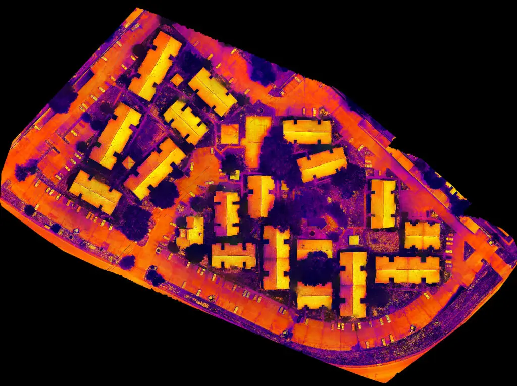
With the recent introduction to the market of the Mavic 3 Enterprise drones by DJI, we have seen more users uploading thermal data from the Mavic 3 Thermal drone to GeoNadir. Thermal data is not the easiest data to capture from a drone mapping mission, and this case study gives some insights into how to […]
Mapping with Waypoints
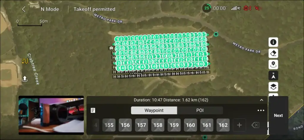
Using Waypoint Map for a mapping mission Thanks to Mick Green at DriftMedia who has shared this ‘how to’ video on using Waypoint Map so you can capture a mapping mission with the DJI Mini 4 Pro, DJI Air 3, or Mavic 3 Pro using the DJI RC or RC2 remote control. Mick is also using […]
Getting the basics right with the Pilot Institute
Getting the basics right with the Pilot Institute In the rapidly evolving world of drone technology, getting the basics right, understanding the drone and what it can do, and how to use this to best effect for your projects has never been more critical. This is where the offerings of the Pilot Institute, particularly their […]
Detecting change with drones – a Cyclone Jasper case study
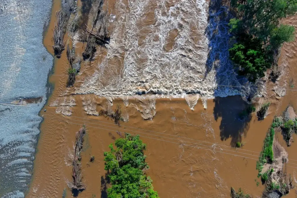
In a recent lunch and learn webinar we explored the role of drone mapping in detecting environmental change. Here I’ll revisit the highlights of the webinar, diving into the aftermath of Tropical Cyclone Jasper and examine how comprehensive datasets can reshape disaster response strategies. Tropical Cyclone Jasper threatened the far north Queensland region, providing an […]
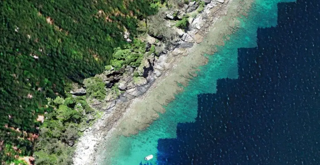
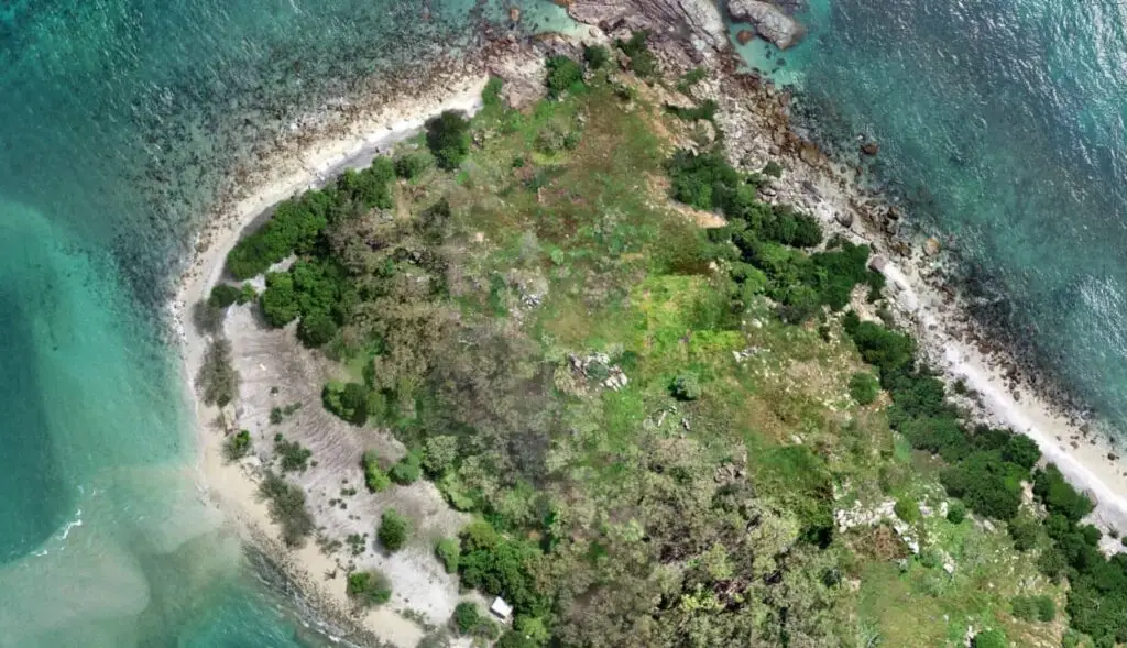
Mapping the bathymetry of the Mediterranean
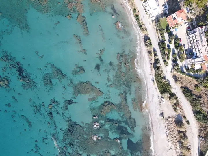
When most people think of the ocean, they think mostly of water, not the land that lies underneath it. But bathymetry, which is the study of water depth, is critical for understanding our coastlines. Water depth influences currents, waves, and where different marine life can live. Like topography on land, drone mapping can help collect […]
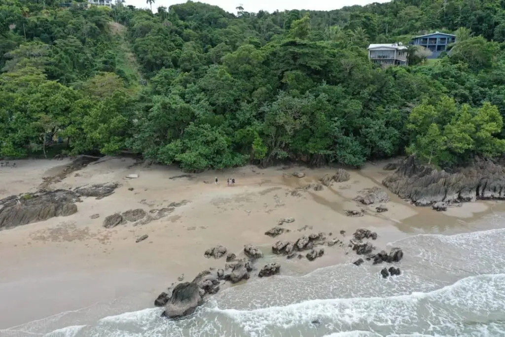
Mangrove conservation – How can drones help?
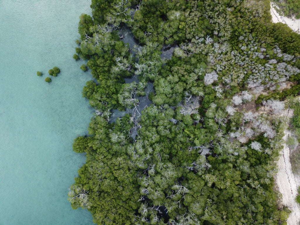
Mangrove conservation is a pressing global concern. These habitats are highly productive ecosystems that offer many environmental services. Mangrove forests store nearly 10 times more carbon per hectare compared to terrestrial forests, playing an important role in the fight against climate change! They also safeguard the coastlines of tropical and subtropical regions, home to nearly […]
Environmental monitoring and management with drones
The old saying “a stitch in time saves nine” is pretty apt for environmental monitoring and management. The sooner that we can spot a problem in the environment, the smaller it usually is and the easier it is to fix. When a problem goes unnoticed for a while, it can quickly snowball and become very […]
Drone surveying: The new go-to for measuring elevation
Accurate topographic data supports emergency management strategies, land-use planning, mining operations, and many elements of environmental research. Thanks to NASA’s Shuttle Topography Radio Mission (STRM), most of the earth now has at least 30m resolution elevation data. But for many projects, this just isn’t enough detail. Drone surveying presents a new, flexible, affordable method for collecting elevation […]
Rivers of ice: Using drones to understand glaciers
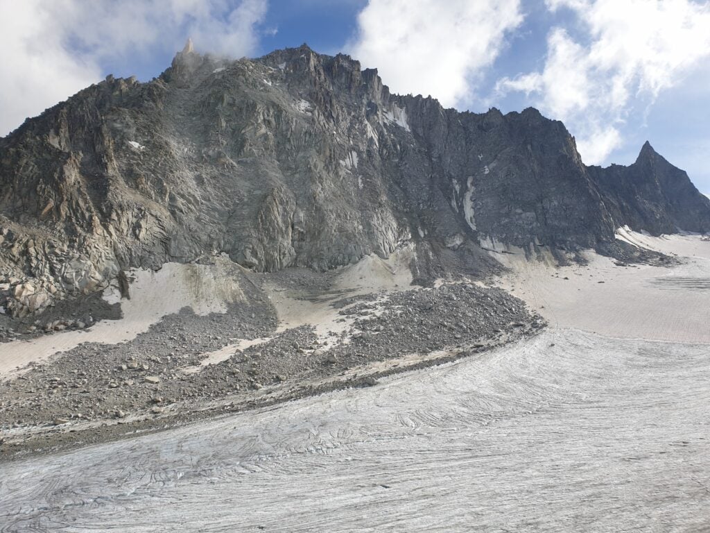
It’s not news that glaciers are retreating globally. In recent years, the steady retreat of glaciers has been one of our most visible indicators of climate change. Between 1994 and 2017, 6.1 trillion tonnes of ice was lost from the world’s glaciers. But understanding the relationship between climate change and glaciers isn’t as simple as […]
What is the resolution of drone mapping?
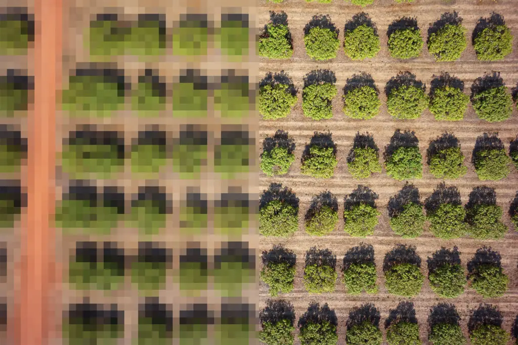
Many people use drones for mapping to achieve greater resolution when compared to traditional aerial photography or satellite imagery. But what does ‘resolution’ really mean when considering remotely sensed data? There are actually three main types of resolution relevant here: spatial, spectral, and temporal. Let’s explore each below in the context of drone data collection. […]
Drone Surveying Equipment – What to pack when going on a family holiday.
Learn how to pack the bare minimum when taking your drone surveying equipment on a family holiday. It’s school holidays in Queensland and what better time to get out and about camping! It might be the middle of winter for most of Australia, but that seasonal description doesn’t really fit in the tropical north. So […]
Up and away! The best time for drone mapping
When is the best time to fly your drone? One of the things that I love about working with drones is the ability to be flexible about when and where I fly to capture data. I’ve worked with satellite data for over two decades and it can be really restrictive when data are only acquired […]
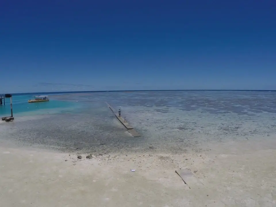
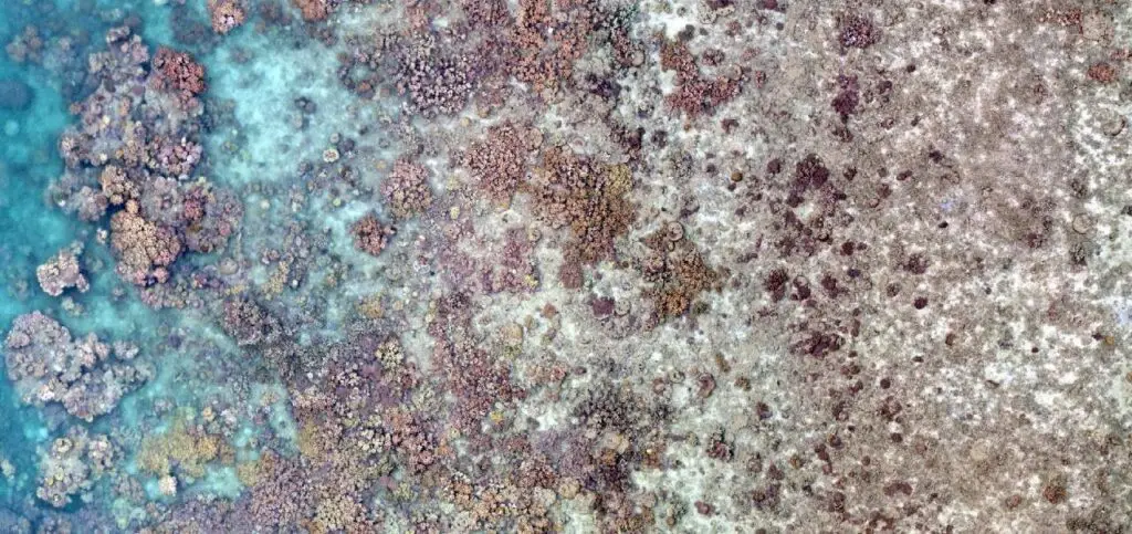
Spectacular drone mapping on the Great Barrier Reef to find live coral
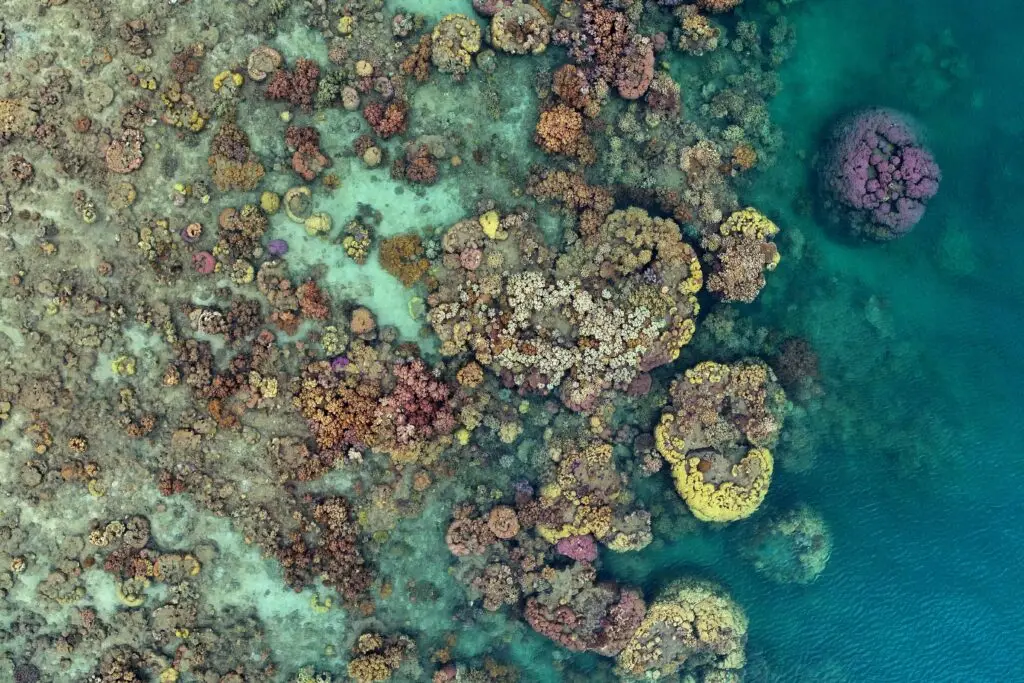
How much live coral do we have on the Great Barrier Reef? Get valuable information & learn more about our drone mapping on the Reef. As a student in the late 1990’s I was incredibly fortunate to visit the University of Queensland Heron Island Research Station many times, firstly for undergraduate subjects, and then later for my […]
What is an Orthomosaic?
Orthomosaic, the Short Answer: The output from a process where a number of overlapping photos (e.g. from a drone or aerial camera) are stitched together with distortions removed to create a complete and continuous image representation or map of a portion of the earth. The orthomosaic below is made up of 283 individual drone photographs. […]
How to figure out the optimal drone flying height for mapping!

People frequently ask about how to calculate the optimal drone flying height, however, it’s the wrong question to ask. What is more important is to understand the size of the feature/s that you are trying to map. It may come as no surprise that as you increase the altitude of your drone, you are able […]
Ten Tips for Catching a Drone Safely with your Hands.
Catching a drone by hand can be dangerous! Find out how to catch a drone with your hand safely in this article. Get more information today! I often joke that drones are like flying Edward Scissorhands. Those propellers can really do some damage if they come into contact with anything other than air! Just check […]
Drone data…don’t lose it, use it!
How many drone datasets do you suppose there might be around the world? Discover more about how to upload drone data. I consider myself to be a biographer for Mother Earth. I tell stories of her beauty, challenge, and change, using drones and satellites as my scientific illustrators. Over the years I have amassed many […]
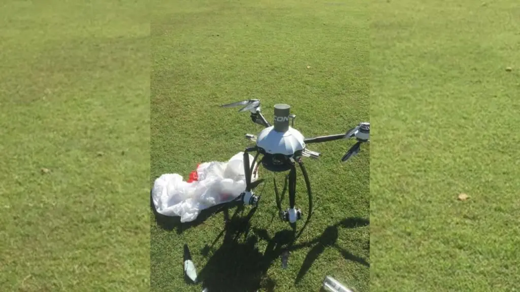
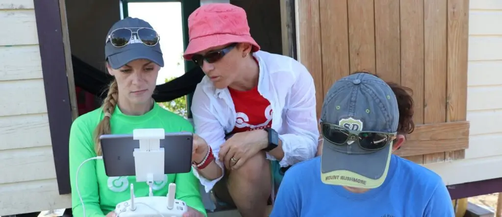
How can I get ground control in a marine environment?
I’m sure that my certified surveyor friends cringe when they hear about our methods of ‘Marine ground control’ on the reef! But here goes… What is ‘ground control’? No, we’re not calling Major Tom… Ground control points (GCPs) are points or features on the surface of the earth (or even underwater) with a known location. […]
Let’s Talk About Drone Crashes
Drone crashes do happen, but there are ways to avoid them. Find out how in this article. It doesn’t matter if I’m talking to kids or adults, the most common question I’m asked about droning is if I’ve crashed. And while I can’t say that watching a 35kg beast crash is the highlight of my […]
Drone Pilots Reinvent Themselves as Mother Earth’s Paparazzi
Mother Earth’s Paparazzi is a term used to describe drone enthusiasts who capture images of mother earth to help protect at-risk ecosystems. Over the past seven years, I have captured tens of thousands of beautiful drone images. But I don’t consider myself a skilled photographer – I’m simply lucky that my subject is stunning! And […]
How to Map With a Drone (Top 10 Tips)
How to map with a drone: I know that lots of people love flying drones, but I’m not one of them! Yet what I do love is the #earthobservation data that I can capture with my drone. I’ve been working with remote sensing data since the late 1990’s and know full well that not all data […]
Calling drone pilots help map the sea cucumbers population
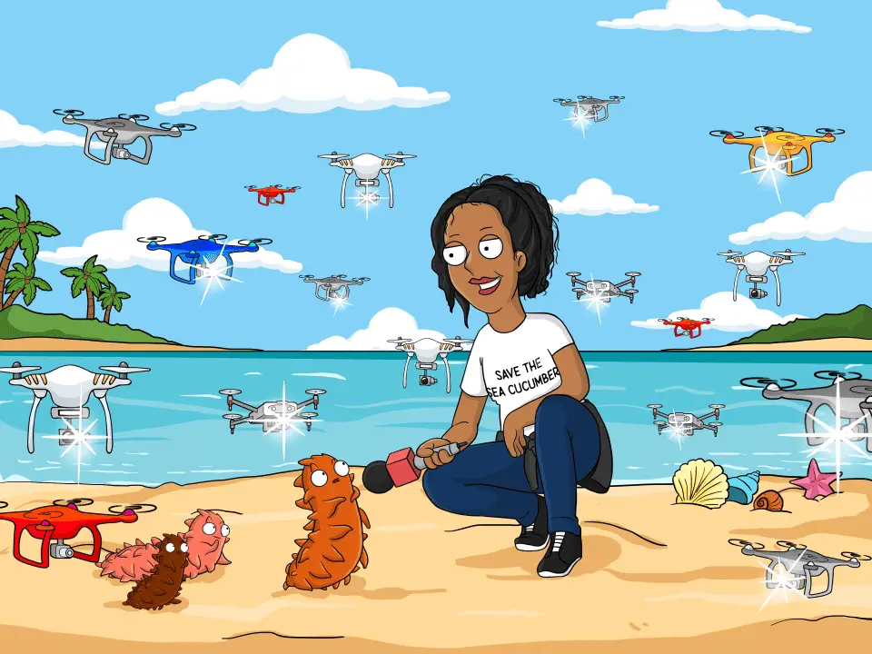
Sea Cucumbers have threatened species and it’s critical we create the largest population map of their habitats. The first time I flew my drone on Heron Reef about five years ago I was blown away by what I would now be able to map and monitor. I was looking for live coral and I certainly […]
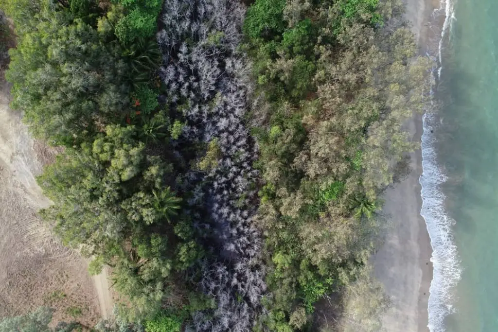
Earth observation data reveals the when and where of mangrove dieback
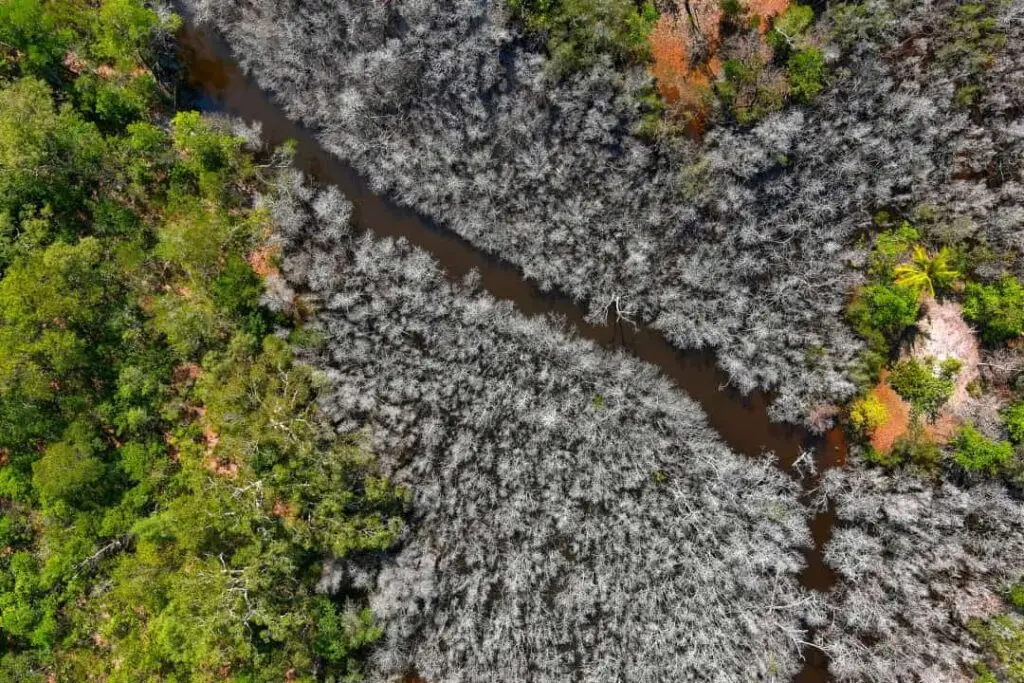
Earth observation data reveals valuable information that you should know. In the wake of the United Nations Climate Change Conference in Glasgow (#COP26) there’s even more than usual climate related information hitting the headlines. And this just landed from Professor Peter Macreadie and team from Deakin University (and others), reminding us to consider the role of blue carbon ecosystems (e.g. mangroves, […]
(Fantome Island) Before quarantine hotels there were leprosariums
(fantome island) Australian Aboriginal and Torres Strait Islander people are advised that this article contains material that may be considered culturally sensitive, including imagery of previous occupations. In this ‘unprecedented time’ of global pandemic, I wonder – just how unprecedented is it? Certainly we’ve seen the fear of mass contagion and need to isolate the […]