Built for consultants
Bring environmental data together to support monitoring, reporting, and client decisions.
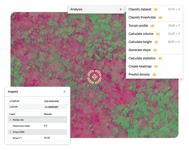
Features that matter most to consultants
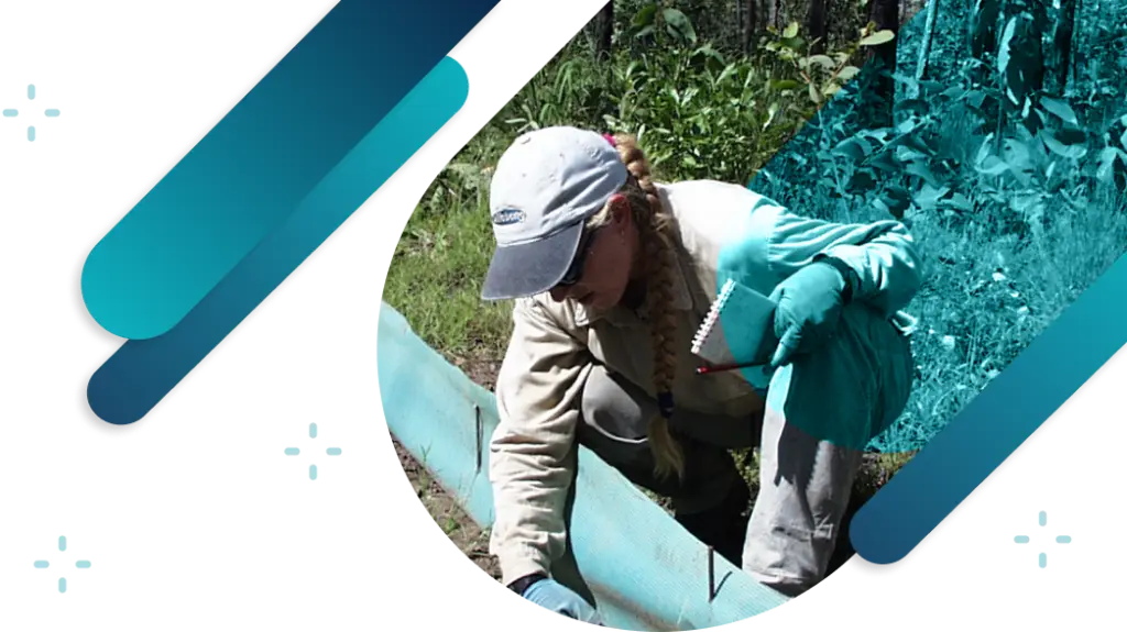
We work in the field, so we know workflows are important.
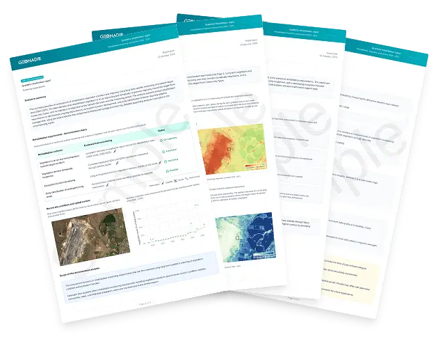
Simple reporting
Produce clear, defensible outputs that meet client and regulatory expectations.
GeoNadir helps consultants turn imagery, field data, and analysis into consistent maps and reports that are easy to explain and reuse across projects.
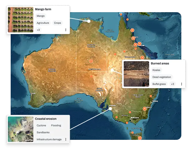
Multi-project ease
Manage data across multiple clients, sites, and contracts.
GeoNadir supports separate projects and workspaces so teams can work efficiently across engagements while keeping client data clearly separated.
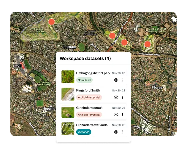
Data in one place
Environmental data is often shared between consultants, clients, and project partners throughout a project.
GeoNadir reduces file handovers and duplication so everyone works from the same, up-to-date information.
Simple, but powerful
Tools and support that scale with your consulting team.
GeoNadir provides practical spatial tools, backed by training and ongoing support, so teams can work confidently without the overhead of complex GIS software.
We're here to help...let's talk!
Book a call with a GeoNadir expert at a time that suits you.
Plans to suit your organisation
Try the core tools of GeoNadir for free. No credit card required.
- 1 user, unlimited guests
- 100 GB processing & storage
- Up to 500 images per dataset
- RGB orthomosaics & elevation models
- Sentinel-2 satellite data
- 1 project for data analysis
- Drawing tools & map styling
- Unlimited project sharing & commenting
For individuals and small teams of drone pilots and data analysts.
- Up to 5 users, unlimited guests
- 1 TB processing & storage
- Up to 3,000 images per dataset
- RGB & thermal orthomosaics & elevation models
- 25 projects for data analysis
- Advanced analysis — volumes, heights, change detection
- NDVI & spectral indices
- 5 dataset downloads per month
- Personalised onboarding call
Powerful Professional add-ons tailored to your workflow for teams.
- Additional users
- Additional storage
- Historical processed data upload
- Multispectral orthomosaic processing
- GCP processing
- Custom project limits
| Feature | Essentials | Professional | Pro + add-on |
|---|---|---|---|
| Usage Limits | |||
| Users | 1 | 5 | Custom |
| Guests | Unlimited | Unlimited | Unlimited |
| Projects | 1 | 25 | Custom |
| Processing & storage | 100 GB | 1 TB | Custom |
| Max images per dataset | 500 | 3,000 | Custom |
| Data Upload | |||
| Geotagged JPG (drone mapping) | |||
| Vector data | |||
| Historical processed data upload | |||
| Photos as points | |||
| Data Processing | |||
| RGB orthomosaics | |||
| Thermal orthomosaics | |||
| Multispectral orthomosaics | |||
| Digital elevation models (DSM / DTM) | |||
| GCP processing | |||
| Data Management | |||
| Central data library | |||
| Keep data private | |||
| Find and use public data | |||
| Data Streaming | |||
| Sentinel-2 satellite data | |||
| TMS link for orthomosaics | |||
| Data Analysis | |||
| Drawing tools | |||
| Magic wand AI polygons | |||
| Measure areas | |||
| Measure volumes | |||
| Calculate heights | |||
| Detect change | |||
| Spectral indices (NDVI & more) | |||
| Contrast enhancement | |||
| Map styling | |||
| Data Reports | |||
| Heat maps | |||
| Vector statistics | |||
| Dataset statistics | |||
| CSV data exports | |||
| Environmental condition assessments | |||
| Data Downloads | |||
| Download processed orthomosaic, DTM, DSM | |||
| Export vectors | |||
| Export CSV from reports | |||
| Data Sharing | |||
| Share project for viewing & commenting | Unlimited | Unlimited | |
| Share project for editing | |||
| Real-time collaboration | |||
| Comments on projects | |||
| User roles and permissions | |||
| Support | |||
| Free 15 min onboarding session | |||
| Chat support | |||
| Self-serve knowledge base | |||
| Personalised onboarding call | |||
Trusted by teams


We're here to help...let's talk!
Book a call with a GeoNadir expert at a time that suits you.
Looking to build your drone mapping and data analysis skills?

Take our free drone mapping course
Learn how to capture, process, and analyse drone mapping data to produce accurate maps and meaningful environmental insights.

Purchase the right drone
Getting the right drone for drone mapping is not a case of getting one that just fits your budget! It is making sure that the drone you get has a mapping capability first!

Book a free consultation
A 20 minute consultation could save your team thousands of $$ by getting the right advice. Book a consultation and get set up with the right workflow for your site.
Purchase a DJI drone kit
We have been flying drones since 2013, so we know what works.
We sell DJI drones to the Australian market.
By sharing with our experts what you want to achieve with the data, you will get the right advice before you purchase a drone.
We consistently save our customers money by getting them the right drone for the job!
What's new!
For the latest insights check out our most recent articles.


