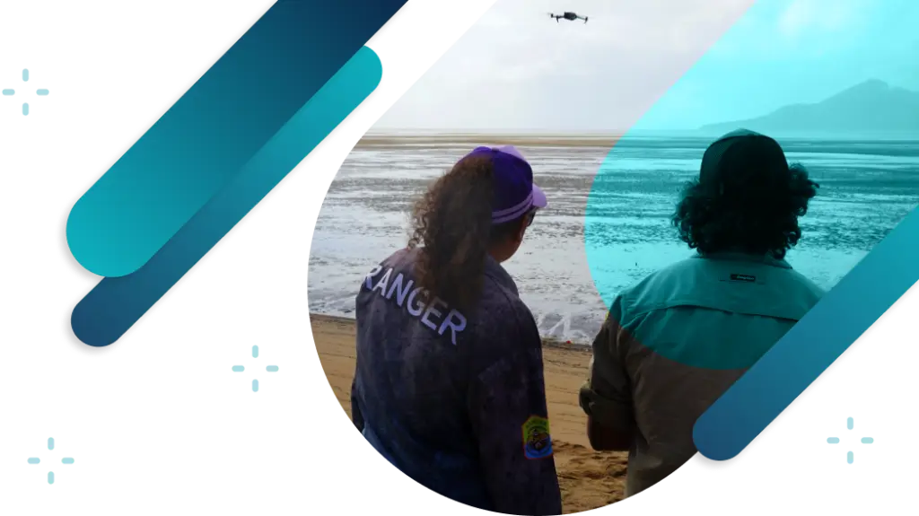
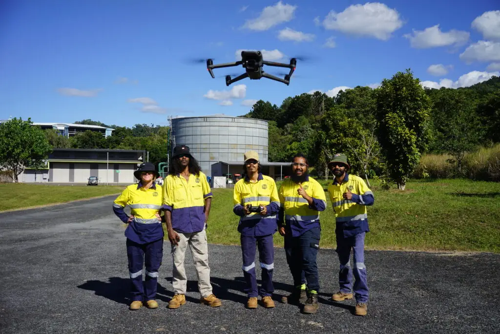
Built for land and sea rangers
Bring environmental data together to support monitoring and on-ground work.
We often start with training
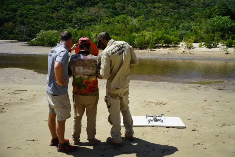
We train ranger teams around Australia as part of their on Country drone monitoring programs. Typically we run a three-day drone mapping course that covers practical flying skills, data capture missions, and data analysis in your location.
How it works
Understand your team needs
We will do a discovery call to understand the outcomes you are wanting to achieve from the training, your participants experience and needs, and your budget.
We will then design the course to meet your needs.
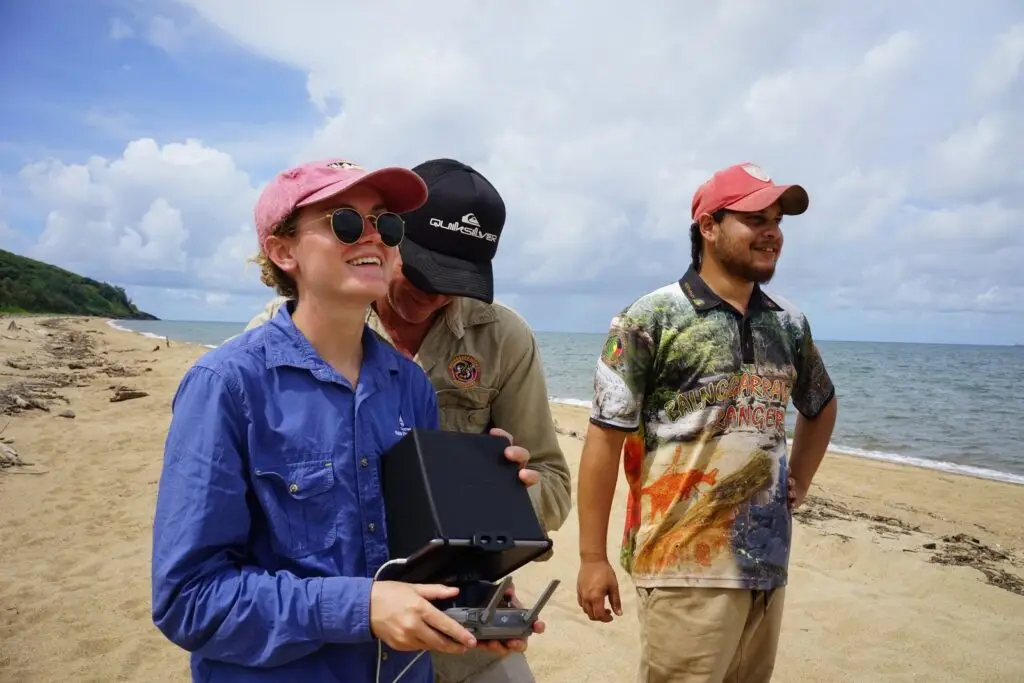
Practical flying
We take people who have never flown a drone before and give them the confidence to fly. We start with microdrones indoors, taking our 10 years of experience teaching thousands of people to fly, before venturing outside.
We cover manual flight skills so participants are confident with all the controls and buttons on the controller.
A heavy emphasis is placed on safe and legal flying.
Mapping missions
We cover the basics of conducting a mapping mission before getting out there and flying a couple.
We discuss the challenges likely to be faced in your environment, and how to overcome these so you team can still collect good data.
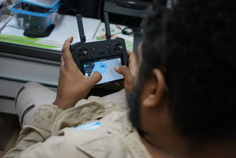
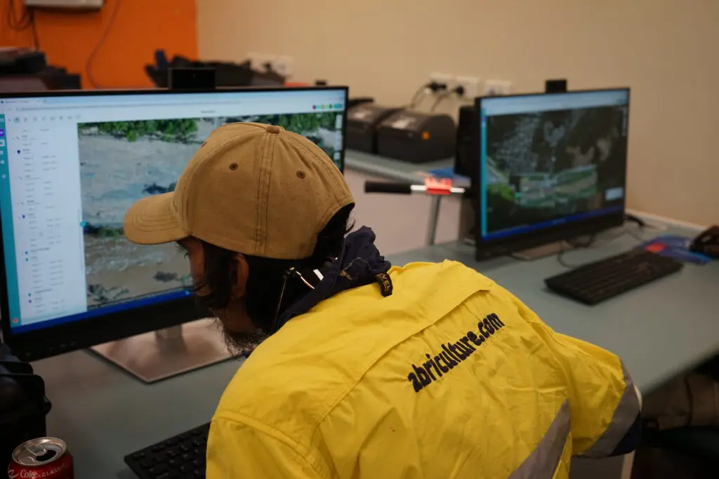
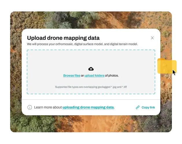
Data processing
Back inside we upload the drone mapping data to GeoNadir and cover what is happening during the processing stage.
Understanding what is happening helps to reduce the number of mistakes made in the data capture phase.
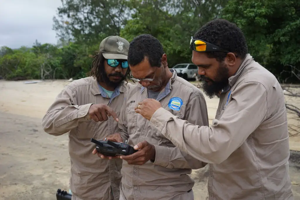
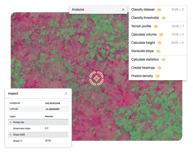
Data analysis
We go through some data analysis tutorials specific to the outcomes your team needs.
We learn how the GeoNadir tools work, collaborate as a team, and produce insights on the data that are decision-ready.
Questions
We answer lots of questions throughout the training.
We’ve been flying since 2013, flown nearly every DJI sub 2kg model of drone, and made a ton of mistakes along the way.
We share our learnings so your team doesn’t have to make the same costly mistakes as we have!
We're here to help...let's talk!
Book a call with a GeoNadir expert at a time that suits you.
We then implement easy to use software
Our software supports rangers to use drones on Country for monitoring works.
Affordable pricing
We know the ‘top dogs’ of drone mapping software can be expensive, and you are paying for features you don’t use.
Others have complicated gigapixel pricing where you pay for processing on top of a monthly subscription.
Our subscriptions are simple so you know what you are paying each month.
Simple processing
We process RGB, thermal, and multispectral data and all you have to do is drag and drop the raw images into GeoNadir.
Our automated process then takes over and you will be sent an email once it’s processed.
You don’t have to install anything, set processing parameters, or have a high powered computer to run it.
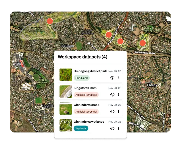
Data in one place
Environmental data is often collected by rangers and shared with coordinators, agencies, and partners.
Over time, this can lead to files being passed around, information being duplicated, or important context being lost.
GeoNadir helps keep data together so everyone works from the same information, with changes visible and easy to understand.
Simple, but powerful
Ranger teams need tools that fit into field work and day-to-day programs.
Complex GIS software can be difficult to learn and hard to support in small teams.
GeoNadir offers practical spatial tools, backed by training and support designed for ranger teams.
We're here to help...let's talk!
Book a call with a GeoNadir expert at a time that suits you.
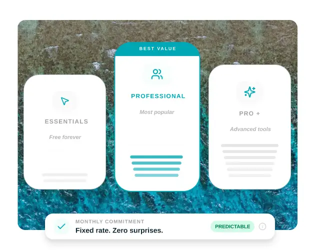
Plans to suit your organisation
Try the core tools of GeoNadir for free. No credit card required.
- 1 user, unlimited guests
- 100 GB processing & storage
- Up to 500 images per dataset
- RGB orthomosaics & elevation models
- Sentinel-2 satellite data
- 1 project for data analysis
- Drawing tools & map styling
- Unlimited project sharing & commenting
For individuals and small teams of drone pilots and data analysts.
- Up to 5 users, unlimited guests
- 1 TB processing & storage
- Up to 3,000 images per dataset
- RGB & thermal orthomosaics & elevation models
- 25 projects for data analysis
- Advanced analysis — volumes, heights, change detection
- NDVI & spectral indices
- 5 dataset downloads per month
- Personalised onboarding call
Powerful Professional add-ons tailored to your workflow for teams.
- Additional users
- Additional storage
- Historical processed data upload
- Multispectral orthomosaic processing
- GCP processing
- Custom project limits
| Feature | Essentials | Professional | Pro + add-on |
|---|---|---|---|
| Usage Limits | |||
| Users | 1 | 5 | Custom |
| Guests | Unlimited | Unlimited | Unlimited |
| Projects | 1 | 25 | Custom |
| Processing & storage | 100 GB | 1 TB | Custom |
| Max images per dataset | 500 | 3,000 | Custom |
| Data Upload | |||
| Geotagged JPG (drone mapping) | |||
| Vector data | |||
| Historical processed data upload | |||
| Photos as points | |||
| Data Processing | |||
| RGB orthomosaics | |||
| Thermal orthomosaics | |||
| Multispectral orthomosaics | |||
| Digital elevation models (DSM / DTM) | |||
| GCP processing | |||
| Data Management | |||
| Central data library | |||
| Keep data private | |||
| Find and use public data | |||
| Data Streaming | |||
| Sentinel-2 satellite data | |||
| TMS link for orthomosaics | |||
| Data Analysis | |||
| Drawing tools | |||
| Magic wand AI polygons | |||
| Measure areas | |||
| Measure volumes | |||
| Calculate heights | |||
| Detect change | |||
| Spectral indices (NDVI & more) | |||
| Contrast enhancement | |||
| Map styling | |||
| Data Reports | |||
| Heat maps | |||
| Vector statistics | |||
| Dataset statistics | |||
| CSV data exports | |||
| Environmental condition assessments | |||
| Data Downloads | |||
| Download processed orthomosaic, DTM, DSM | |||
| Export vectors | |||
| Export CSV from reports | |||
| Data Sharing | |||
| Share project for viewing & commenting | Unlimited | Unlimited | |
| Share project for editing | |||
| Real-time collaboration | |||
| Comments on projects | |||
| User roles and permissions | |||
| Support | |||
| Free 15 min onboarding session | |||
| Chat support | |||
| Self-serve knowledge base | |||
| Personalised onboarding call | |||
Trusted by teams


We're here to help...let's talk!
Book a call with a GeoNadir expert at a time that suits you.
Looking to build your drone mapping and data analysis skills?

Take our free drone mapping course
Learn how to capture, process, and analyse drone mapping data to produce accurate maps and meaningful environmental insights.

Purchase the right drone
Getting the right drone for drone mapping is not a case of getting one that just fits your budget! It is making sure that the drone you get has a mapping capability first!

Book a free consultation
A 20 minute consultation could save your team thousands of $$ by getting the right advice. Book a consultation and get set up with the right workflow for your site.
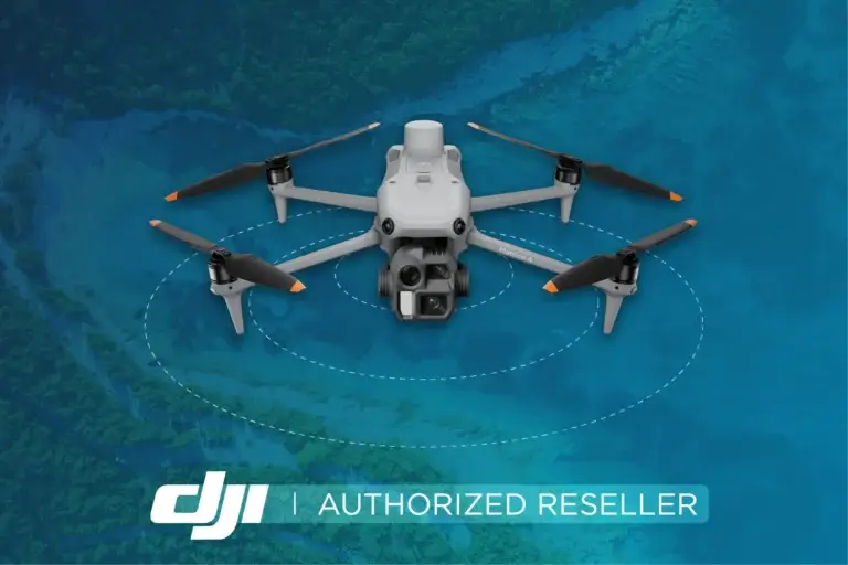
Purchase a DJI drone kit
We have been flying drones since 2013, so we know what works.
We sell DJI drones to the Australian market.
By sharing with our experts what you want to achieve with the data, you will get the right advice before you purchase a drone.
We consistently save our customers money by getting them the right drone for the job!
What's new!
For the latest insights check out our most recent articles.


