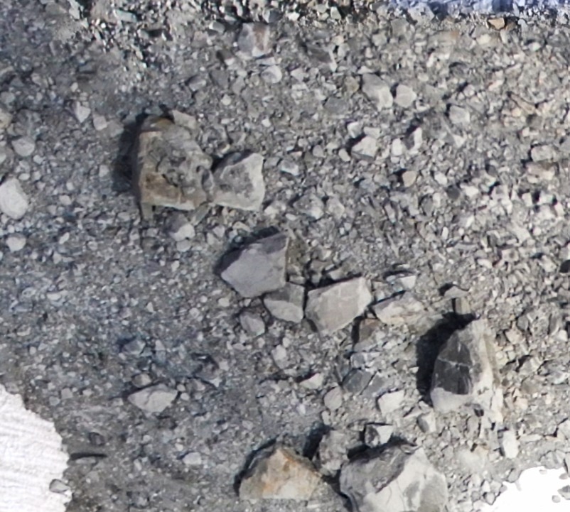
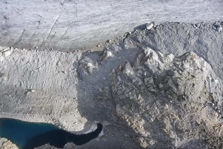
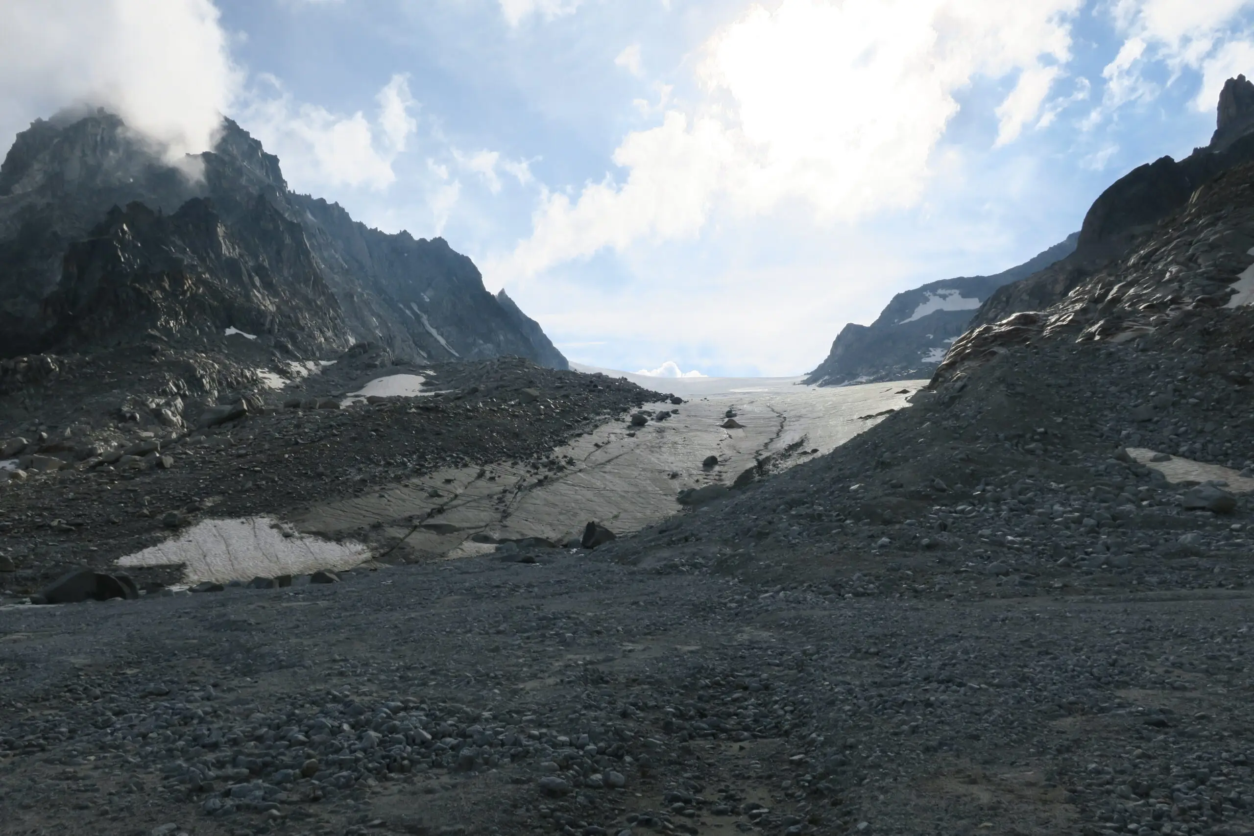
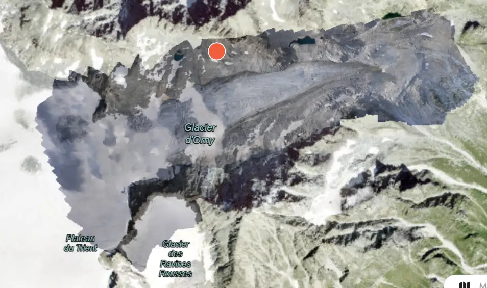
Rivers of ice: Using drones to understand glaciers

It’s not news that glaciers are retreating globally. In recent years, the steady retreat of glaciers has been one of our most visible indicators of climate change. Between 1994 and 2017, 6.1 trillion tonnes of ice was lost from the world’s glaciers. But understanding the relationship between climate change and glaciers isn’t as simple as melting ice, and understanding the impact of disappearing glaciers is more complicated again. The race is on to understand these natural wonders and how they are changing. 

Studying glaciers

To learn the secrets of glaciers, scientists have to collect data on them regularly, and this can be tricky. Limited information can be collected from field-based glacier monitoring. By their nature, glaciers are often hard to access and can be quite dangerous to cross. They are also very big and some parts will always be inaccessible due to safety risks. All of this means that monitoring glaciers in person is very expensive and often doesn’t capture the bigger picture of what is going on.

So, what about satellite images? Satellites certainly offer the bigger picture and provide a straightforward way to monitor glaciers through time. The problem is that the picture is sometimes too big. Most open access satellite images are relatively low resolution, so small, important details aren’t always visible. While there are higher resolution satellite images available, these can be expensive to access, especially over large areas. 

Drones for glaciers

Drones are proving to provide a good balance between the detail of on-ground monitoring and the scale of satellite imagery. 

For starters, they offer a lot more flexibility in the timing and resolution of the collected data. You can choose the best time to fly to capture your data, and also plan for picture resolution so you don’t miss important details. It’s also easier to modify what kind of data is collected on a drone. For example, trading a camera for an infrared (heat) sensor on a drone can help researchers understand how different parts of a glacier are warming.

At the same time, drones offer advantages over traditional field work because you don’t have to traverse potentially dangerous icefields to get your data. They can also help you collect a lot more data because of their ability to cover large areas, including areas too dangerous to traverse on foot.

Why is it important to understand glaciers?

Glaciers are often looked at through the lens of climate change, and for good reason. Beyond being a good visual measure of climate change, melting glaciers are one of the major contributing factors to sea level rise. 

Glaciers area also the world’s largest largest freshwater reservoir, and many communities rely on glacial meltwater for reliable freshwater. They are particularly valuable for their ability to supply drinking water when droughts dry up other sources. Annual meltwater from the Himalayas alone has been estimated to support the basic needs of 136 million people. But as glaciers continue to melt faster than snowfall replenishes them, these vast reservoirs store less and less water for the future.  This poses a serious threat to water security for millions of people.

As glaciers melt, they also affect the stability of the mountains and valleys they once covered. Glaciers and permafrost help to support otherwise crumbly mountain sides. As the ice and permafrost melts, this support is lost, causing landslides and rockfalls. Large rockfalls can be dangerous to settlements downstream, or they can create natural dams in glacial valleys that cause flooding when they break.

Studying the behaviour of glaciers today means that scientists can better understand the dangers and risks associated with glacial melt in the future.

Drone Image glaciers Drone image
Satellite image of glaciers Orny Satellite image

Mapping Glacier d’Orny

Glacier d’Orny, on the southern border of Switzerland, is one glacier that has recently been mapped using drones. In 2020, Andrea Blindenbacher and her team set out to map as much of this glacier as they could. This river of ice in the Swiss Alps is over 2.5km long and ranges in altitude from 2,700m to 3,000m. Flying drones in the Alps presented Andrea and her team with some pretty interesting challenges.

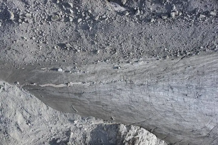
Fixed-wing vs Multirotor drones

Andrea and her team couldn’t use a multirotor drone for their mapping mission. Multirotor drones, like helicopters, use the rapid spinning of their blades to push air down and create lift. This gives them easy manoeuvrability, and the ability to hover in place, take-off and land vertically. Multirotor drones are often the preferred kind of drone for mapping since they give the user lots of flexibility in how they fly. But up in the Alps, the air gets so thin with altitude that multirotor drones can’t create enough lift to fly.
Launching fixed wing drone
The team launching the fixed-wing drone. Source: Drones for Earth

Instead, Andrea and her team used a fixed-wing drone to map the glacier. Fixed-wing drones  work more like aeroplanes – they create lift through the way air moves around their wings. This means that they can easily fly in the thin air of the alps. But it also means that, like aeroplanes, they need lots of space to take-off and land, extra space to turn, and they can’t hover in place. So, fixed-wing drone missions usually need to be planned a bit more carefully so that the drone can take-off, land and turn safely without compromising the quality of the mapping.

This was even more the case for Andrea and her team who also had to avoid the steep sides of the glacial valley, while keeping an eye out for sudden weather changes that are common in the Swiss Alps in summer. But using a fixed-wing drone also gave the team an advantage. These drones use less battery, so they can fly for longer and map more area than multirotor drones. That’s a win when you’re trying to map a big glacier! You can read more about the adventures of Andrea and her team here.

The result

Despite the challenges, I think we can agree that the outcome from their mapping mission is pretty spectacular! 

Although Andrea and her team weren’t looking to answer any specific questions about this glacier with their flight, this dataset is now available for anyone to view on GeoNadir. Hopefully it can help other scientists learn more about this glacier and others around the world. You can learn more about the history and value of open data here.

Subscribe for more stories from above, tips, & tricks

Share this article with your peers on social media.

Facebook
Twitter
LinkedIn
Topographic map with dots displaying data points of environmental drone mapping data. Three drone mapping overlays in different environments

Get a free account

  • Unlimited orthomosaics
  • Unlimited uploads
  • Free storage
Manage, process, analyze, and collaborate with your drone mapping data.