
When is the best time to fly your drone? One of the things that I love about working with drones is the ability to be flexible about when and where I fly to capture data. I’ve worked with satellite data for over two decades and it can be really restrictive when data are only acquired at a set time of day, and only when the satellite passes over a specific location.
The orbit of many satellites is designed such that the satellite can capture data in the morning, aligned with the statistically determined probability of lower cloud cover. But what if that time of day isn’t optimal for some other aspect of the environment of interest? Or what if it happens to be raining or cloudy on the day of capture? That means that we can miss our window of opportunity to capture imagery for our application.
So what’s the solution?
Having flexibility with drones means we can manipulate the Venn diagram to find the optimal time of image capture. We look for times where the optimal weather conditions, environmental conditions, and our own availability align – or at least present the least compromise. For more detail, check out this paper: Joyce K, Duce S, Leahy S, Leon J and Maier S (2019) Principles and practice of acquiring drone-based image data in marine environments. Marine and Freshwater Research, 70(7): 952-963 If you don’t have access to this journal, just send me a message and I’ll get you a copy of the paper.
In general, consider the factors below:
Sun angle
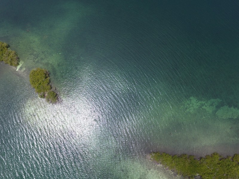
The angle of the sun definitely plays a huge role in whether the data you capture are excellent or sub-par for a number of reasons. The sun needs to be high enough in the sky to provide sufficient light for quality photography, but the actual time of day corresponding to ‘sufficient light’ will be location and season-dependent. Low sun angles also create shadows from tall objects (trees, buildings, boulders), so it’s best to capture data close to midday in terrestrial environments to avoid these shadows (unless you want to use them to calculate object height!). Conversely, the middle of the day is terrible if you have water in your scene as the sunglint will mean that it’s very difficult to see below the surface of the water.
Clouds
While clouds are less likely to obscure features in drone imagery than with satellite data (drones generally fly below the clouds), shadows and varying light intensities due to clouds impact the quality of mapping data (see this image by Daniel Nugroho, on GeoNadir Platform). Where possible choose a completely sunny day, or alternatively one with uniform, thick cloud cover for more stable lighting.
Wind
All drones have an upper limit in terms of their ability to operate effectively in wind, but this will most likely be far higher than the wind levels that are tolerable for mapping. Because the process of stitching together individual photos relies on software being able to identify matching features in adjacent images, problems arise when those features are moving. So grasses, leaves, branches, etc. blowing in the wind are not so good. In marine or aquatic environments, surface ripples or white caps on water bodies are also not good. Unless you want to study water movement of course!
Tides
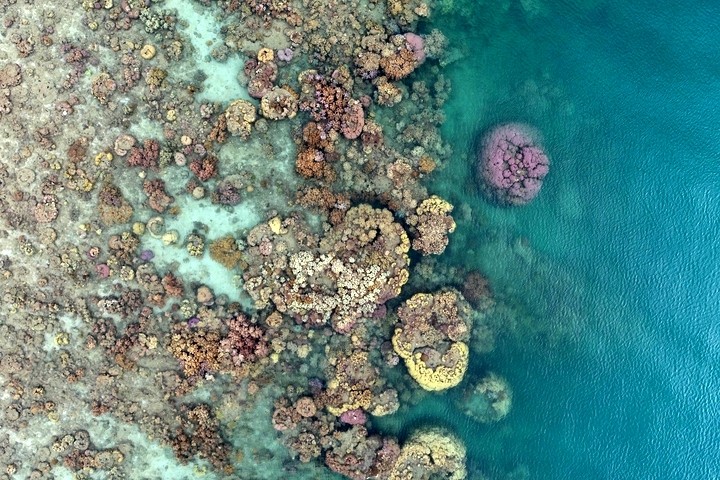
If you are working in a coastal or marine environment, chances are you are conscious of the tides in your location. As water obscures submerged features, we want to fly on those days/times when the tide is as low as possible. If you look over the side of your boat and can’t see the bottom, then don’t expect a drone to magically be able to do so. This image is pretty cool as you can see how water depth affects our ability to see the corals. It’s very low tide and in the left half of the image, the water depth would be less than 30cm. Of course, it was a spectacularly calm afternoon as well!
Seasons
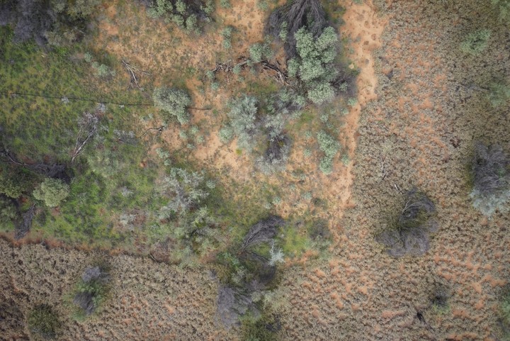
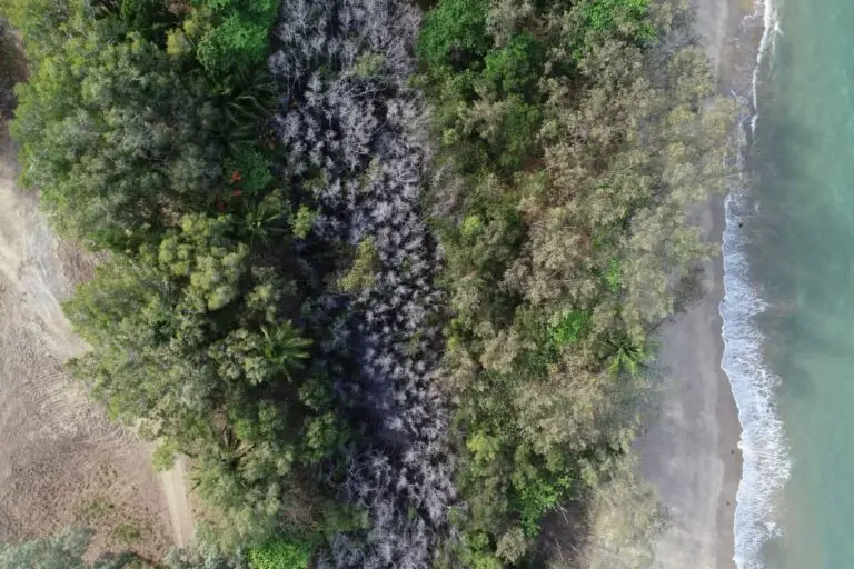
Perhaps you are interested in a particular plant and it’s easily distinguishable from the surrounding vegetation at a certain time of year when it flowers, for example. Or maybe it stays green for longer during a dry season. It’s important to understand the ecosystem to determine the best time of year you capture your data to achieve success. You can distinguish the native grasses from the invasive buffelgrass in this image as the native grasses are much greener.
The Goldilocks Zone
Finding the time that’s ‘just right’ for you and your application can definitely be a challenge. You can probably see from above that aligning all of the above factors might seem nearly impossible, depending on the environment you are mapping. But the idyllic days do exist, we just need to be flexible and ready to get our batteries charged in time!
With experience, you’ll get to understand your own level of compromise on ‘perfection’ as well. But remember that it’s better to put time into capturing analysis-ready data in the first place, than trying to out-process bad data.
Once you’ve captured your amazing data, why not share it with the world via GeoNadir? Every dataset has a story and I’d love to hear yours.

