
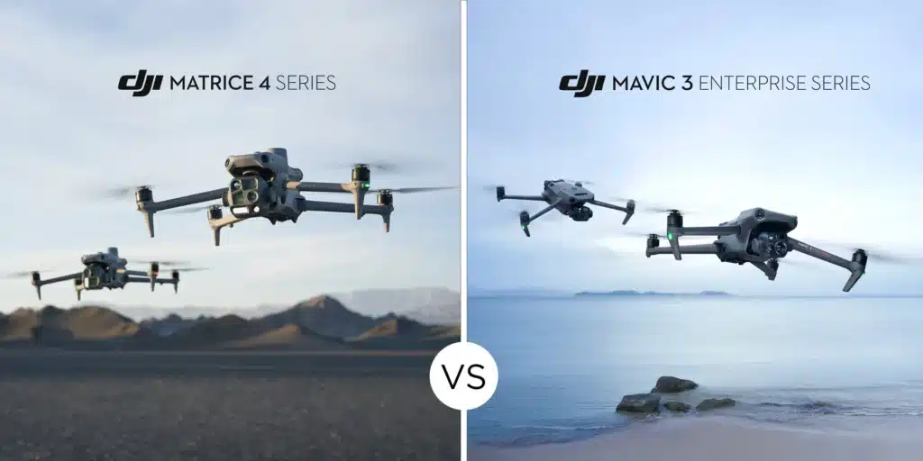
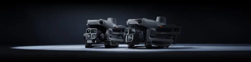
When it comes to drone mapping and surveying, two of the top contenders from DJI’s lineup are the Mavic 3 Enterprise (M3E) and the Matrice 4 Enterprise (M4E).
We decided to upgrade our drone and purchased a M4E and got into the field to test its mapping capabilities. We can honestly say we are impressed with this drone and the technology packed into all 1219 grams!
With the DJI RC Plus 2 controller and DJI Pilot 2 app, the mission planning is simple. The controller seems to be designed for ‘large’ hands and Karen finds it chunky for her hands. Unlike the similarly sized Autel controller, there is no tripod mount on the back, although we did find a third-party bracket.
Contents
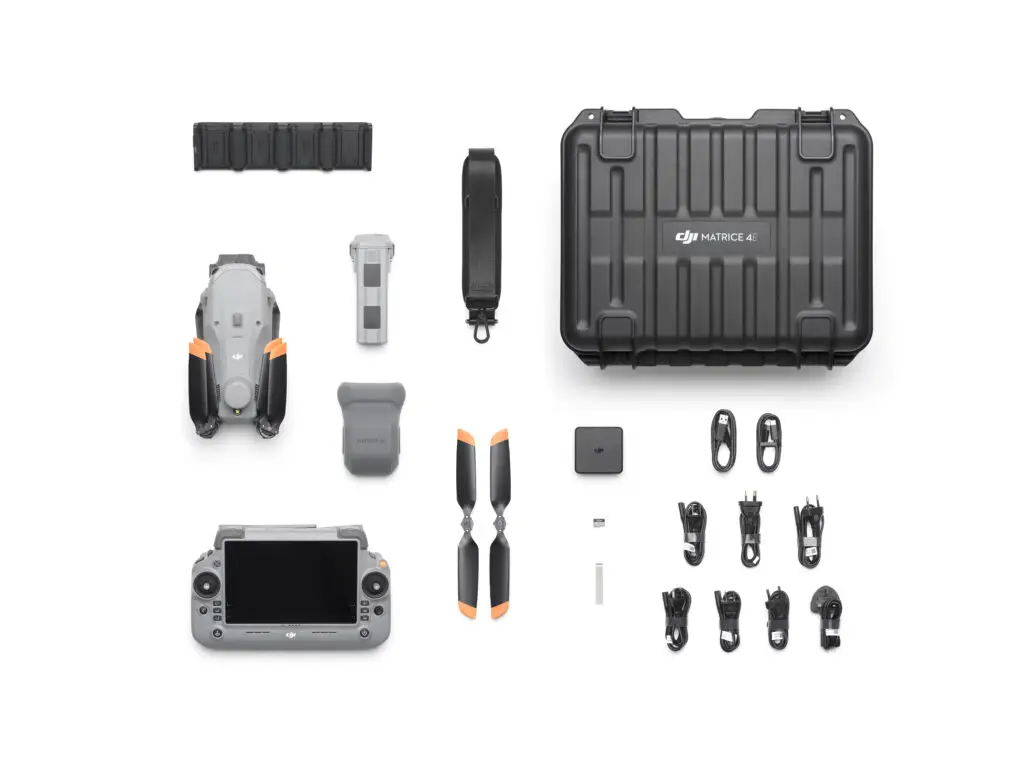
The drone comes in a hardcase that keeps everything well organised and secure, but isn’t as easy to throw on your back and hike cross country. It isn’t quite as portable as the DJI Mavic 2 Pro and the ‘handbag’ that was available for this model. With the size of the remote controller and if you need to carry it longer distances then it needs a backpack rather than a handbag to fit everything in – perhaps we might see one like we have for our old Phantom 4 Pro?
Overall, we think this is a fantastic option for those who are using drones in their work for mapping. The technology that is built into the drone reducesthe cognitive load on pilots, and makes capturing good mapping data (almost) fool proof!
Don’t waste $$$, get the right advice first!
Getting the right drone for drone mapping is not a case of getting one that just fits your budget! It is making sure that the drone you get has a mapping capability first!
A 15-minute consultation with our team could save you thousands of dollars!
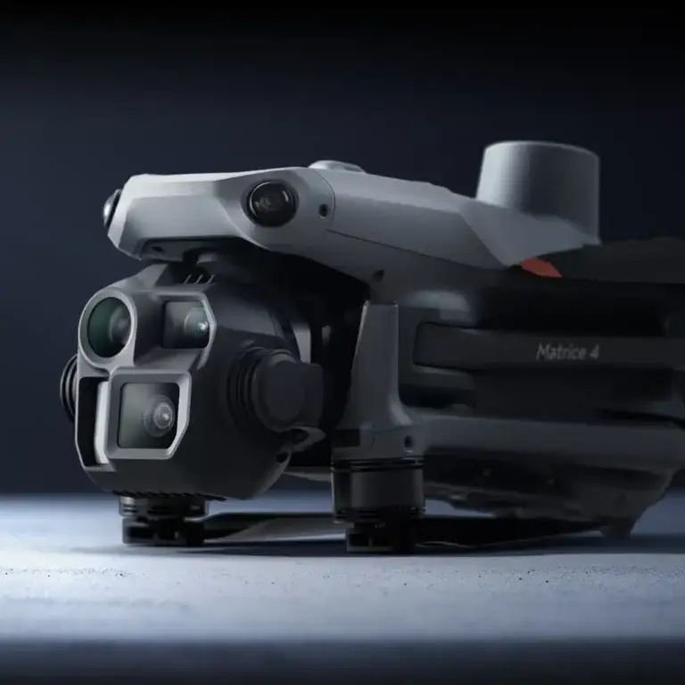
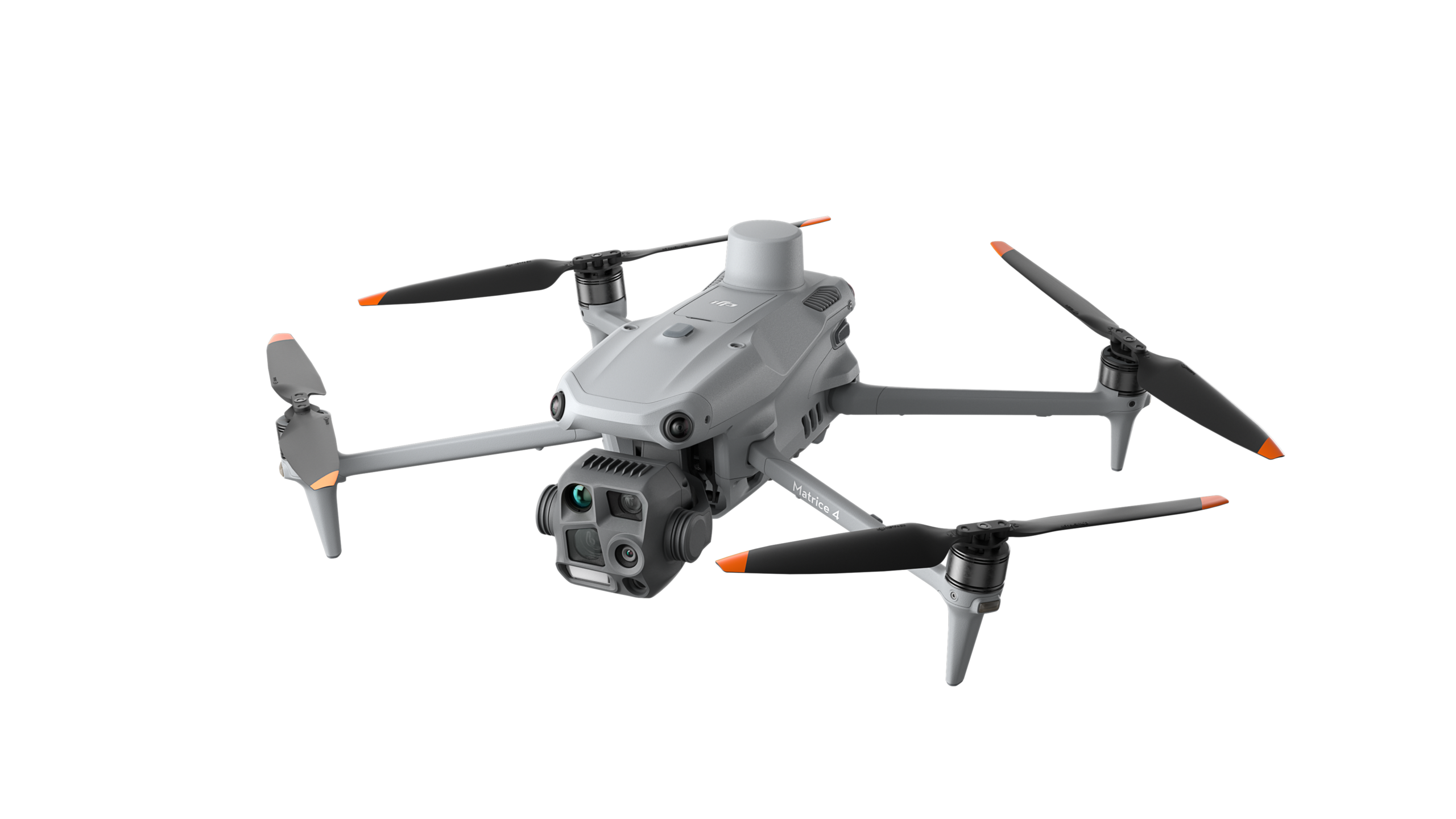
What we thought about the Matrice 4 Enterprise
The Matrice 4 Enterprise was released in early 2025 as an upgraded model from the M3E. The Mavic series moving forward will be focusing on photography and cinematography use cases, whereas the Matrice series will be focusing on mapping, surveying, search and rescue type use cases.
This will help to remove the confusion over the Mavic Pro and Enterprise drones for consumers. Many people will associate the ‘Matrice’ name with larger drones that are also subject to additional regulations. But don’t worry, the M4E comes in well below the 2kg limit at a mere 1,219g.
The Matrice series has an Enterprise (RGB sensors) and Thermal (RGB and thermal sensors) model options. We tested the Enterprise model. There is currently no Matrice 4 Multispectral, so if you are wanting a multispectral sensor, then the Mavic 3 Multispectral remains your best option.
What drone mappers will like
The upgraded Matrice 4 Enterprise has a few things that mappers will like:
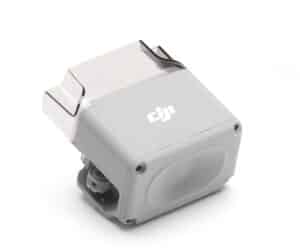
- Firstly, it has an integrated RTK module which can connect directly to NTRIP CORS, increasing its positional accuracy. It also is compatible with the new DJI D-RTK 3 base station.
- It can fly faster and for (slightly – 4 min) longer, meaning it can cover more area per flight.
- The wide-angle camera has a mechanical shutter to reduce motion blur and enables quick interval shooting at 0.5 seconds (faster than the Mavic 3E which has a 0.7 second interval shooting capability). This helps to get the best quality photos when conducting a mapping mission and a lower interval increases the amount of data captured in a shorter time.
There are some upgraded features which improve the safety of the drone in flight and reduce the cognitive load on the pilot, including increased return-to-home smarts allowing for better obstacle avoidance.
It also has some other features which might not be directly suitable for mapping missions, but provide additional use cases:
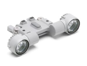
- Speaker for search and rescue or public safety (add on purchase).
- Light for search and rescue and inspections (add on purchase).
- Laser range finder for measuring distances whilst in flight.
- Built in AI model capable of detecting vehicles, vessels, and subjects. Custom developed AI models can also be used via the DJI AI Developer Platform. This could be handy for search and rescue or counting type operations. We haven’t yet tested the user friendliness or effectiveness of the DJI AI Developer Platform.
Basic comparisons: Matrice 4 Enterprise vs Mavic 3 Enterprise
| DJI Matrice 4 Series | DJI Mavic 3 Series | |
|---|---|---|
| Take off weight | 1219 grams | 915 grams |
| Max horizontal speed | 21 m/s / 75 km/hr | 15 m/s / 54 km/hr |
| Max flight time | 49 mins | 45 mins |
| Remote | DJI RC Plus 2 | DJI RC Plus |
| Wide-Angle Camera | 4/3-inch CMOS | 20 MP | 4/3-inch CMOS | 20 MP |
| Medium Tele Camera | 1/1.3-inch CMOS | 48 MP | N/A |
| Telephoto Camera | 1/1.5-inch CMOS | 48 MP | 1/2-inch CMOS | 12 MP |
Other camera modes for mapping
In addition to the standard nadir image capture, there are three other modes the Matrice 4 Enterprise can collect data in. We have tested these modes and are not convinced that they provide any benefit reconstructing orthomosaics.
Smart (three directional) ortho capture: The M4E can capture oblique images while conducting a mapping mission where traditionally only nadir images are captured. DJI states it allows reconstruction of the orthomosaic to be more effective. We did not find this to be true in our test.
Five directional capture: This is presented as being more effective for 3D model captures. As we focus mapping with orthomosaics using nadir imagery, we aren’t going to discuss this here. But we will provide a separate blog on our thoughts with the data we captured.
Capturing the data
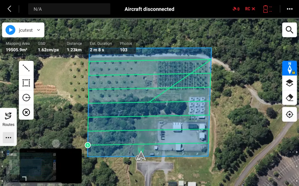
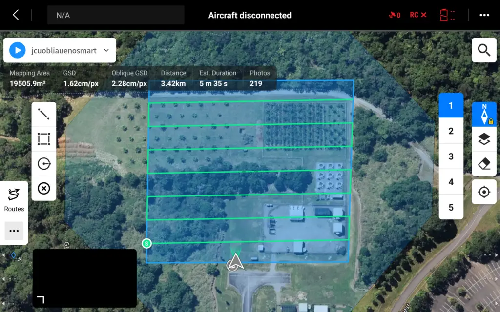
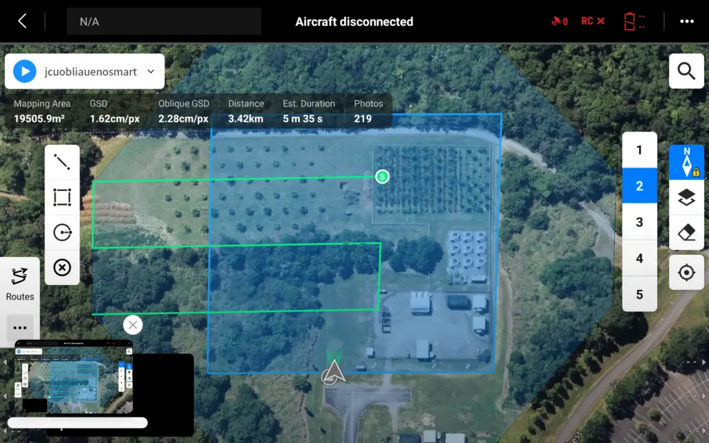
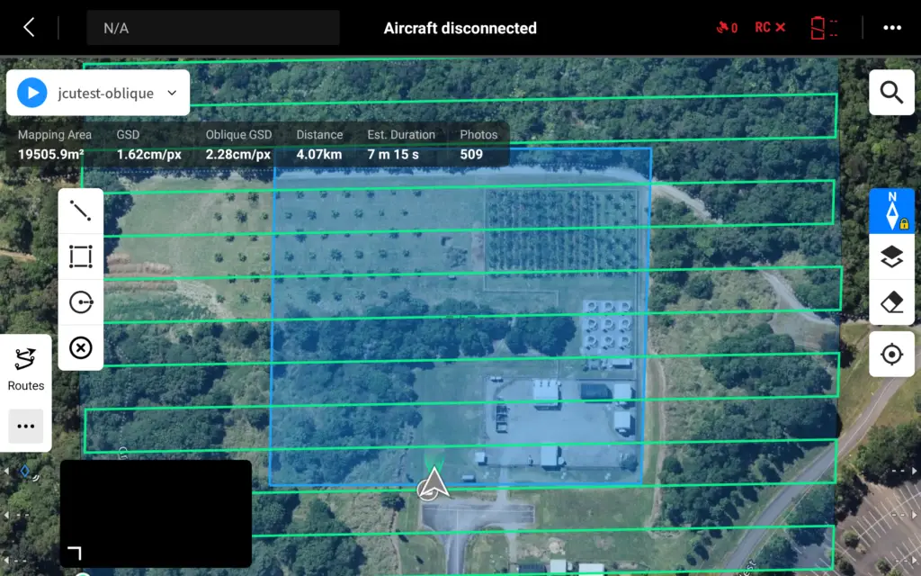
We conducted a test mission over a site that was 19,500m2 (1.95 ha) in size and relatively square in shape, comparing the different types of missions available in the planning app. Each mission had consistent settings where available, including 80% overlap and sidelap. The RTK was not switched on and a GNSS positional fix with 32 satellites was achieved. The only parameters that changed werethe settings calculated by the app, such as flight speed.
We tested the four mapping settings in DJI Pilot 2, as planned on the remote controller:
- Ortho – nadir images only
- Ortho with smart capture
- Oblique
- Oblique with smart
Here is a summary of the key flight details from each flight mission.
| Nadir only | Ortho with smart capture | Oblique | Oblique with smart capture | |
|---|---|---|---|---|
| Number of photos | 103 | 159 | 219 | 509 |
| Altitude | 60 m | 60 m | 60 m | 60 m |
| Flight time | 2 min 8 sec | 2 min 36 sec | 5 min 35 sec | 7 min 15 sec |
| Distance covered | 1.23 km | 682 m | 3.42 km | 4.07 km |
| Flight speed | 12.7 m/s | 4.2 m/s | 12.7 m/s | 4.3 – 12.7 m/s |
| Mapping area | 19,500 m2 | 19,500 m2 | 19,500 m2 | 19,500 m2 |
Ortho mission, smart capture off vs on
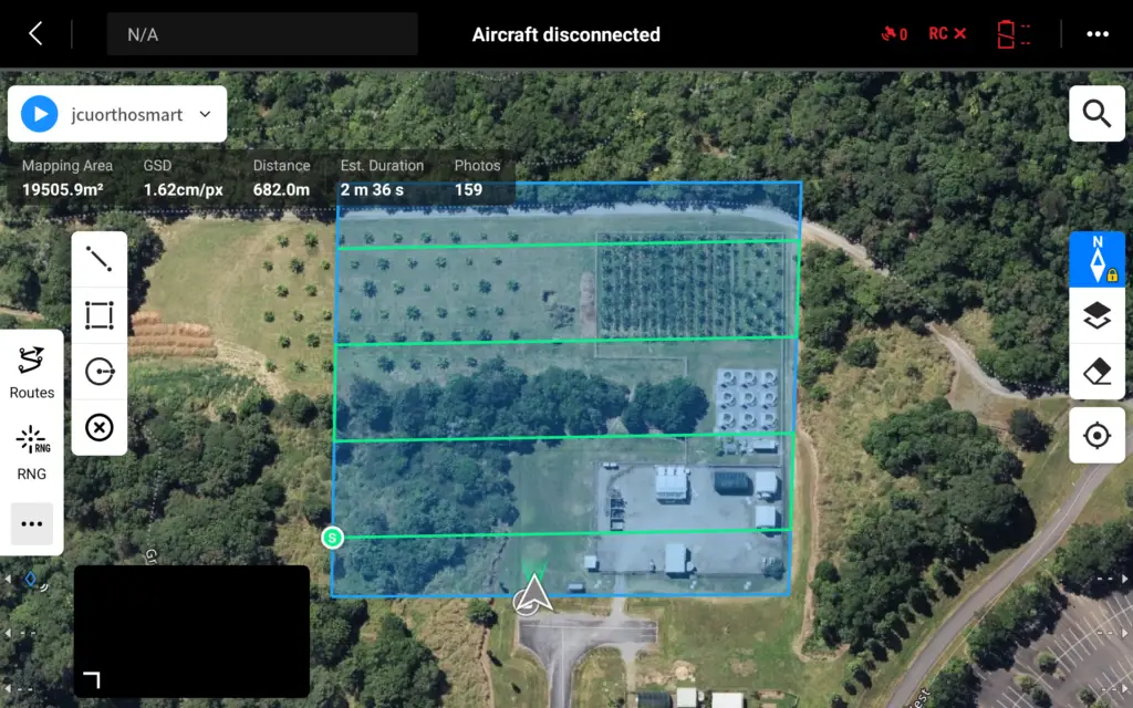
The ortho capture with nadir photos only (smart oblique turned off) was the fastest and collected the fewest photos (left image). Ortho with smart capture turned on flew fewer flight lines, but captured more photos as it collected a nadir, left oblique, and right oblique as it flew (right image). It also flew considerably slower as the gimbal needed to rotate at each point to capture the three photos.
Oblique mission, no smart capture
The oblique mission with smart oblique turned off flew in five different positions. Essentially it flew a ‘lawnmower pattern’ first collecting nadir and left oblique and right oblique images. It then flew four different patterns from the centre of the capture area to outside of the capture area taking oblique photos looking into the centre.
Oblique mission, smart capture on
The oblique mission with smart oblique turned on only flew an enlarged ‘lawnmower pattern’ over the flight capture area, but with the camera collecting images in five directions at certain parts of the flight. It slowed its flight down over the centre of the flight area, collecting more photos compared to the outside edges.
Processing the data
We processed the data in GeoNadir across the four different mission types and found that the standard orthomosaic flight mission, flown with nadir only images produced the best result:.
- It is the fastest to fly (can cover more area per battery)
- It takes the least amount of photos (reduces the upload and storage requirements)
- It reconstructs the orthomosaic with no discernible differences in quality compared to the other three options.
You can view the four datasets in this GeoNadir project by clicking here.
Price breakdown (AUD)
| DJI Mavic 3E Series | DJI Matrice 4E Series | |
|---|---|---|
| Without RTK | $6,049 | NA |
| With RTK module | $7,009 | $7,395 |
| Without RTK, including three spare batteries and charging hub | $6,769 | NA |
| With RTK, including three spare batteries and charging hub | $7,729 | $8,235 |
Both models are priced with 1 year of DJI Care or equivalent.
Prices are in Austrlaian dollars and inclusive of GST. Prices are subject to change and a formal quote is required to confirm exact pricing.
Summary
The Matrice 4 Enterprise is a great mapping drone if you can justify the price. If you currently have the Mavic 3 Enterprise, would we recommend you upgrade to the M4E? Probably not. You won’t see any major differences in the photo outputs for orthomosaics, and the faster flight time probably won’t be a reason the boss will accept either.
But, if you are still flying with a Mavic 2 Pro or Phantom 4 Pro in your drone hanger like we were, then the upgrade in technology will be substantial.
If you are deciding between the M3E and the M4E then the biggest factor will come down to cost. The Mavic 3 Enterprise is the cheapest option if you are not wanting RTK. If you do want RTK, then the M4E pricing becomes more comparable with M4E options being around 5 – 6% more expensive.
Don’t waste $$$, get the right advice first!
Getting the right drone for drone mapping is not a case of getting one that just fits your budget! It is making sure that the drone you get has a mapping capability first!
A 15-minute consultation with our team could save you thousands of dollars!
Buy drones from us
You can purchase the full range of DJI Enterprise products from us.
(Australian customers only)
Want to learn more?
Read more about choosing the right drones, learn about RTK, and decide which sensor is best for you.
Click here to learn more.