
I’m sure that my certified surveyor friends cringe when they hear about our methods of ‘Marine ground control’ on the reef! But here goes…
What is ‘ground control’?
No, we’re not calling Major Tom… Ground control points (GCPs) are points or features on the surface of the earth (or even underwater) with a known location. We want these points to be identifiable in corresponding drone or satellite imagery so that we can align our datasets to the ‘correct’ location on a map.
Where do we find good GCPs?
On land, you may be able to find survey markers that have been placed specifically for surveyors to use for ground control. However these are often too small to be found in satellite or drone imagery, so we need to identify other features in the environment and use GPS to record their location. The size of the feature will depend on the scale of the imagery being used – for example road intersections work well with Landsat data, while paint markings on a road are better suited to drone imagery.
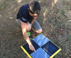
Sometimes it’s not possible to find reasonable ground control so we need to create our own. Aeropoints are designed for this purpose when using drones and even have an in-built GPS – you can read more about using these as GCPs here.
But what about marine environments?
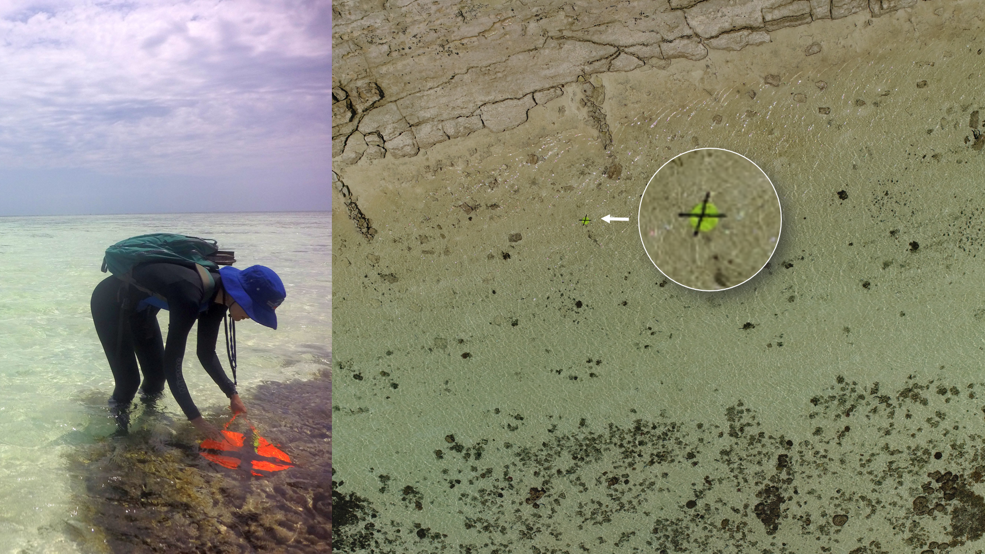
Of course there’s nothing to stop us using Aeropoints on an island, however most of the time I’m actually interested in the underwater habitats. The laminated cards that Dr Javier Leon, University of the Sunshine Coast uses are a good option here. We use dive weights to hold these down underwater. The patterns on the cards are also recognised within the Agisoft Metashape photogrammety software, which helps georeference the images and resultant orthomosaics.
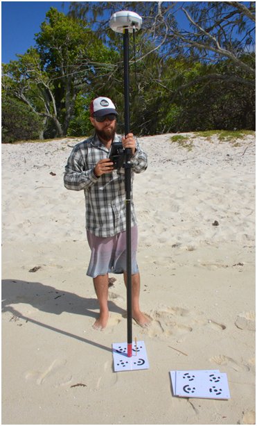
My personal favourite is the wonderful fluorescent sun hat, pioneered as a GCP by Dr Stephanie Duce from James Cook University. I love the multi-purpose use here 🙂 They are also super easy to see in our drone imagery and come in a variety of fashion colours! At low tide we use the RTK GPS to precisely measure the hat location for those that are deployed in areas easily accessible by walking on the reef flat.
What if it’s not possible to keep an RTK GPS dry?
This is actually the reality of most of the work that I do. So most of the time we do not have precise or accurate location data… gasp! Often we can co-register our drone data to available satellite imagery, but sometimes the latter is far too coarse so we just have to make do with what we have.
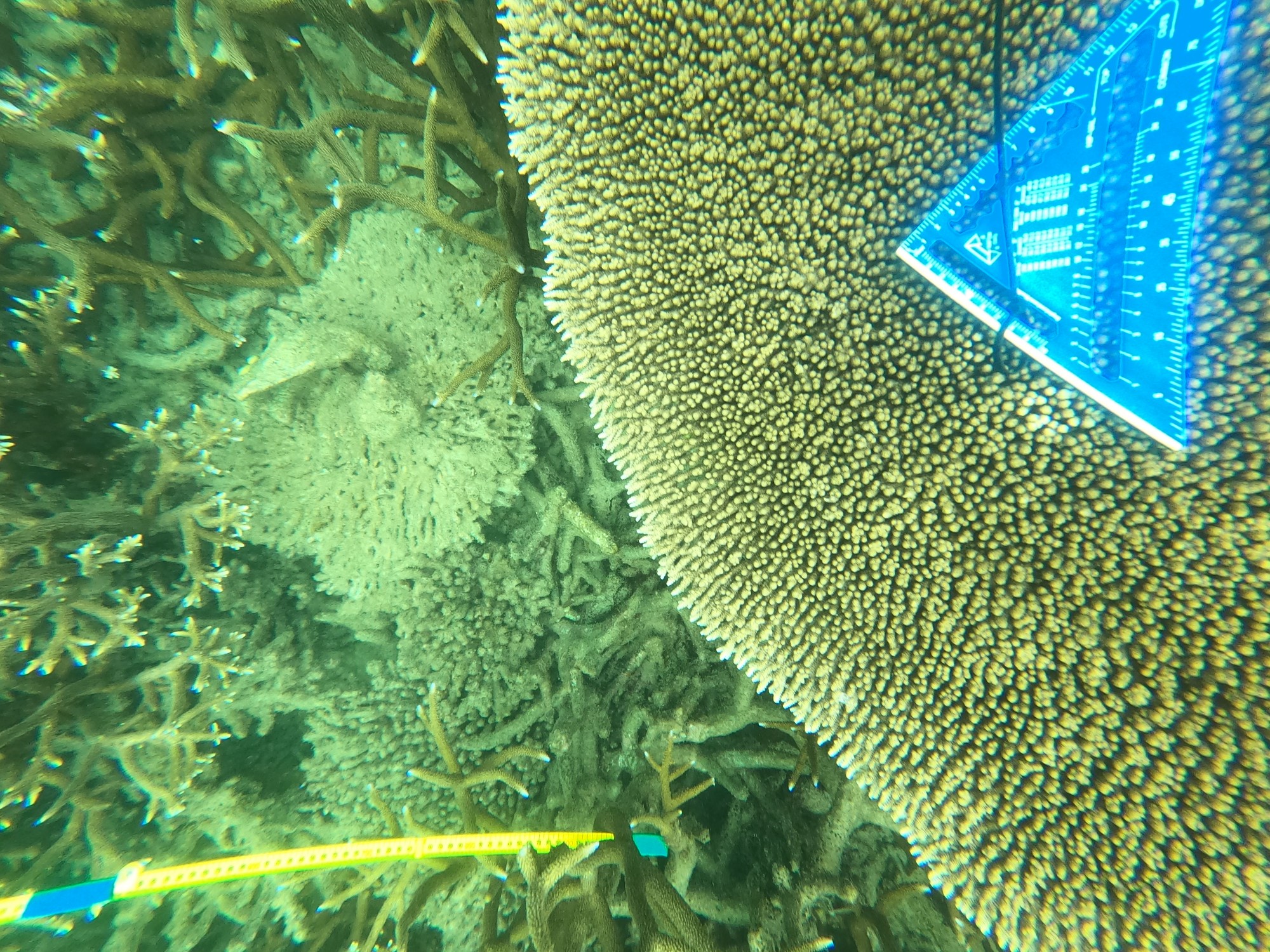
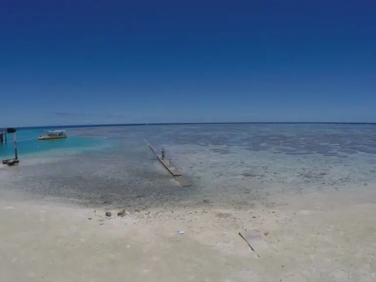
We can still co-register the drone imagery to suitable in-situ data such as this underwater image mosaic captured along a transect line below for example. A number of corals are easily identifiable, as is the transect tape (within the full resolution imagery), and some metallic set squares we have placed at the start and end of the transect. We use a hand held GPS in a water proof bag to get their approximate location too. You can check out this drone dataset for yourself here in GeoNadir.

Why do we need ground control when drones have GPS anyway?
Correct – the drones we use do have GPS, and there are some drones now that also have an RTK GPS. But as with all GPS there is a margin of error. It also represents the location of the drone at the time of image capture, which may not be exactly the same as the on-ground projection of the data due to the aircraft roll and pitch as well as any off-nadir camera angle. So location of tagged imagery isn’t necessarily as accurate as we might like.
A final word about marine ground control
The purists might feel debilitated by the level of precision and accuracy I deal with in marine environments. However I’m a firm believer that something is better than nothing and even if it’s not possible to get ground (or sea) control, there’s plenty of good that I can still extract from my data.
I’m on a mission to make the most detailed map ever possible of the planet using drone data – with or without ground control. If you have a dataset that you’d like to contribute, please visit www.GeoNadir.com
If you’d like to learn more about drone mapping, check out my online training course

