Drone mapping training
Learn how to capture, process, and analyse drone mapping data to produce accurate maps and meaningful environmental insights.
Designed for environmental professionals
Online Training
Our online, self-paced drone mapping course teaches you how to capture, process, and analyse drone mapping data to produce accurate maps and meaningful environmental insights.
Designed for those getting started with drone mapping and who want to learn more about data analysis on the GeoNadir platform.
In Person Training
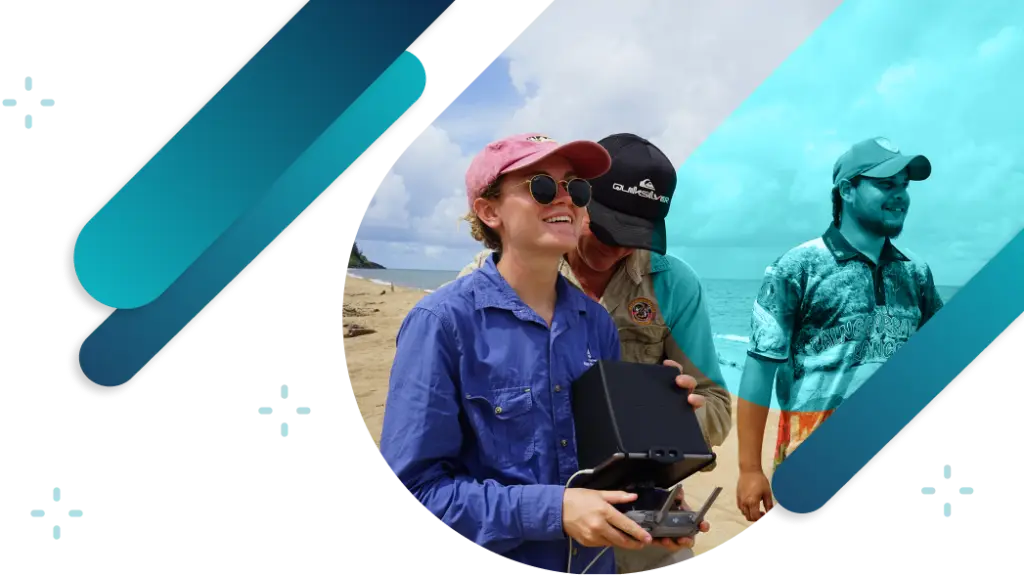
Our three day face-to-face drone mapping training gives you practical drone flying skills, and a GeoNadir expert to guide you through data processing, analysis, and workflows for your use case.
Designed for beginners to advanced drone flyers who want to become confident in collecting and analysing data.
Free online course
A self-paced online course that is designed for people just getting started with drones, through to those who want to explore real-world applications of geospatial data analysis and interpretation.
Course modules
Understand geospatial
Build core geospatial literacy and learn how spatial data flows from collection to insight.
Choose equipment
Select drones, sensors, and accessories that deliver reliable data for environmental mapping.
Collect quality data
Plan flights, manage data, and follow best practices for consistent, repeatable results.
Analyse and interpret data
Turn raw imagery into environmental insights using visualisation and analysis tools.
Apply your skills
Explore real-world tutorials that combine drone and satellite data for climate and ecosystem analysis.
Tutorials covered in the course
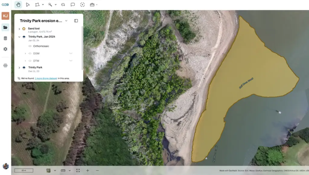
Coastal change monitoring to calculate sand loss and visualise shoreline change.
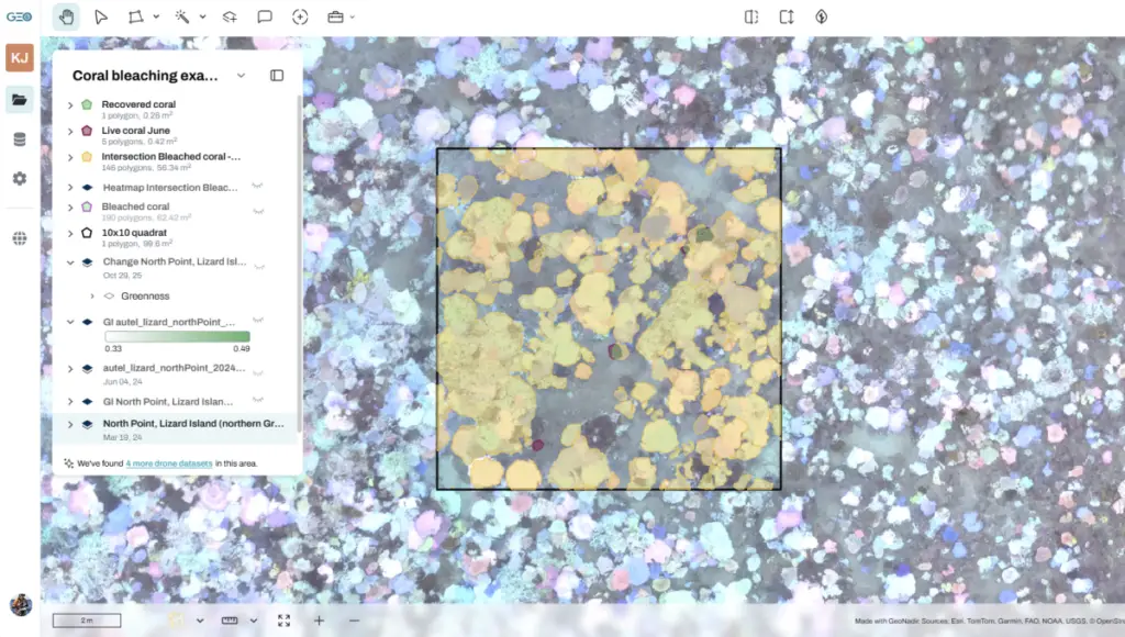
Reef monitoring to compare pre/post bleaching events and visualise change.
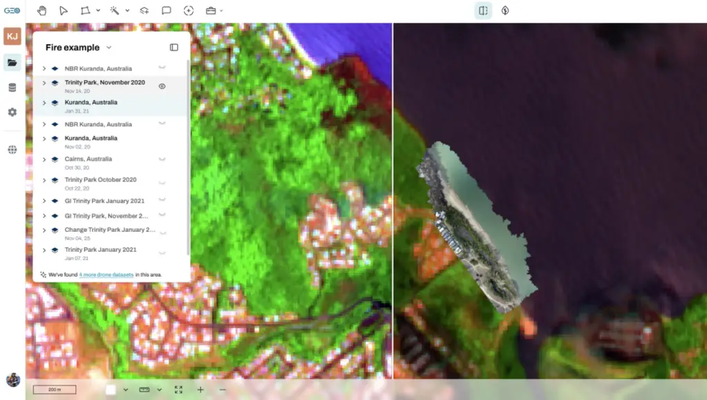
Fire and ecosystem resilience to assess fire severity and vegetation regrowth.
Why is it free?
Previously we have sold this course for $750. Thanks to some generous support through the NRMA Insurance Help Fund they have funded access to this course for anyone.
NRMA Insurance Help Fund is funding several projects we are conducting with community partners to empower them to see, measure, and understand environmental change – so they can act with confidence.
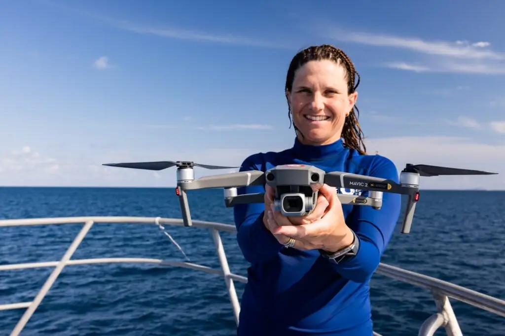
Your instructor
Dr Karen Joyce has 25 years experience in geospatial technology across military, government, industry, and academia. She lives and breathes Earth observation.
Karen has been teaching remote sensing and GIS at universities since the late 90’s. Karen got a taste of drones at NASA in 2013, and since then has built her own drone capabilities for research and commercial purposes.
She has taught hundreds of people to fly drones for the first time, and her online content is viewed thousands of times each week by people around the world.
Karen is a co-founder of GeoNadir, and is regularly asked to speak at international conferences on research and practical applications of drone and satellite data in an environmental context.
In person training
Our multi day in person training is customised to suit the needs and flying experience of participants. Typically we run a three-day drone mapping course that covers practical flying skills, data capture missions, and data analysis in your location.
How it works
Understand your team needs
We will do a discovery call to understand the outcomes you are wanting to achieve from the training, your participants experience and needs, and your budget.
We will then design the course to meet your needs.
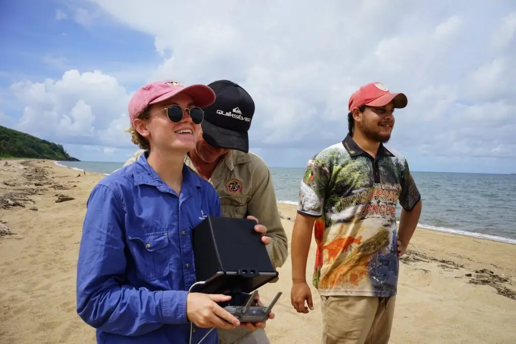
Practical flying
We take people who have never flown a drone before and give them the confidence to fly. We start with microdrones indoors, taking our 10 years of experience teaching thousands of people to fly, before venturing outside.
We cover manual flight skills so participants are confident with all the controls and buttons on the controller.
A heavy emphasis is placed on safe and legal flying.
Mapping missions
We cover the basics of conducting a mapping mission before getting out there and flying a couple.
We discuss the challenges likely to be faced in your environment, and how to overcome these so you team can still collect good data.
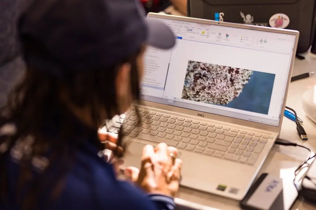
Data processing
Back inside we upload the drone mapping data to GeoNadir and cover what is happening during the processing stage.
Understanding what is happening helps to reduce the number of mistakes made in the data capture phase.
Data analysis
We go through some data analysis tutorials specific to the outcomes your team needs.
We learn how the GeoNadir tools work, collaborate as a team, and produce insights on the data that are decision-ready.
Questions
We answer lots of questions throughout the training.
We’ve been flying since 2013, flown nearly every DJI sub 2kg model of drone, and made a ton of mistakes along the way.
We share our learnings so your team doesn’t have to make the same costly mistakes as we have!
We're here to help...let's talk!
Book a call with a GeoNadir expert at a time that suits you.
Created by environmental professionals like you
years flying drones
people using in our learning materials
team field days last year
What's new!
For the latest insights check out our most recent articles.