
Mangrove conservation is a pressing global concern. These habitats are highly productive ecosystems that offer many environmental services. Mangrove forests store nearly 10 times more carbon per hectare compared to terrestrial forests, playing an important role in the fight against climate change! They also safeguard the coastlines of tropical and subtropical regions, home to nearly two billion people. But, they are becoming increasingly vulnerable due to the rapid growth of human development.
To better understand mangroves, which are an essential part of globally degrading coastlines, I studied how Geographic Information Systems (GIS) can map these ecosystems so that it may give us a better understanding to enhance how we manage them. This study investigated data collected along the South Pioneer Bay of Orpheus Island Research Station in Queensland, Australia.
Why is mapping important for mangrove conservation, and how can drones help?
Habitat maps show the geographic distribution of different physical characteristics within an area, allowing us to identify priority areas for conservation. Traditionally, mapping involved satellite images & in-situ surveying. These are often time-consuming, intrusive, or lack the necessary spatial resolution for detailed analyses. However, drones are becoming a popular alternative, offering a new and exciting way to overcome past shortcomings.
Satellites are affected by atmospheric conditions and often have a set revisit frequency. This limitation leads to us missing the best conditions to map our ecosystems. However, a major advantage of drones is that they overcome these conditions and allow us to choose the best marine conditions for mapping aquatic environments as well! Moreover, drones are less invasive than on-site surveying methods, so they’re safer for the environment and the researchers.
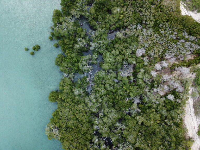
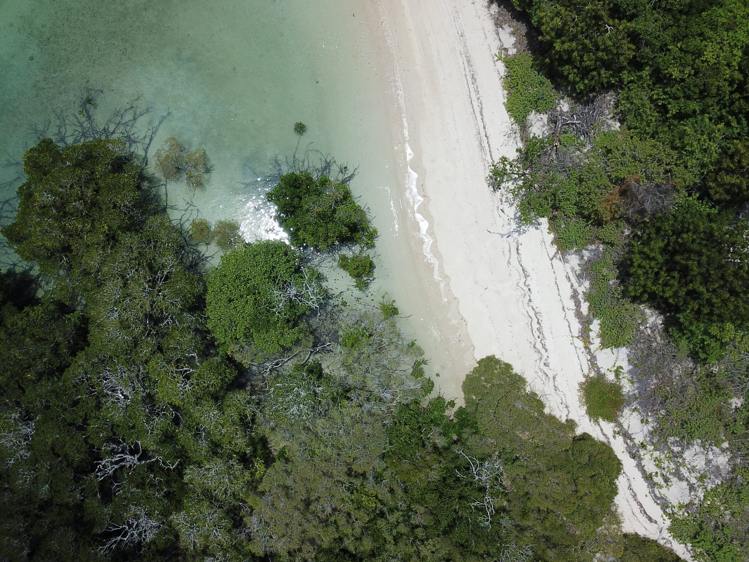
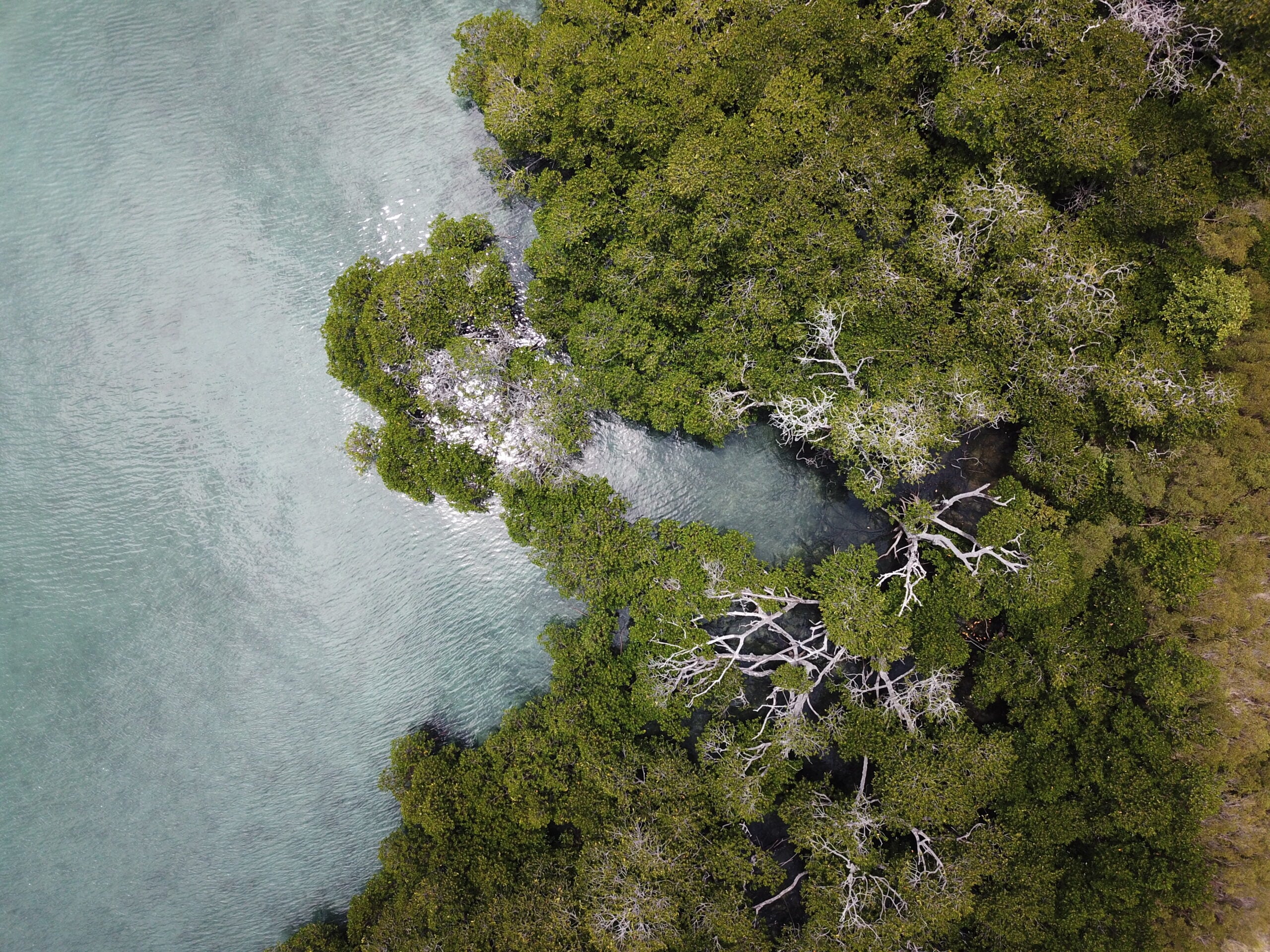
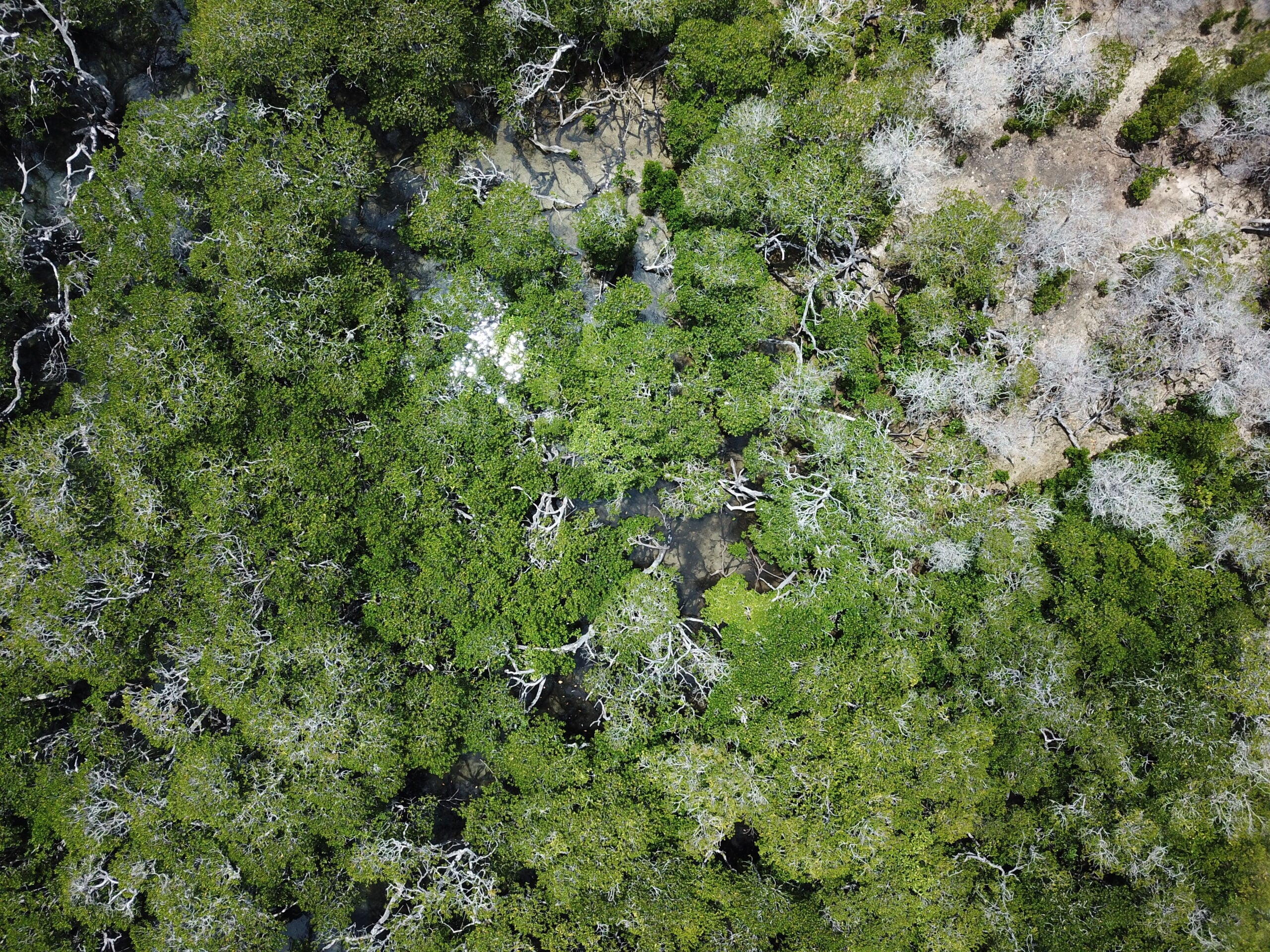
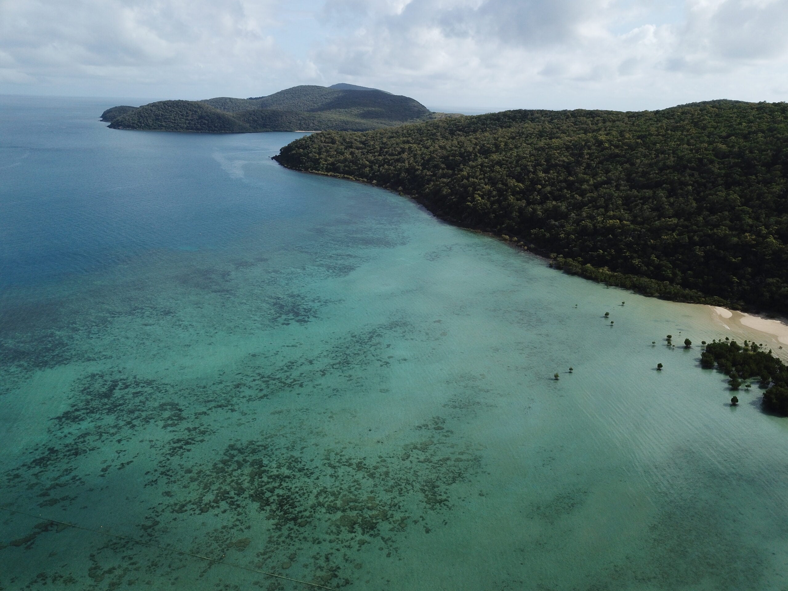
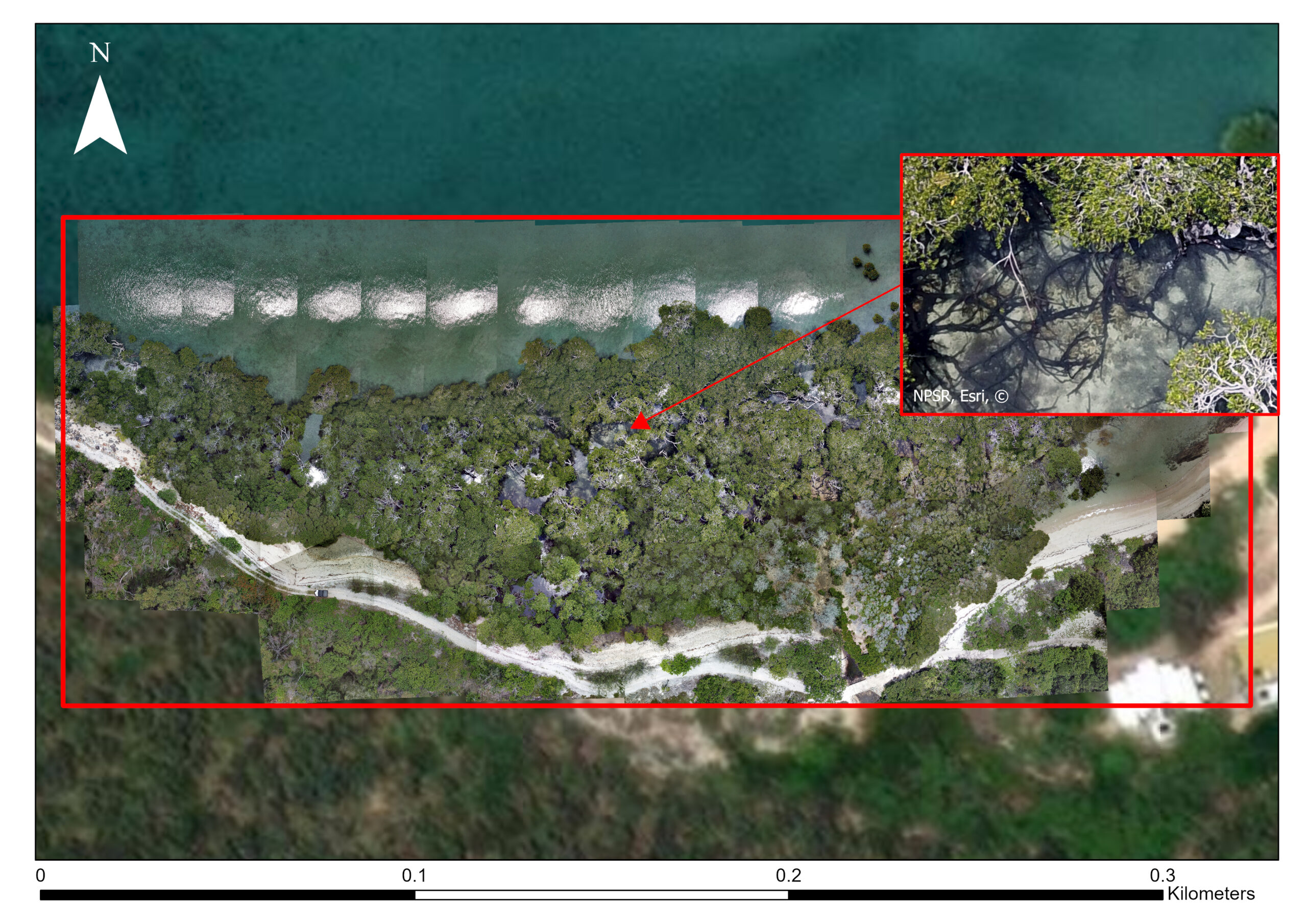 Drone Image
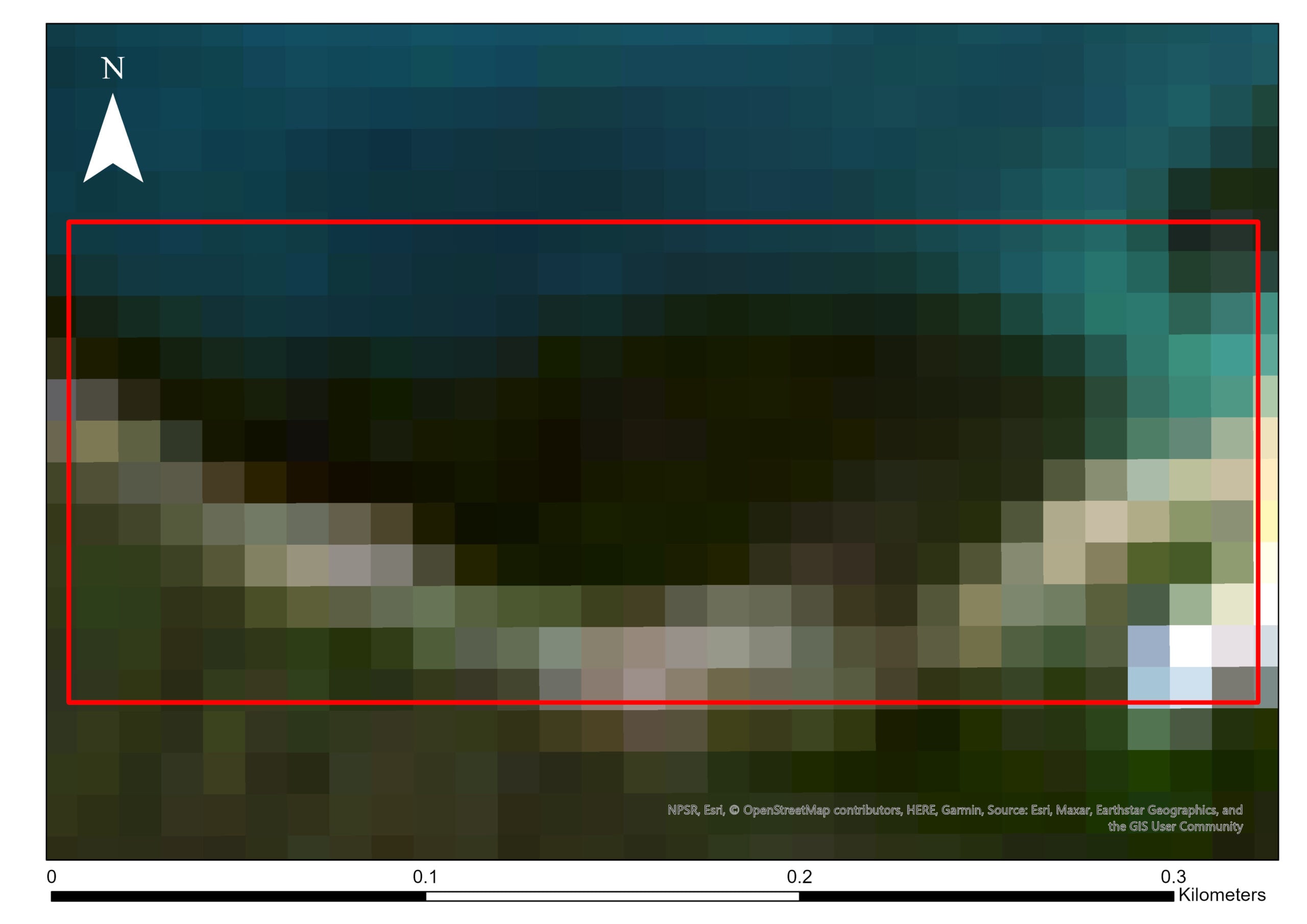 Satellite Image
The image above shows the visual difference between the study site mapped using a drone (right) and its free satellite imagery (left).
Visualising the mangroves of Orpheus Island
I used ArcGIS Pro to stitch 283 drone images to map the study site to create an orthomosaic. The orthomosaic was analyzed using three methods to explore how mangroves can be visualised, which were selected by reviewing the current literature on drone mapping, and classifying vegetated environments. Three common methods were used to investigate how they may assist in mangrove conservation.
- Finding out the level of ‘greenness’ of pixels
- Assigning sections of the image by the colour information in the pixels
- Grouping visually (colour, shape, size) similar sections of the image into classes
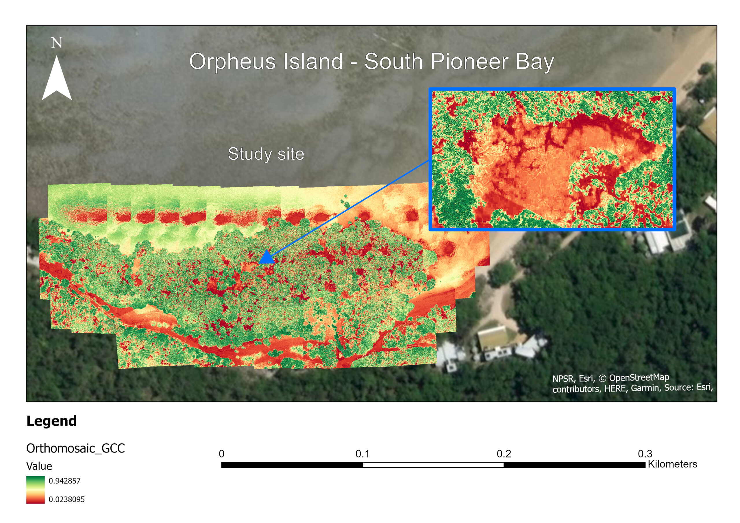
1. Green Chromatic Coordinate (GCC)
GCC is a ratio of the “greenness” of pixels in the orthomosaic. It enables us to identify which parts of the vegetation are healthy and, conversely, where managers can take steps to improve mangrove health
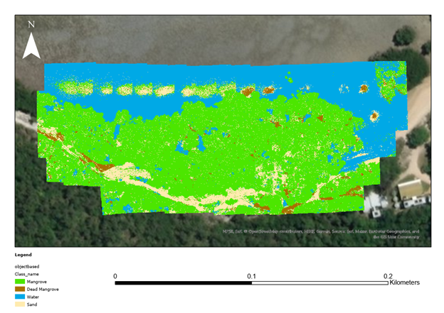
2. Pixel-Based Classification
This method classifies the study site into four pre-selected classes. The reflectance of light in each pixel decides the different classes in the drone images. It uses the contrast in colours between the sand, water, and mangroves.
3. Object-Based Classification
This method classifies the study site by grouping neighbouring pixels based on the average reflectance of pixels within segments. This classification method also considered the shape of features within the image.
Results, and how this may help mangrove conservation
The study found that all three methods had a high overall accuracy in classifying the mangroves. The GCC allowed us to see parts of the mangrove that are healthy and the areas that are impacted by mangrove dieback as a heatmap. Both the pixel-based and object-based classifications were useful to identify live mangroves from the dead. However, the pixel-based classification was found to be the more accurate of the two classifications.
The orthomosaic produced in this study had a spatial resolution of 1.6 cm per pixel (compared to the 10 metre resolution in the satellite image above!). This allows environmental managers to use it for validating satellite data, ensuring the accuracy of large scale analyses. Therefore, the above results of this study will allow scientists to determine important indicators of mangrove health, making use of its high level of detail.
Using drones to validate satellite imagery and photogrammetry provides critical information for mangrove conservation. Further improvements of this study show the potential to provide us with better understanding of mangroves.
What's next?
An important part of this study is the accuracy assessment of the tested methods. Regardless of their relatively high accuracy (87.5%), there are further steps that we can take to improve them- such as adding a little effort to crop out unnecessary features from the stitched image.
Sharing knowledge on how to use drones to conserve our endangered ecosystems is crucial. So, if you are a drone pilot or are aspiring to become one, find out how you can help out on our mission to build a drone map of our planet here by sharing your data!
Feel free to get in touch with the GeoNadir team if you would like to learn more about this study!

