Islands of the Great Barrier Reef are more than just ‘oh cay’
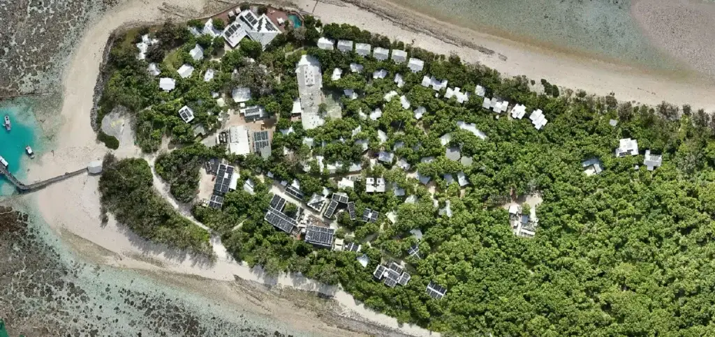
The coral cays of the Great Barrier Reef are more than just picturesque, sandy islands. They are dynamic, living systems that play a crucial role in the health of the reef and support a wide range of biodiversity, from nesting seabirds to critical turtle habitats. However, their ever-changing nature, shaped by ocean currents, storms, and […]
AI for wildlife monitoring with drones on the Great Barrier Reef
The future of ecological conservation lies in innovative technologies that streamline data collection and analysis. One such revolution in conservation science is integrating drones with artificial intelligence (AI) for wildlife monitoring. This offers a non-invasive, efficient, and cost-effective way to gather information, but unfortunately it’s not always straightforward! We’ve recently been working with Olivier Decitre […]
LiDAR drone mapping – what you need to know before delving in!
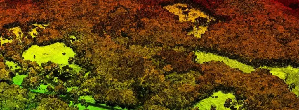
Besides my robovac, I confess to knowing next to nothing about LiDAR. But don’t let that deter you from reading on! I promise I’ve brought in the big guns. While I’ve been working in the Earth observation industry for 25 years, my area of expertise is multispectral and hyperspectral data analysis. So when someone asks […]
How contrast enhancement can help you get more from drone mapping
Have you ever captured data that looks a little too dark or too bright? Sometimes we mess up the camera settings or the lighting conditions change considerably during capture. Or maybe the features you’re most interested in are underwater or in the shadows, so they’re naturally a little dark. What if you know there are […]
How drone mapping fits into the image processing sequence
A standard image processing sequence has driven remote sensing and Earth observation applications for decades. This sequence is a framework of stages through which to progress and applies equally to drones as it does to more traditional satellite mapping. It takes us from defining the problem to communicating results and all the steps in between, […]
Drone mapping training opens up a whole new world of possibilities
As a remote sensing scientist, mapping is my bread and butter. I have a deep passion for Earth observation data, and I could easily spend all day studying different ecosystems and their changes over time. Integrating drone data into my work for ecosystem analysis over the past decade has been a game changer. While it […]
Multispectral drone mapping unpacked
While multispectral imaging may have been developed as a military surveillance technique, these days its benefits are far more wide ranging. From Earth observation sensors on satellites to laboratory based systems, they can be deployed to detect, identify, and measure features invisible to the human eye at a variety of scales. Let’s look at how […]
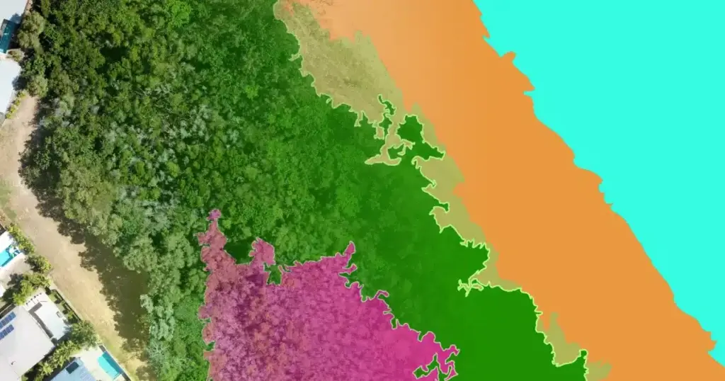
Why is snapping important for creating accurate maps?
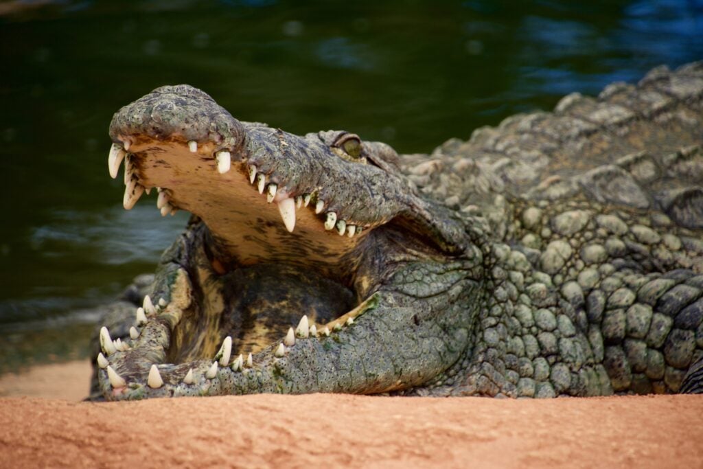
What do crocodiles and GeoNadir projects have in common? We both love snapping! But of course in vastly different ways 🙂 When we snap as part of creating insights with our drone mapping data, this is a good thing. Not something to be afraid of! So what is snapping, and how can it help us […]
Can you use MetaAI’s tool ‘Segment Anything’ for drone imagery?
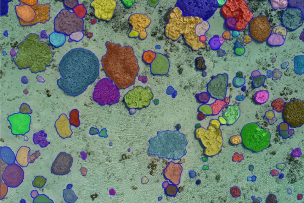
Move over ChatGPT, there’s a new AI kid on the block! Just this week MetaAI released a new tool called ‘Segment Anything’ (Meta is best known as the Facebook parent company). And it’s unleashed the same fears and excitement as many tech tools before it. As someone who has been segmenting Earth observation imagery for […]
What is the benefit of building a circular data economy?
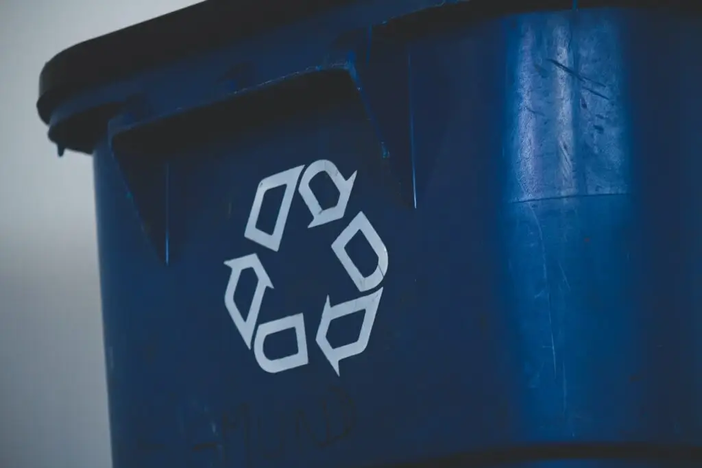
Over the years we’ve become accustomed to reusing, recycling, and upcycling a wide variety of different products and materials. At the same time, a greater awareness of the health and environmental impacts of practices such as fast food and fast fashion have also led calls for more sustainable ways of living. Collectively, this opens discussions […]
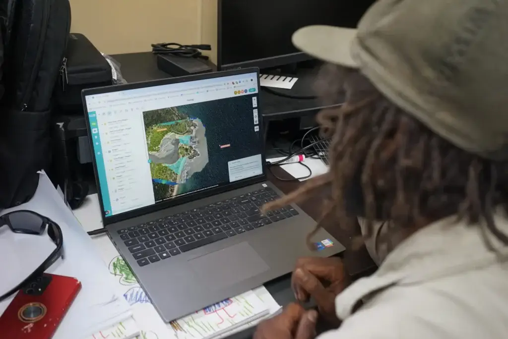
Drone mapping an isolated reef in the Caribbean
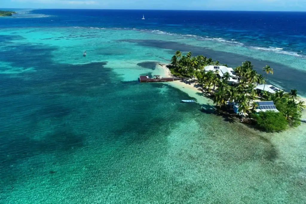
People often ask me what inspired me to create GeoNadir. To be honest, first and foremost it was selfish intention to make my life easier. Since 2013 I have amassed a huge amount of drone mapping data, and I’ve always had the problem of how to store, process, and share it in a simple workflow. […]
Drone image dataset (Best Tips to Upload a dataset)
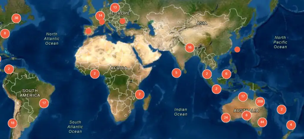
Here at GeoNadir, we want to create the biggest repository of free drone image datasets and drone mapping imagery from around the world. We want to make sure that all drone data is FAIR (Findable, Accessible, Interoperable and Reusable) so the treasure trove of knowledge stored in drone images can be used by people all over […]
How drones are improving landslide risk management in Brazil
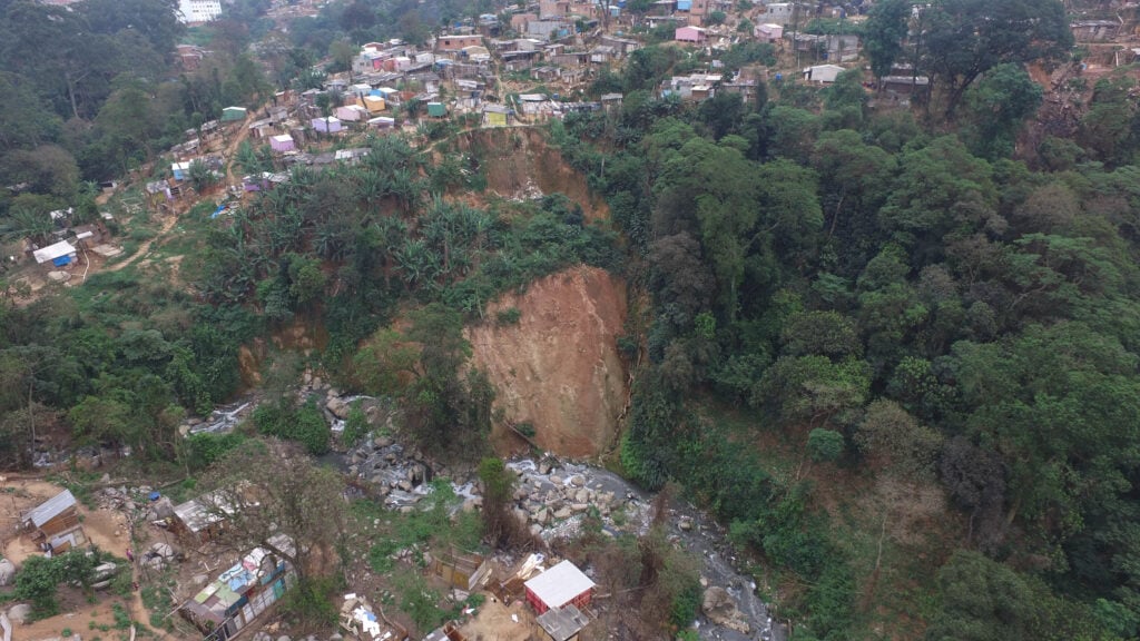
If you were watching international news in February, you would have heard about the devastating landslides that swept through the Brazilian city of Petrópolis. Extreme rainfall along the Serra do Mar range triggered 269 landslides. Combined with flash flooding 217 people died and more than 850 homes were destroyed. While this natural disaster was undeniably catastrophic, […]
What is photogrammetry?
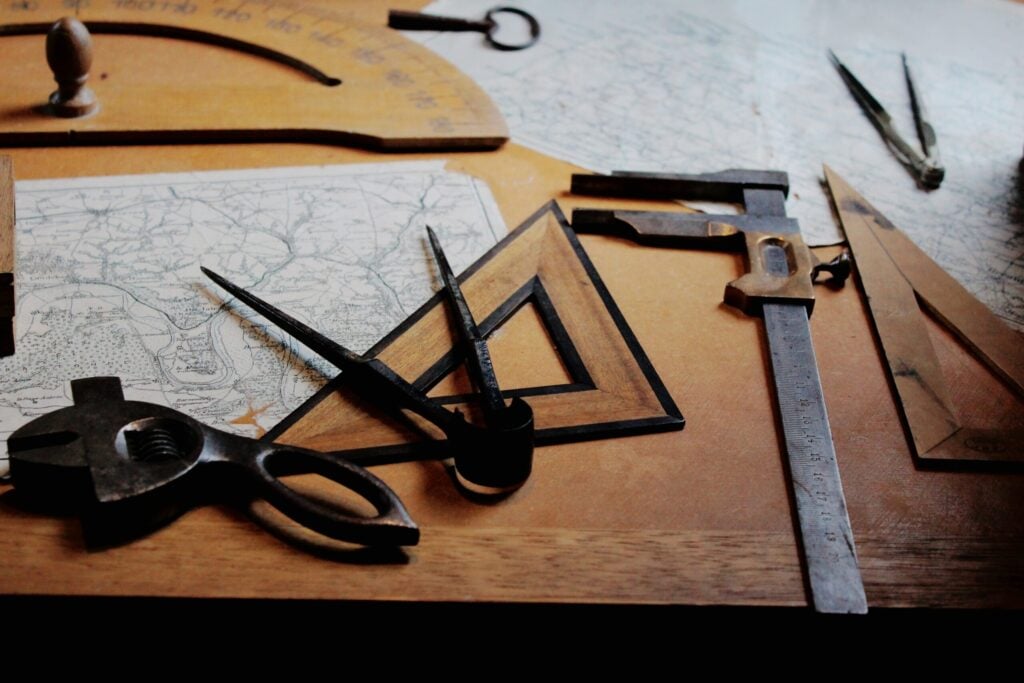
Photogrammetry is the science of taking measurements from photographs. We can make photographic measurements using photos taken at ground level, from aerial platforms, and even underwater. One of the most important elements of photogrammetry is taking lots of photos with high amounts of overlap between adjacent pictures. Aerial photogrammetry was initially limited to organisations […]
Understanding the cycles of coastal lakes and lagoons
Intermittently Closed and Open Lakes and Lagoons (or ICOLLs for short) are a common ecosystem near many coastal towns. But despite being on many people’s back doorstep, local communities often misunderstand them. This makes managing these systems tricky, especially when what the environment needs isn’t what the community wants. Stories from Above is about learning […]
Open Data: there’s no such thing as free
For the past 20 years, open data has been rapidly changing the face of earth observation applications and innovations. Twenty years ago (yikes!) Luther Vandross and Janet Jackson crooned ‘the best things in life are free’ and it seems that Barack Obama agreed. By the end of 2008, the entire archive of Landsat data […]