
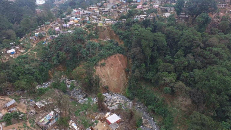
If you were watching international news in February, you would have heard about the devastating landslides that swept through the Brazilian city of Petrópolis. Extreme rainfall along the Serra do Mar range triggered 269 landslides. Combined with flash flooding 217 people died and more than 850 homes were destroyed.
While this natural disaster was undeniably catastrophic, it was unusual only in the scale of the devastation. Landslides are common in Brazil and often result in loss of life and property. In the same region of Brazil, more than 1500 people have died from similar landslides in the past few decades. In 2011, the region was hit by a series of heavy storms that triggered multiple landslides and flash flooding that killed more than 900 people.
Image credit for featured image: Camila Viana
Landslides are one of the most frequent natural hazards in Brazil, so researchers are working hard to learn more about them to make sure future events are less devastating. Part of this means figuring out which areas are more susceptible to landslides, and what kinds of conditions trigger them. It’s also about spotting early warning signs so people can evacuate. Drone mapping is one technology that is helping with landslide risk management.
What causes landslides?
The term landslide refers to any mass movement of soil, rocks, or earth down a slope. Depending on conditions, they can be slow-moving, shifting marginally over a period of months, or very rapid. It is rapid landslides that cause the most harm since they often occur with little warning.
Landslides happen when the forces pulling down on a slope are stronger than the forces holding the slope in place. While the downward force (gravity) stays constant, there are lots of different factors that can impact the stability of the slope, weakening the forces that hold it in place. Things that rapidly change the stability of the slope, like earthquakes, rainfall or volcanic eruptions, can trigger landslides. That being said, not all slopes will have landslides in response to a trigger event. Figuring out why some slopes slip and others don’t is one of the first steps to identifying landslide risk.
What changes landslide risk?
There are lots of factors that play into risk, and they all interact with each other.
Slope – Most landslides occur in mountainous regions because steeper slopes are generally less stable.
Soil depth – Thicker soils have the ability to hold more water in rainfall events. Water adds extra weight to the side of the slope. It can also help overcome the natural friction holding the soil together, making it more likely to slip.
Geology – Different types of rocks beneath the soil also change landslide risk. The underlying rock also changes the soil that makes up the slope. Soils with smaller grains are generally more landslide-prone.
Beyond limiting where people build, we can’t change these risk factors. Some regions just have underlying characteristics that make them less stable. We also can’t do much to decrease landslide triggers. We can’t stop earthquakes from happening or change the amount of rain that falls. But there are man-made factors we can influence that are making these landslides more dangerous than they have to be.
Brazil experiences a lot of landslides, particularly along the Serra do Mar range, because of how steep the slopes are and how much rain the country receives. But it’s been made worse by deforestation, which has removed stabilising trees from these slopes. A lot of illegal housing is also built on these slopes, placing poorer people directly in the path of danger.
Using drones to understand landslides
One of the best ways to understand landslide risk is to understand factors that have caused them in the past. This means looking at old or ongoing landslide sites, but doing this quantitatively in the field is difficult. Landslides can be very big, and by nature occur on steep, often hard to access slopes. Traditional field work to assess them can be very time consuming.
Satellite imagery can be good for identifying where landslides have occurred and how large they are. But the resolution of satellite images is often too low to show important details and features.
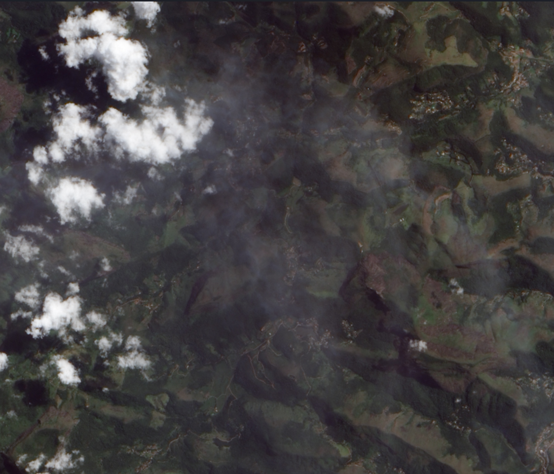
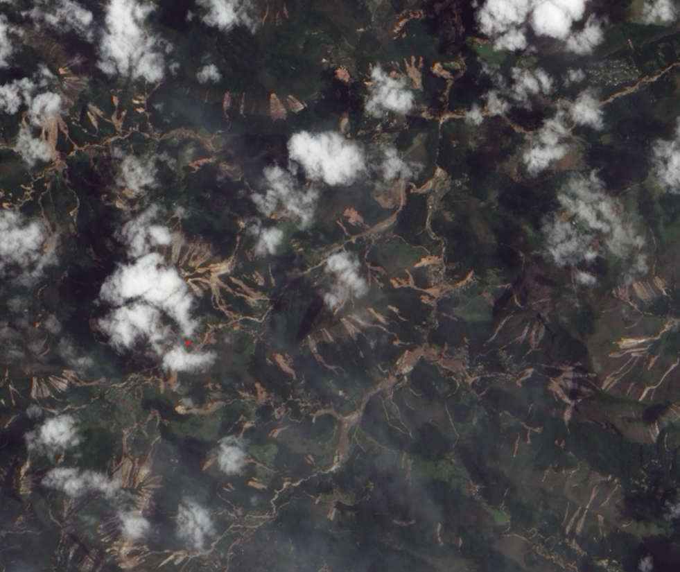
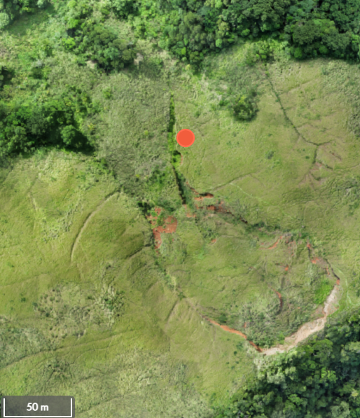
Carlos Grohmann and his team from the University of São Paulo are instead using drones to help them learn about landslides. By mapping landslides with drones, they have high quality images to track how a landslide changes with time. By comparing two orthomosaics from the same site, they hope to spot small changes, like cracks or shifting earth. Signs like these can indicate how the landslide is moving and can help his team determine what’s causing the landslide to change. Below are two sites Carlos and his team have mapped.
You can view both the Lagoinha and Toque Toque Grande landslide datasets on GeoNadir.
All of these data can then be put together to make landslide susceptibility models more accurate. These models not only identify where there is landslide risk, but also what conditions might trigger slips in that area. Authorities can then use this information to help warn people when there is a high risk of landslides.
Real-time identification of risk
Developing susceptibility models takes time and data. In the meantime, there are other ways that drones are helping gauge landslide risk. Part of the work the Brazilian government currently does to reduce risks is identifying landslide warning signs. New cracks in the ground or buildings that have shifted from their original position are signs that a slope might be unstable. With heavy rain, these areas might slip. When this happens in cities, the results can be catastrophic, as we saw earlier this year. By spotting signs of instability early, authorities can warn residents and help them evacuate before triggering events, like heavy rainfall.
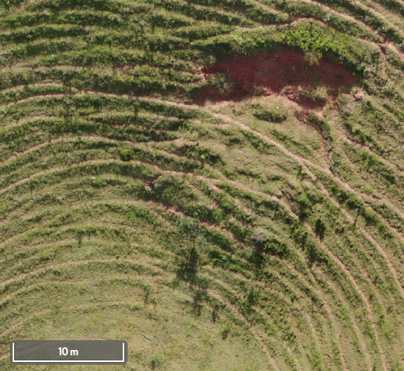
At the moment, these surveys for warning signs are done on foot or by flying over the city with a helicopter to take pictures. These methods either take a lot of time and manpower, or they’re very expensive. Through their work, Carlos and his team hope to demonstrate how these surveys can be done much more efficiently, and cheaply with drone mapping. The orthomosaic below is a suburb in São Paulo potentially at high risk of landslides. It was flown by Carlos in one drone flight. Now there is a quantitative record of what this part of the city looked like on that day. By mapping the same area again in the future, the team can compare the two orthomosaics and look for any landslide warning signs. Using drones to undertake these surveys could save time, money and people-power.
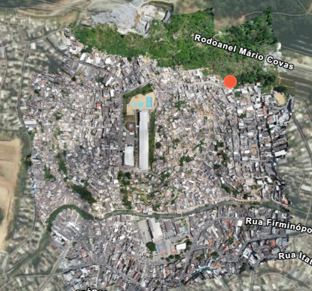
An orthomosaic of a suburb in São Paulo, Brazil. Carlos and his team captured it as part of a discretionary trust process to assess the investment value of a property near the university. By analyzing landslide warning signs and terrain stability, they aimed to understand potential risks that could impact long term property value and development prospects. You can view the dataset on GeoNadir.
Check out more datasets on GeoNadir
Carlos and his team’s work with landslides is just one of many stories about the innovative ways people are using drones to solve environmental problems. You can read about them on the Stories from Above blog, or you can check out some of the other fascinating datasets people have uploaded on GeoNadir.
The research by Carlos and his team is supported by the São Paulo Research Foundation (FAPESP) grants #2016/06628-0 and #2019/26568-0.

