What do crocodiles and GeoNadir projects have in common? We both love snapping! But of course in vastly different ways 🙂 When we snap as part of creating insights with our drone mapping data, this is a good thing. Not something to be afraid of!
So what is snapping, and how can it help us create more accurate maps? What happens if we don’t snap? Read on to learn more.
Contents
What is snapping?
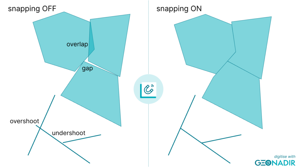
In the context of making a map, snapping allows us to align or connect map features to each other. As we draw adjacent features, our cursor is attracted to nearby shapes that already exist, like a magnet near a fridge.
Using this technique helps ensure that different features within map layers, such as roads, buildings, or rivers, are correctly connected or aligned at their endpoints, edges, or intersections.
For example, when digitizing a road network on a map, snapping connects the endpoints of different road segments to create a continuous and seamless representation of the road system. Similarly, we can use it to align the corners or vertices of polygons, such as land cover types or boundaries, so they match with other map features.
What happens if I don’t snap?
Several issues can arise without snapping the map-making process:
Misalignment: Map features may not align accurately or seamlessly with each other. Roads, rivers, or boundaries may appear disjointed or disconnected where they should intersect or meet.
Gaps or overlaps: For example, when digitizing polygons, such as land parcels, the absence of snapping can result in slivers or gaps between adjacent polygons, affecting the accuracy of the map representation.
- Inaccurate measurements: For instance, if a road network is not snapped, the calculated length of a road segment may be incorrect This affects distance calculations and analysis based on the map data. Similarly, polygon area could be over or underestimated due to overlaps or gaps respectively.
Reduced map quality: Let’s face it, a snapped map just looks better! Snapping helps create visually appealing maps with clean lines and smooth connection. Without it, the map may appear cluttered, disjointed, or visually unappealing, reducing its overall quality and usability.

Creating accurate maps
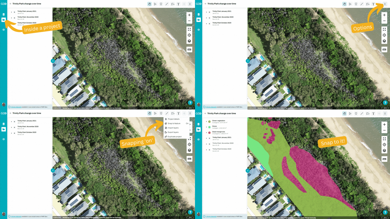
Most mapping and GIS packages like ArcGIS Pro and QGIS allow you to toggle snapping on and off while digitising. In GeoNadir, it is turned on by default when you are working within a project. This means you don’t need to do anything, just start drawing to create insights on your drone mapping orthomosaics! As you near the edge of another line or polygon when you’re drawing, you’ll notice your cursor gets attracted to it like a magnet.
The following video shows how to get started with digitising information over your drone mapping data in GeoNadir.

So, what are you waiting for? Snap to it!
Get started with your free GeoNadir account today for the ultimate drone mapping experience. it’s the best place, to store, process, analyse, and share your drone mapping data.


