
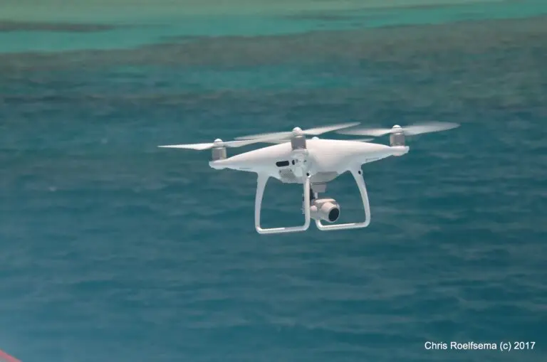
In the past decade, drone technology has advanced from clumsy, expensive, DIY kits to sleek, user-friendly, commercial models. Each new improvement and advancement in processing software has expanded the number of fields where drones can help solve problems. It can be hard to keep up, especially if you’re someone without a remote sensing background. So what can you do with a drone? Are they the solution you’ve been looking for?
From monitoring wildlife with thermal cameras to mapping coral bleaching, a tool for resolving disputes involving retaining walls, drones are hugely flexible. If we listed all the different ways they could be used, we’d be here all day. But one thing basically all drone uses have in common is that they let us capture data, usually pictures, from a new perspective, across a large area and at a level of detail that we can’t achieve otherwise.
When are drones helpful?
Drones fill the data collection niche between on-the-ground surveying and satellites. While we can get a lot of detail from on-the-ground surveying, the total area that we can sample from the ground is small. It can also take a lot of time, work and money and not all places are safe for people to sample in person.
Satellites are unparalleled in the amount of ground they cover. Most of the earth has historical satellite images. The tricky part is accessing satellite imagery that is high enough resolution and taken frequently enough and at the right time to spot what you want to see. While some satellite imagery is available for free (e.g. Sentinel Playground or Google Earth), free imagery usually has comparatively low spatial resolution and a slow revisit period. For example, the Sentinel-2 satellites only have a resolution of 10m and a 5 day revisit period. It can be expensive to access commercial satellites that offer a higher image resolution and a quicker revisit period. Sometimes, even the best satellites available aren’t enough.
So, if a problem you’re dealing with is too detailed for satellite imagery but too big to get a grasp on from the ground, drones might be for you.
Case study: Glaciers
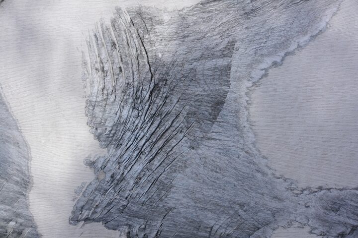
Understanding glaciers and how they are melting is important for predicting the impact of climate change on these fragile systems.
Drones help access parts of glaciers that are too dangerous to be accessed on foot. Adding a thermal camera to a drone can also help show which parts of the glacier are melting most rapidly.
You can read more about mapping glaciers with drones here.
A picture of Glacier D’Orny in Switzerland, mapped by Andrea Blindenbacher and her team from Drones for Earth. View the image collection on GeoNadir.
The advantages of drones
What gives drones such an advantage over ground surveying or satellites? It comes down to flexibility and the amount of area that you can cover. When you use a drone, you get to choose the area, resolution, timing and frequency of your data collection. By flying lower or using a higher resolution camera, you can easily increase the resolution of the images that your drone collects. Because you choose when to collect the data, you can collect data when you can see details most clearly (e.g. low tide) or whenever you need to. Plus, you can add extra sensors to your drone to collect data beyond the visible spectrum of light.
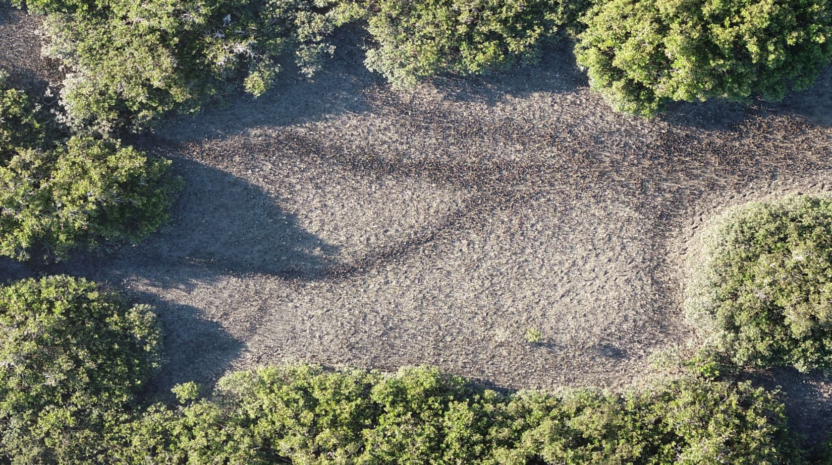
Case study: Oyster Reefs
Oyster reefs are an important intertidal ecosystem that can be vulnerable to disturbance. That means it’s important to monitor these ecosystems consistently, but satellites are too low resolution and rarely take pictures at low tide when the oysters are visible.
Drones offer a way to quickly map large areas of an oyster reef in the small low-tide window, with enough detail to accurately distinguish oysters from the surrounding sediment.
Keeping it versatile: Drone mapping
These images are then fed into a photogrammetry program, which stitches them together into one continuous image called an orthomosaic. Photogrammetry software can be tricky to navigate as a beginner, but if you upload your drone mapping images to GeoNadir, we’ll turn them into an orthomosaic for free!
The end result is a detailed picture of your area of interest that can be analysed for all kinds of useful data. Plus, you can go back and re-map it whenever you want to get a detailed record of change over time.
Tip: Depending on what kind of drone mapping you want to do, you might want a different kind of drone. Fixed-wing and multirotor drones have different advantages and disadvantages depending on the environment they are flying in. You can learn more here.
Limits on what you can do with a drone
As awesome as drones are, you can’t fly them anywhere, anytime. Every country has its own rules and regulations around flying drones, but in general, if you don’t have a specific qualification:
- Your drone can’t leave your line-of-sight
- You can’t fly more than 120m above the ground
- You can’t fly at night
- You need a license to fly drones above a certain size
- Some areas are off-limits without special permission, like around airports or in some national parks
- You can’t fly close to people, or over populous areas (like a busy beach)
You can double-check the specific rules for your country here:
Looking for more inspiration?
The sky is the limit (or actually, 120m above the ground is the limit!) when it comes to the amazing things you could discover with drone mapping. But if you need some more inspiration for what you can map with your drone, check out the awesome datasets on GeoNadir that people have uploaded from all over the world.
You can also read about some of the incredible work people have been doing with drones on the Stories from Above blog.
When you go mapping, consider uploading your collection to GeoNadir so that other people can learn from and be inspired by you!
Happy flying!

