Category: Drone Mapping Tips & Tricks

Flight Parameter Calculator

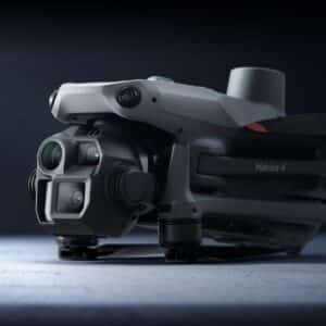
Drone mapping parameter estimator – All Models Flight parameter estimator Select your drone: Autel EVO IIHoly Stone HS720DJI Air 2SDJI Matrice 4EDJI Matrice 4T (thermal)DJI Mavic 2 ProDJI Mavic 3 Enterprise (RGB)DJI Mavic 3 MultispectralDJI Mavic 3 ProDJI Mavic Air (v1)DJI Mavic Air 2DJI Mavic ProDJI Mini 2DJI Mini 3 ProDJI Mini 4 ProDJI Phantom

Read More »
Drone Mapping Tips & Tricks

A review of the Matrice 4 Enterprise (M4E)

When it comes to drone mapping and surveying, two of the top contenders from DJI’s lineup are the Mavic 3 Enterprise (M3E) and the Matrice 4 Enterprise (M4E). We decided to upgrade our drone and purchased a M4E and got into the field to test its mapping capabilities. We can honestly say we are impressed

Read More »
evidence of coastal erosion from the ground level along a beach with exposed tree routes
Drone Mapping Tips & Tricks

Ten ways to assess coastal erosion with drone mapping

Coastal environments are in constant flux, influenced by tides, storms, and human activity. Understanding these changes is critical for managing coastal erosion, assessing storm impacts, and informing conservation efforts. Drone mapping provides a powerful way to track these changes with high spatial accuracy. In no particular order, here are ten ways you can assess beach

Read More »
Drone Mapping Tips & Tricks

RTK, Ground Control Points, and GPS accuracy explained

When using drones to create a map, you have different options to achieve different levels of positional accuracy. The best choice depends on your specific requirements and what equipment you have available to you. Positional accuracy refers to how precisely a mapped location matches its true position on the Earth’s surface. In drone mapping, accuracy

Read More »
Drone Mapping Tips & Tricks

Geospatial AI and collaboration in the future of Earth observation

Earth observation (EO) data are everywhere, just like Swifties. Datasets are growing by over 100 petabytes per year, with a steady expansion in geospatial AI technology driven by new satellites and the democratization of data capture through drones. In fact, there are more drones in circulation today than there are kilometers of coastline worldwide. Despite

Read More »
Multispectral mapping drone flying over grassy background
Drone Data Processing

Multispectral mapping Made Easy? Hands-On with the DJI Mavic 3 Multispectral and Terra App

Integrating drone technology with cutting-edge software has revolutionized the way industries collect, process, and analyze geospatial data. One of the most versatile tools in this field is the DJI Mavic 3 Multispectral (Mavic 3M), a drone designed for precision agriculture, environmental monitoring, and land management. DJI also provides its own data processing software, DJI Terra,

Read More »
Drone Mapping Tips & Tricks

LiDAR drone mapping – what you need to know before delving in!

Besides my robovac, I confess to knowing next to nothing about LiDAR. But don’t let that deter you from reading on! I promise I’ve brought in the big guns. While I’ve been working in the Earth observation industry for 25 years, my area of expertise is multispectral and hyperspectral data analysis. So when someone asks

Read More »
Drone Mapping Tips & Tricks

What is the best drone for mapping

Does it start with my budget? Getting the best drone for mapping is not a case of getting the one that fits your budget! There are several considerations that you need to make before you purchase, and we will cover them here. With DJI holding the dominant market share globally, it means that the availability

Read More »
Drone Data Capture

Mapping with Waypoints

Using Waypoint Map for a mapping mission Thanks to Mick Green at DriftMedia who has shared this ‘how to’ video on using Waypoint Map so you can capture a mapping mission with the DJI Mini 4 Pro, DJI Air 3, or Mavic 3 Pro using the DJI RC or RC2 remote control. Mick is also using

Read More »
Person on a computer looking at drone mapping imagery
Drone Mapping Tips & Tricks

Drone mapping training opens up a whole new world of possibilities

As a remote sensing scientist, mapping is my bread and butter. I have a deep passion for Earth observation data, and I could easily spend all day studying different ecosystems and their changes over time. Integrating drone data into my work for ecosystem analysis over the past decade has been a game changer. While it

Read More »
Drone Mapping Tips & Tricks

Natural ground control points increase drone mapping accuracy

Accurate mapping is the cornerstone of numerous fields, from urban planning and environmental management to disaster response and infrastructure development. At the heart of achieving precision in mapping lies the strategic placement of ground control points (GCPs), which serve as reference markers for aligning aerial (including drone) or satellite imagery with real-world coordinates. While traditional

Read More »
Drone Data Processing

Multispectral drone mapping unpacked

While multispectral imaging may have been developed as a military surveillance technique, these days its benefits are far more wide ranging. From Earth observation sensors on satellites to laboratory based systems, they can be deployed to detect, identify, and measure features invisible to the human eye at a variety of scales. Let’s look at how

Read More »
Drone Data Processing

Ground control points (GCPs) can enhance your drone mapping accuracy

Wanting to make decisions using your drone mapping data? If so, understanding your location precision and accuracy is paramount, and ground control points – GCPs – might be your answer. As aerial surveys become increasingly integral to various industries, ensuring accuracy in data processing and location information is essential. Let’s delve into the significance of

Read More »
Drone Data Capture

Getting the basics right with the Pilot Institute

Getting the basics right with the Pilot Institute In the rapidly evolving world of drone technology, getting the basics right, understanding the drone and what it can do, and how to use this to best effect for your projects has never been more critical. This is where the offerings of the Pilot Institute, particularly their

Read More »
aerial view of a flooded footbridge vertically taken from a drone
Case Studies

Detecting change with drones – a Cyclone Jasper case study

In a recent lunch and learn webinar we explored the role of drone mapping in detecting environmental change. Here I’ll revisit the highlights of the webinar, diving into the aftermath of Tropical Cyclone Jasper and examine how comprehensive datasets can reshape disaster response strategies. Tropical Cyclone Jasper threatened the far north Queensland region, providing an

Read More »
Case Studies

Thermal Drone Data on GeoNadir

Thermal drone mapping: A case study with SmartShot Photo We recently spoke with Michael Bevis, the owner of SmartShot Real Estate Photography in Texas, USA about how he has processed his thermal drone mapping data on GeoNadir for free to create insights for his customers. Michael has been in the real estate business for years

Read More »
Aerial view of a salt marsh from a drone
Drone Mapping Tips & Tricks

Salt marsh restoration tracking with drones

Coastal wetlands form a crucial connection between the land and sea. They provide protection from erosion, habitat for important fisheries species, and store large amounts of carbon. While mangroves might be the most well-known type of wetlands, other elements of these ecosystems are just as important for broader ecosystem health. Salt marshes are one important

Read More »
Drone Mapping Tips & Tricks

How many GCPs do I need for drone mapping?

When it comes to geospatial data analysis and mapping, accuracy is crucial. One important tool that helps achieve high accuracy is ground control points (GCPs). In this blog post, I want to share my experience processing one of our recent datasets using different numbers of GCPs ranging from 1 to 5. Join me as we

Read More »