When drones first started gaining attention, they weren’t very accessible or useful for people without a technical background. It’s no surprise then, that until recently, drone mapping has mostly been the domain of universities, governments, or large companies. But as the technology has matured, drones and data processing software have become more accessible and affordable. Now, drones are offering solutions for everyday people, like farmers in Hungary wanting to measure the extent of wildlife damage to their crops.
The conflict between hunters and farmers in Hungary
Hungary has a long history of hunting. It’s home to many key game species like wild boar and red, roe, and fallow deer. These species are popular with both local and international hunters, making them a valuable source of local income. However, while the abundance of large game species is valuable for hunting, they also threaten Hungary’s agricultural industry.
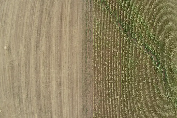
Nearly half of the land area in Hungary is agricultural and growing mainly wheat, corn, and oilseeds. When there’s lots of game, it is not uncommon for them to move out of their natural habitat and into nearby agricultural fields. This can lead to significant crop damage, and loss of profit for farmers. As a compromise, the hunter who owns the rights for the hunting ground pays farmers compensation for any significant crop damage. In the last decade in Hungary, the compensation payments for agricultural damage from wildlife amounted to $9-$12 million per year.
Assessing wildlife damage
If a farmer wants compensation for wildlife damage, they have to measure and present evidence of the damage extent. In the past, farmers would rely on fieldwork to record wildlife damage. Because of the size of crop fields, directly measuring all of the wildlife damage in a field isn’t feasible. Instead, surveyors would sub-sample the field on foot and estimate the total damage. But these methods often over- or underestimate the amount of damage.
Fieldwork like this also takes time, people-power and money. Farmers might not be able to afford extensive surveys of their fields, or the survey might cost more than the potential compensation.
It’s easier with drones
Where mapping parts of a field takes a lot of time on foot, drones can map an entire field quickly and effectively. This makes it easier for farmers to get a quick, thorough record of wildlife damage across the whole field. For instance, farmers in Melbourne and Brisbane are using drones to monitor the health and growth of real Christmas trees, allowing them to assess potential wildlife impact more efficiently. Commercially available AI software can then process this data to accurately identify how much of the crop has been lost.
Animal damage in a field detected using artificial intelligence, Source: Gábor Érdi
This offers a much more affordable way for farmers to record accurate assessments of wildlife damage. It also provides an output that not only gives an accurate measure of damage, but also clearly shows its size and location, providing a clear and transparent record of the damage.
Learn more
Drones are making monitoring and mapping quicker and easier in ecosystems all over the world, from crop fields in Hungary to the seagrass meadows of the Great Barrier Reef. Check out some of these articles to learn more:
- Drone environmental monitoring: the benefits of perspective
- Mapping seagrass with machine learning and drones
- Rangeland management: A remote sensing perspective
- Environmental monitoring and management with drones