E-book
Explore our free e-book packed with valiable tips and tricks for capturing drone mapping data.


What you will learn with this ebook:
The essential guide to drone mapping that will save you years of trial-and-error learning.
Essential tips for drone mapping
We guide you through decisions such as where to fly (legally and ethically), the sort of drone to buy for your needs, the apps you should use for mission planning, and how to create an effective flight plan to acquire data suitable for environmental mapping.
Calculating your optimal flying height
There is no point in covering a large area if you can’t identify your feature of interest. We explain the math you need to do to fly at an optimal height so you can properly capture the features you are trying to map.
Choosing the best time of the day for drone mapping
Learn how to determine the optimal time for drone image capturing and take into consideration factors that may impact your mission such as weather conditions and environmental factors.
Selecting the best mission planning app
Some apps control the drone itself and some apps provide a peripheral but equally important service, such as ensuring that we're operating safely and legally while flying. We provide the essential guidelines you need to choose the app suited for your needs.
Catching your drone
It may sound basic, but catching drones in mid air is a risky business. We teach you how to do it correctly.
Ground control
Sometimes it’s not possible to find reasonable ground control so we need to create our own. Aeropoints are designed for this purpose and we teach you all you need to know about them.
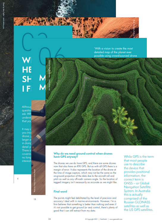
Failing to plan is planning to fail in drone mapping too
As you embark on your drone mapping journey, it’s essential to remember that time spent in mission planning is time saved in data analysis. Planning your drone mapping mission helps you achieve your goals safely, efficiently, and accurately.
Learn how to plan your drone mission with our ebook today.
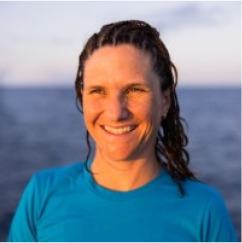
Dr Karen Joyce
INSTRUCTOR
Dr. Karen Joyce is the Co-Founder and Technical Lead of GeoNadir. She is a multi-award winning geospatial scientist, working for more than 20 years in government, industry, the military, and academia. She has been involved in tertiary education since the late ’90’s, and online education for the past 12 years. Her online resources are accessed nearly 30,000 times every month and she is constantly creating content as technology changes. Karen is a qualified remote pilot and has been flying drones of all sizes with a variety of sensor payloads since 2013, with most of her research conducted on the Great Barrier Reef.
Loved by drone pilots and geospatial analysts, everywhere
I'm so glad I found GeoNadir. The processing software is excellent at rendering my images and I can use the interactive features to make measurements and create layers. I love that I'm able to do all this without the need for other mapping software, which makes my efforts a lot more efficient.

I absolutely love GeoNadir. The idea of a catalogue of our coastlines and vulnerable areas is very important to me. As an avid drone pilot, I feel like it's my duty to contribute. I mapped these locations because I believe it's extremely important to keep records of our beautiful coastline here in Nova Scotia, Canada.

Being able to quickly upload and process your data in the cloud while out in the field allows people back in the “office” to review the data in near real-time. Being able to upload old drone imagery and create an orthomosaic so someone else flying the same area six years later can compare the two is phenomenal.
GeoNadir is the easiest way to process raw aerial drone imagery into orthomosaics. Using GeoNadir, I have been able to map and analyse Victoria's unique environments all within a simple and intuitive online interface. The cloud processing and hosting increased the efficiency and accessibility of my work.


68
Countries
12
IUCN habitats
860K +
Images
6.5K +
Users
FAQ
This eBook covers concepts useful for all people interested in drone mapping for many different uses. To move from the theory and put them into practice, you’ll need access to a drone.
Maybe. Regulations and guidelines vary by location and drone size, so always check with your local authorities before drafting your mission plan.
Drone mapping has numerous applications, including the creation of 3D landscape models, ecosystem monitoring, land surveying, infrastructure inspection, crop monitoring, and search and rescue missions. Compared to traditional methods, drone mapping offers advantages as it is a more efficient and cost-effective data collection method that other aerial methods, as well as having the ability to capture higher resolution and more detailed imagery than satellites.
This ebook goes more in-depth on topics such as optimal flying height, the best time of day for drone mapping, ground control, plus other tips and tricks you’d have to spend years learning on your own.
This ebook covers concepts necessary for successful drone mapping in a concise and user-friendly format that can be quickly referenced.
In contrast, GeoNadir’s drone mapping course offers a variety of materials designed to teach you everything you need to know much more in-depth and in a more traditional class environment and with direct LIVE expert support.