
Creating a sustainable future is a tricky balancing act of causing the smallest environmental impact for the largest positive outcome. Knowing the environmental impact of an activity, and mitigating the impact, depends heavily on good environmental monitoring. Drones are quickly becoming an indispensable tool in this space. Drone environmental monitoring offers a fast, cost effective, and comprehensive way to collect data. These data then help us make informed environmental decisions.
Why is environmental monitoring important?
As much as we’d like to protect all of nature, realistically it’s just not possible. We still need places for people to live, land to grow food, and ports to move things around the planet. But for all these vital activities, there are ways to minimise their impact. We can choose to develop areas that have already been disturbed and are home to fewer threatened species. We can also manage the way we develop and use areas to be more environmentally friendly. But the only way we can get data to make these choices is through environmental monitoring. The more data we have, the more informed our actions can be.
Drone environmental monitoring
Drone environmental monitoring has changed the game. Prior to drones, the options for environmental monitoring were on the ground fieldwork or satellite images. While fieldwork often provides high-quality data, it’s time-consuming, and generally only measures a small area. The resulting gaps in the data can hide important information. Fieldwork also takes a lot more people power, which can be expensive. While satellites continue to improve in leaps and bounds, access to high-resolution satellite data is still expensive. You also can’t control the timing of satellite imagery, so features you’re trying to monitor might not always be visible.
Drones offer a way to collect high spatial resolution aerial imagery in a way that’s both flexible and affordable. Drones can also quickly cover larger areas than fieldwork and they offer new ways to access traditionally inaccessible areas. Plus, there’s a range of environmental sensors you can add to drones, and data processing software is always improving. Drones are offering new perspectives in all fields of environmental monitoring.
Now, hypotheticals are all well and good, but what about some actual examples of how drones are helping? Read on for the stories of two drone environmental monitoring datasets uploaded to GeoNadir.
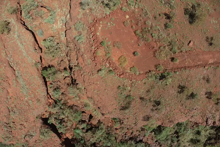
Iron ore mining in the Pilbara, Western Australia
Steel produced from iron ore is a critical part of renewable technologies that will help us transition from fossil fuels. At the same time, mining is unquestionably devastating for the biodiversity in and around mine sites. In Australia, mines also often pose a significant risk to Indigenous cultural heritage. The new Gudai-Darri iron ore mine in the Pilbarra is close to many environmentally and culturally valuable sites. Mining could put these sites at risk of damage.
How drone environmental monitoring is helping
Drone environmental monitoring is one tool Rio Tinto is using to help make sure these exceptional sites aren’t being damaged. By consistently monitoring sites and collecting high-quality data they can quickly detect changes and mitigate any damage. Using drones and photogrammetry, Rio Tinto is creating orthomosaics and 3D models to collect baseline, undisturbed data of important sites.
Drone environmental monitoring offers some key advantages:
- The ability to monitor and collect data over large areas in a time-efficient manner
- An image record and quantitative 3D model of undisturbed sites so changes or damage can be accurately detected
- The ability to collect data from difficult areas, or areas vulnerable to disturbance without causing damage
- More perspectives than terrestrial laser scanning (terrestrial LiDAR), which relies on line-of-sight
Terrestrial laser scanners are still used to support drone monitoring because they can filter out vegetation in a way drones still struggle with. As processing software for drones continues to get better however, this is becoming less of a problem.

Monitoring seagrass meadows in New Zealand
Seagrass meadows offer many valuable ecosystem services, including habitat for key fisheries species and protection from erosion. Seagrass is also a bio-indicator. This means that scientists can use the health of seagrass as an indicator of the health of the wider ecosystem.
Seagrass naturally varies in extent and coverage with the seasons. But threats like increased nutrients and sediments in the water, disease, and climate change can also affect seagrass extent. Regularly monitoring these meadows can help distinguish natural seasonal variability from threats that might need management intervention.
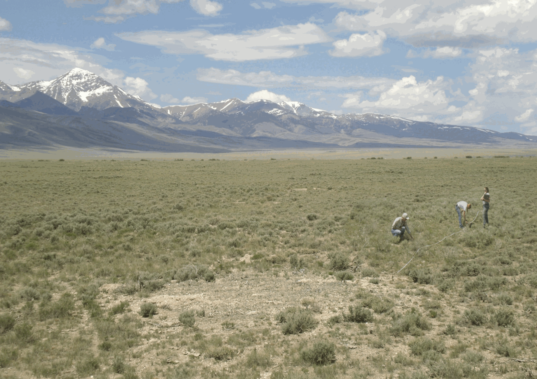
Historically, consistent environmental monitoring of seagrass meadows has been challenging. Seagrass meadows can be big, and can often only be monitored in the short time they are exposed at low-tide or by boat. Monitoring them with fieldwork alone take a lot of time, expertise and money, limiting how much and how often monitoring can be done.
Drones and coastal ecosystems
Drones are helping us monitor and care for our coastal ecosystems in many ways.
- A researcher in Queensland, Australia has been using a different machine learning approach to help map the seagrass meadows of the Great Barrier Reef.
- Drones are also helping monitor an agricultural weed-spraying program that aims to reduce the amount of toxic herbicide being washed onto the reef.
How drones are helping monitor seagrass
Subhash Chand from the Auckland University of Technology has been testing whether drones and machine learning can make seagrass monitoring easier.
Drones help by:
- Quickly collecting data across a large area so more seagrass can be monitored
- Creating a high quality record of total seagrass extent, rather than extrapolating from fieldwork
- Reducing the people power and expense of monitoring

All of these factors mean that using drones to monitor seagrass meadows is cheaper, faster and requires less expertise than traditional methods, removing many of the previous barriers for consistent monitoring. Drones have the potential to facilitate more frequent high quality monitoring of seagrass meadows, offering researchers and managers a better understanding of the natural variability of these ecosystems, their threats, and how they recover from degradation.
Subhash has also researched how drones can help monitor oyster reefs. You can read more here.
How can you help?
People collect drone environmental monitoring data all the time for projects all over the world. But after being used for one project, a lot of this data never sees the light of day again.
At GeoNadir, we’ve created an online platform where you can upload your drone mapping data. Not only is storage free, you’ll also get an automatically generated orthomosaic! Datasets that you upload will be visible to everyone so people can learn, connect, and collaborate to help protect the environment. Check out some of the incredible datasets people have already uploaded to the platform or upload your own!
New to using drones for environmental monitoring? We have free training available, plus lots of helpful tips and tricks on the Stories from Above blog.
Happy flying!

