
Getting an understanding of the size and scope of marine ecosystems has always been a challenge for environmental scientists. Seagrass is no exception. These intertidal and subtidal meadows help support important fisheries species and iconic animals like dugongs. They’re also increasingly under threat from things like poor water quality. But with some meadows being many square kilometers in size, mapping seagrass extent is challenging. Lucas Langlois from James Cook University is trying to improve seagrass mapping on the Great Barrier Reef with drones and machine learning.
So why is mapping seagrass important?
“Generally, the mapping process is the first step in conservation or anything like that endeavour,” Lucas said. “You want to go and look at an area that you want to protect and you want to know: Where is it and how much do we have?”
One reason accurate mapping of coastal ecosystems like seagrass meadows is important is because of a growing interest in blue carbon. Blue carbon refers to carbon captured and stored by the world’s oceans and coastal ecosystems. Preserving or restoring these ecosystems could help with carbon offsetting. But doing that means knowing how much is there. If you’re not accurate, you could throw your carbon offsetting calculations off by huge amounts.
“We’re trying to make that process better so that you then have a better output product. That will then give you better answers to plan out a conservation plan or marine protected area,” he said.
How can we map seagrass?
The first reef-scale mapping effort for seagrass in the Great Barrier Reef was back in the mid-80s, when free-divers made observations from boats. Since then, the best approach for mapping seagrass over large extents was from helicopters. Helicopter surveys have been used to determine meadow boundaries, as well as observational data, like seagrass cover, through haphazard, low-altitude spot-checks.
The problem with these methods is that they aren’t always very accurate. While maps derived from helicopter-based surveys can show seagrass extent, they often miss the complexities of a meadow. Early warning signs, like a seagrass meadow beginning to lose cohesion or fragment, can be important to address issues quickly.
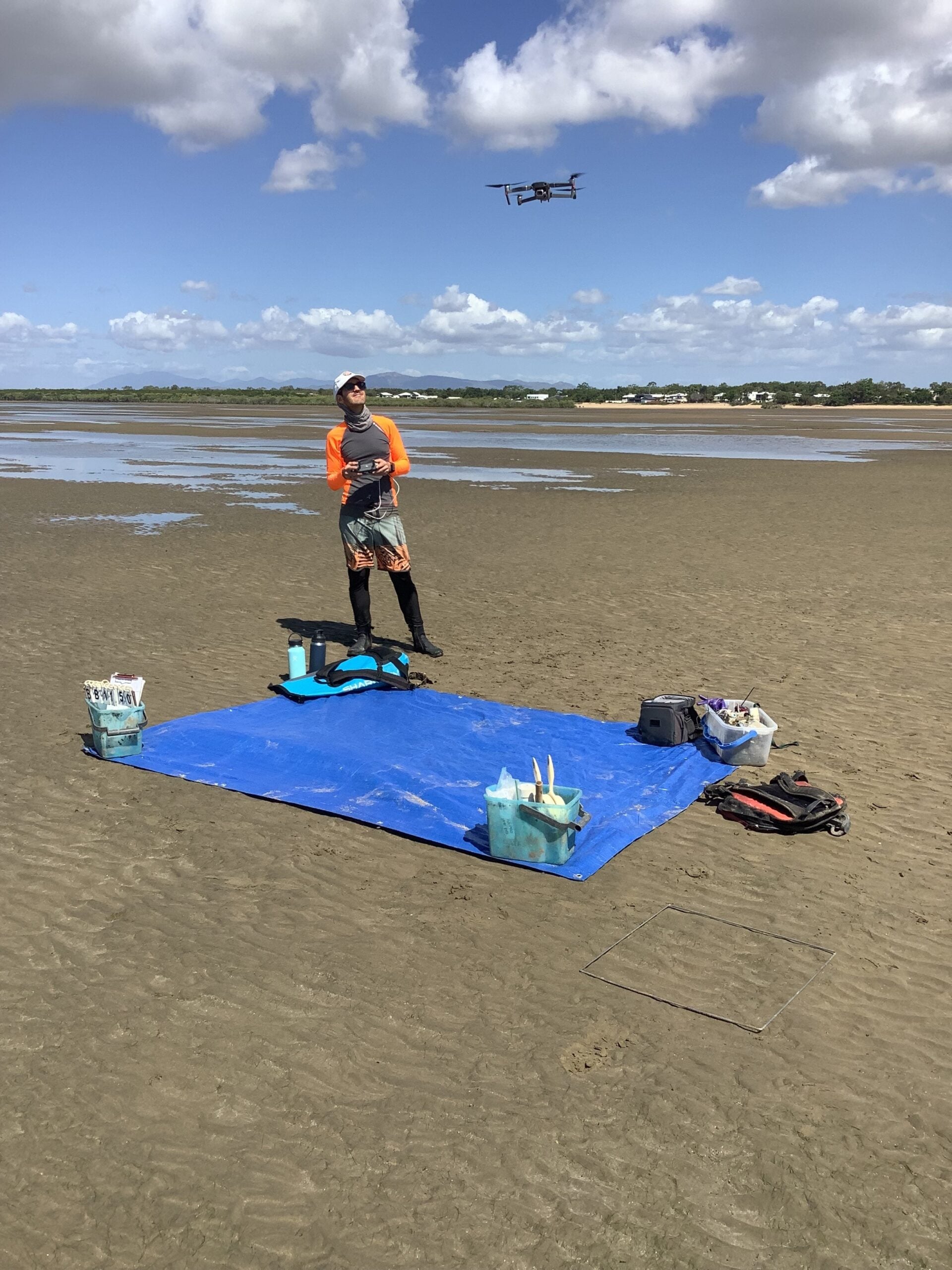
To try and improve the ability of seagrass mapping to detect early change and fragmentation, Lucas looked at how accurately drone mapping, coupled with machine learning, could detect seagrass.
“If we get a big image of a nearshore area, would we first be able to detect seagrass, and second, would we be able to track it over time …seeing how the meadow scape changes or fragments. If we could do that, we think, it will give us a much better idea of what’s happening for seagrass at this precise location and how stressed they can be or how to identify a possible tipping point, beyond which a meadow is lost”
Drones and machine learning for seagrass mapping
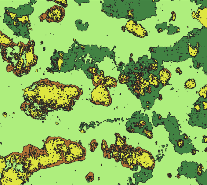 Deep-learning
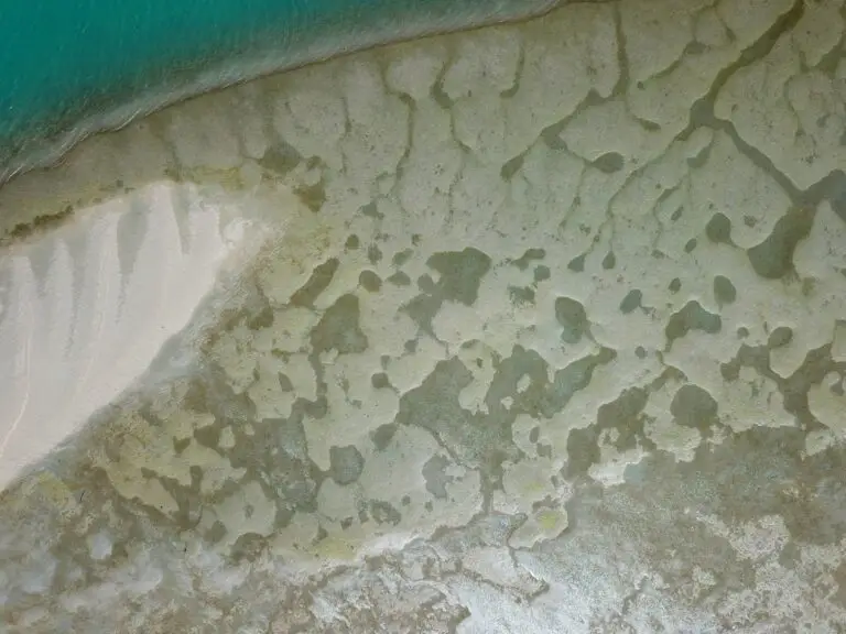
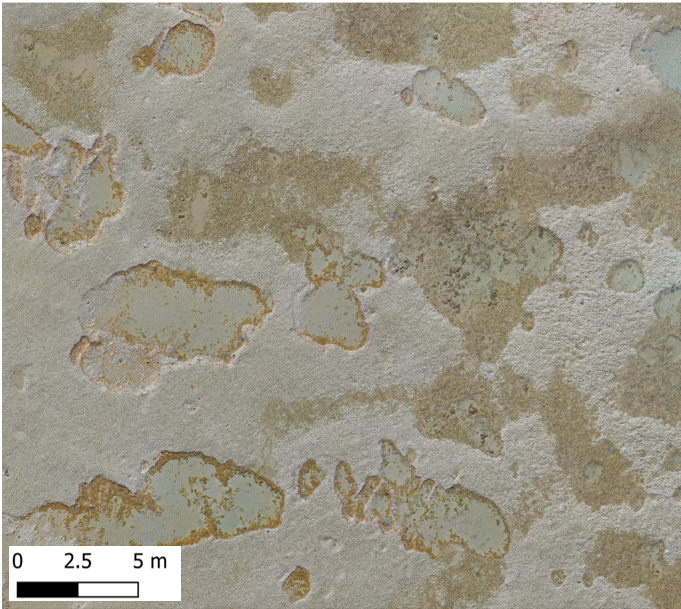 Drone image
 A comparison of drone imagery of seagrass to seagrass extent mapped with deep-learning based on the drone image.
Drone mapping can be a good alternative to field-based measurements. It allows rapid, positionally accurate, high-resolution mapping of an area, with much less footwork. By mapping seagrass with drones, Lucas could capture much greater detail than by the traditional methods of mapping, by foot (fine-scale) or by helicopter (mesoscale) using a handheld GPS. However, there was a new challenge that came about from using drones: efficiently processing all this extra data.
“If you look at the orthomosaic, and if you had to go and draw all the patches or scars [meadowscape] by hand in the level of detail you want, it would take you ages,” Lucas said.
Instead, Lucas developed a deep-learning algorithm to identify seagrass for him. Deep learning works by teaching a computer algorithm to recognise a specific object or texture: in this case seagrass.
Lucas labelled a portion of the seagrass images by hand. He then used them as training images to teach the algorithm what seagrass looked like. Once the model has learned to accurately identify seagrass, it could automatically map seagrass extent in similar images.
“The idea is to train the model to do it for you, and sometimes it does it more accurately than you because it captures those little details” Lucas said.
Seeing the bigger picture
While the area that drones can map is still quite small for large-scale seagrass mapping, they can provide more accurate fine-scale sampling of seagrass meadows. Scaling this up with satellite imagery can then provide a more accurate picture of wider seagrass abundance and extent.
“And that’s what we want to know. Especially for the carbon calculation,” Lucas said.
“It’s really important because what previous research has found is, for example, that there’s more carbon storage in the middle of a patch [of seagrass] compared to the edge of the patch,” he said.
While edge effects are still being researched, it suggests that seagrass fragmentation could impact blue carbon potential. So even if two meadows have the same area, a meadow with holes (scars) will have more edge, and potentially less ability to store blue carbon. It’s one reason Lucas thinks accurate mapping is so important.
“If you can get an accurate representation of all those holes then you can calculate how much edge area there is and then adjust your calculations based on that,” he said.
Machine learning and mapping going forward
Lucas is keen to continue to expand what can be achieved with machine learning and drones for mapping.
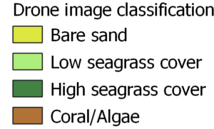
“Trying it out in different areas… see how that performs and how far we can push it. Right now it’s just very basic like that’s sand, that’s low seagrass cover and high. So can we get to identify species?” he said.
“The possibilities are endless as, you know, the drones get better and better battery life and all this kind of stuff and then we’ll be able to map even more and faster. So we’ll have to keep up with the technology as well.”
You can read more about the work that Lucas and his colleagues have done with drones and machine learning for mapping seagrass extent in their recently published paper here.
You can also check out more of the seagrass meadows that Lucas has been mapping on GeoNadir.
Explore more on GeoNadir
Seagrass meadows aren’t the only environment that drones are helping map. Check out the Stories from Above blog to learn about how drones are helping with the monitoring and management of oyster reefs in New Zealand, the management of rangelands in the USA and much more.
Do you use drones for mapping? Consider uploading your dataset to GeoNadir! It’s easy storage for your drone data, and a convenient way to share your mapping data with the world so others can learn from it.

