
Most people don’t put a lot of thought into what makes up the ground that we build, work, and live on. But we can learn a lot from geology. Rocks hold the multi-billion-year-old history of the planet we live on, influence where we can grow food and live, and much more. But deciphering and interpreting millions of years of history from rocks is not a straightforward task. Accurate geological mapping is an important element of a geologist’s toolkit. Producing accurate geological mapping is now much easier with drones.
A crash course in geological mapping
One of the fundamental challenges in geology is data collection. Geologists aim to understand what kind of rocks occur where. From this foundation, they determine how that might impact other factors, like natural hazards or the presence of valuable mineral resources. Geological maps are one way geologists record the distribution of rocks. But soil, plants and ever-expanding urban development cover most rock formations, making this tricky.
Geologists have many tools to help them with geological mapping, but outcrops remain a primary source of evidence. Outcrops are places where erosion from wind and water has left stretches of rock exposed at the surface. To the trained eye, the many features of outcrops can tell a geologist what they are made of, and what processes formed them millions of years ago.
Mapping the coastline of Port Victoria
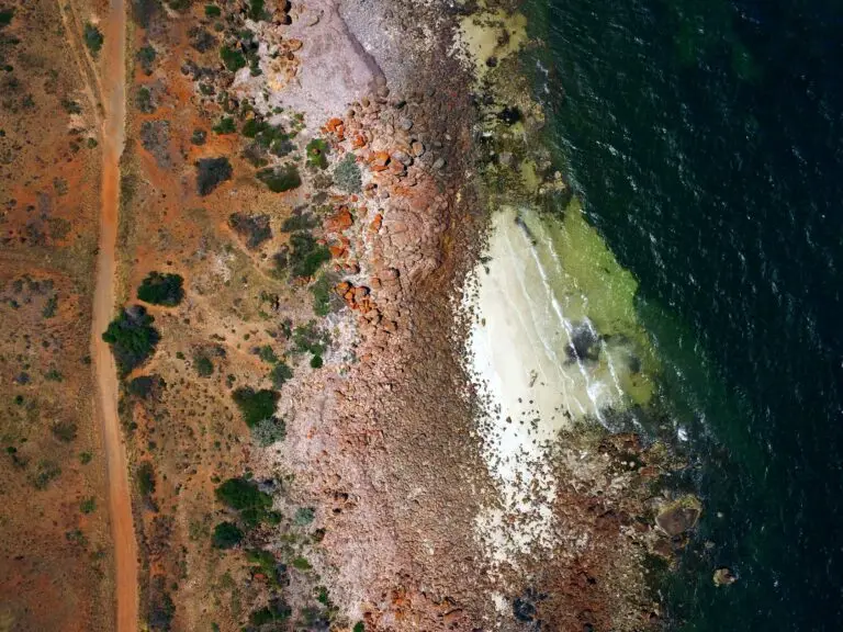
Port Victoria in South Australia, is home to some very old geological outcrops. Continuous wind and waves along the Yorke Penninsula have exposed these outcrops and some of the rocks here are over 1.7 billion years old. The rocks are part of a larger formation, called the Wallaroo group, which helped support extensive copper mining from 1859. In fact, the copper mines in the area are what gave the region its name: the Copper Coast. The Copper Coast is a small part of a metal-rich region in South Australia that holds one of the largest copper and gold deposits in the world.
Mining is a big part of the heritage of the region, and the rocks of the area are the foundation for that. A four-kilometre geological trail was established many years ago along the Port Victoria coastline so visitors to the area could learn about this region’s geological history. Today, Associate Professor Colin Conor, along with his colleague Professor Patrick James are trying to improve the geological mapping of the area with drones to make it easier for people to learn from this outcrop.
Why geologically mapping 1.7 billion-year-old rocks without drones is challenging
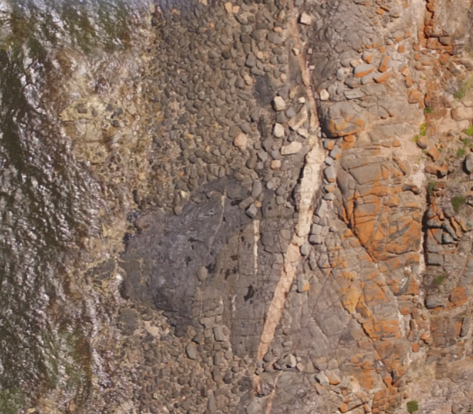
When you have rocks as old as those along the coast of Port Victoria, mapping them is no mean feat. Older rocks tend to have a more complicated make up because they have been influenced by so many forces since their formation. Many different types of rocks can be close together in one area, so mapping needs to be detailed.
 Drone imagery
 Satellite imagery
A comparison of the imagery available to support geological mapping with and without using drone mapping.
Using drones for geological mapping
Drones offered a new way for Pat and Colin to map the Port Victoria outcrop. Drones offer a unique combination of resolution and spatial coverage which makes them invaluable for geological mapping. By flying at low enough altitude, the drone could produce high enough resolution imagery to distinguish individual rocks. Plus, by using multiple ground-control points, they could achieve high geo-referenced accuracy for the orthomosaic product. Combined with field observations, it meant that Colin and Pat could more clearly map the different types of rock directly from the orthomosaic.
Plus, not all outcrops are visible all the time. The outcrops at Port Victoria are regularly obscured at high tide. By having a detailed drone orthomosaic, the outcrops can be analysed regardless of the tide. In other places, chance events like floods often reveal new outcrops, but can just as quickly cover them again. Drones offer a way to get a quick and accurate record of revealed outcrops. That way, geologists can still analyse them in the future, even if the outcrop is lost. They also offer a way to map inaccessible places, like cliff faces. Cliffs often provide valuable geological insight as a cross-section through time. But they can be very difficult to access in person, and aren’t visible from traditional aerial photography or satellites. Using photogrammetry, a drone can map a cliff face for detailed later analysis.
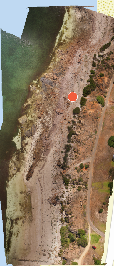
To the left: An orthomosaic of a section of the Port Victoria coastline, produced using drone mapping. You can view the dataset on GeoNadir.

