Category: Product Updates

Case Studies

Thermal Drone Data on GeoNadir

Thermal drone mapping: A case study with SmartShot Photo We recently spoke with Michael Bevis, the owner of SmartShot Real Estate Photography in Texas, USA about how he has processed his thermal drone mapping data on GeoNadir for free to create insights for his customers. Michael has been in the real estate business for years

Read More »
Drone Mapping Tips & Tricks

How to fast track your drone mapping analysis with keyboard shortcuts

There’s no doubt about it – drone mapping analysis and manually digitising a map can be a tedious task! But let’s not make it harder than it needs to be. At GeoNadir we are constantly looking for ways to simplify data processing and analysis workflows, so introducing keyboard shortcuts was a no-brainer for us. They

Read More »
Learn and Inspire

Why is snapping important for creating accurate maps?

What do crocodiles and GeoNadir projects have in common? We both love snapping! But of course in vastly different ways 🙂 When we snap as part of creating insights with our drone mapping data, this is a good thing. Not something to be afraid of!  So what is snapping, and how can it help us

Read More »
3d drone mapping view of Tucson, Arizona
Drone Data Processing

3D drone models and the end of the rainbow

Contents There’s no lack of ‘wow’ when viewing aerial drone footage as photos or videos. But the awe in awesome doesn’t stop there! Our flying tripod friends are also incredible data collection and mapping tools. We use drones to capture information about all sorts of different environments, with detail far greater than you’ll see on

Read More »
Aerial drone image of a creek with deep red sands, coastal vegetation, and sand dunes
Drone Mapping Tips & Tricks

How to share insights from drone mapping data

As humans we like to simplify reality. To take complex systems or ideas and break them down into digestible, communicable chunks. It’s why we classify the Earth as ‘land’ and ‘water’. But the Earth is infinitely complex, as is the drone data that we capture about it. So how can we decomplicate things and make

Read More »
drone image of carrie bow cay
Drone Data Processing

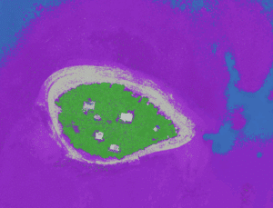
Drone mapping an isolated reef in the Caribbean

People often ask me what inspired me to create GeoNadir. To be honest, first and foremost it was selfish intention to make my life easier. Since 2013 I have amassed a huge amount of drone mapping data, and I’ve always had the problem of how to store, process, and share it in a simple workflow.

Read More »
Image Collections on GeoNadir
Learn and Inspire

Drone image dataset (Best Tips to Upload a dataset)

Here at GeoNadir, we want to create the biggest repository of free drone image datasets and drone mapping imagery from around the world. We want to make sure that all drone data is FAIR (Findable, Accessible, Interoperable and Reusable) so the treasure trove of knowledge stored in drone images can be used by people all over

Read More »
Artistic letters spelling the word create in lots of colours
Product Updates

Mapmaking made easy: Introducing the create feature

If you’ve been looking at the GeoNadir platform recently, you would have seen that it’s had a pretty big update. Making maps with drone orthomosaics is now easier than ever with GeoNadir’s cool new feature called “Create”. This new feature lets you draw on, label and measure your orthomosaics directly on the platform! So what

Read More »
dog with sunglasses looking cool
Product Updates

Ten cool features you might have missed on GeoNadir

We launched our GeoNadir FAIR drone data platform in March 2021 and have been rapidly developing features as we go. With an agile development mentality, we’re constantly pushing updates, bug fixes, and new features to make sure our users get the best experience possible with sharing and exploring drone data around the world. So if you haven’t

Read More »