
Contents
There’s no lack of ‘wow’ when viewing aerial drone footage as photos or videos. But the awe in awesome doesn’t stop there! Our flying tripod friends are also incredible data collection and mapping tools. We use drones to capture information about all sorts of different environments, with detail far greater than you’ll see on Google Earth. And an extra cool super power that you might not have seen before is how we can use them for building 3D drone models.
Let’s jump right in and check out what all the fuss is about.
What are 3D drone models?
If we’re interested in creating a map of an area, we send our drone out on a pre-determined, autonomous mission (see the animation below). This means that we highlight an area on a map that we want to cover, and the drone will use its navigation system to fly systematically over the area, capturing photos as it goes. Each photo will overlap with the last, making sure that there are no gaps in coverage.
With the overlapping images, we create an orthomosaic, or continuous image map. And it’s the overlap that allows us to create a 3D drone model. The third dimension is the elevation of the terrain.
Typically we call these products digital elevation models, or DEMs. Though to complicate matters, we further distinguish our DEMs into DSMs and DTMs. That’s digital surface models, and digital terrain models. Surface models include the trees and houses etc., while terrain models attempt to show what the ground below these features looks like.
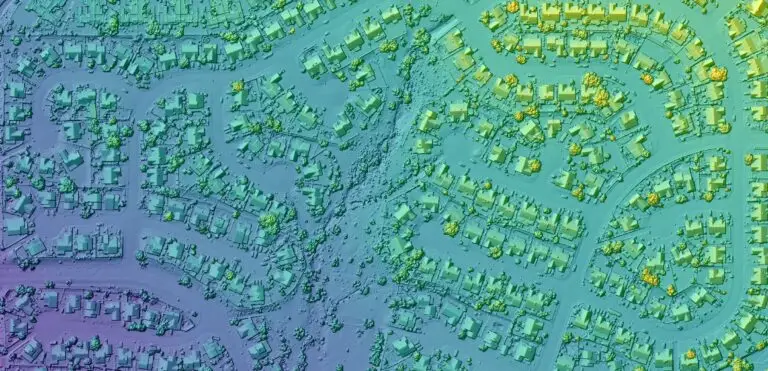
Check out the orthomosaic and DSM below from Tucson, Arizona by David Rogers. See how the DSM really makes the features ‘pop’, particularly when we apply a hillshade effect.

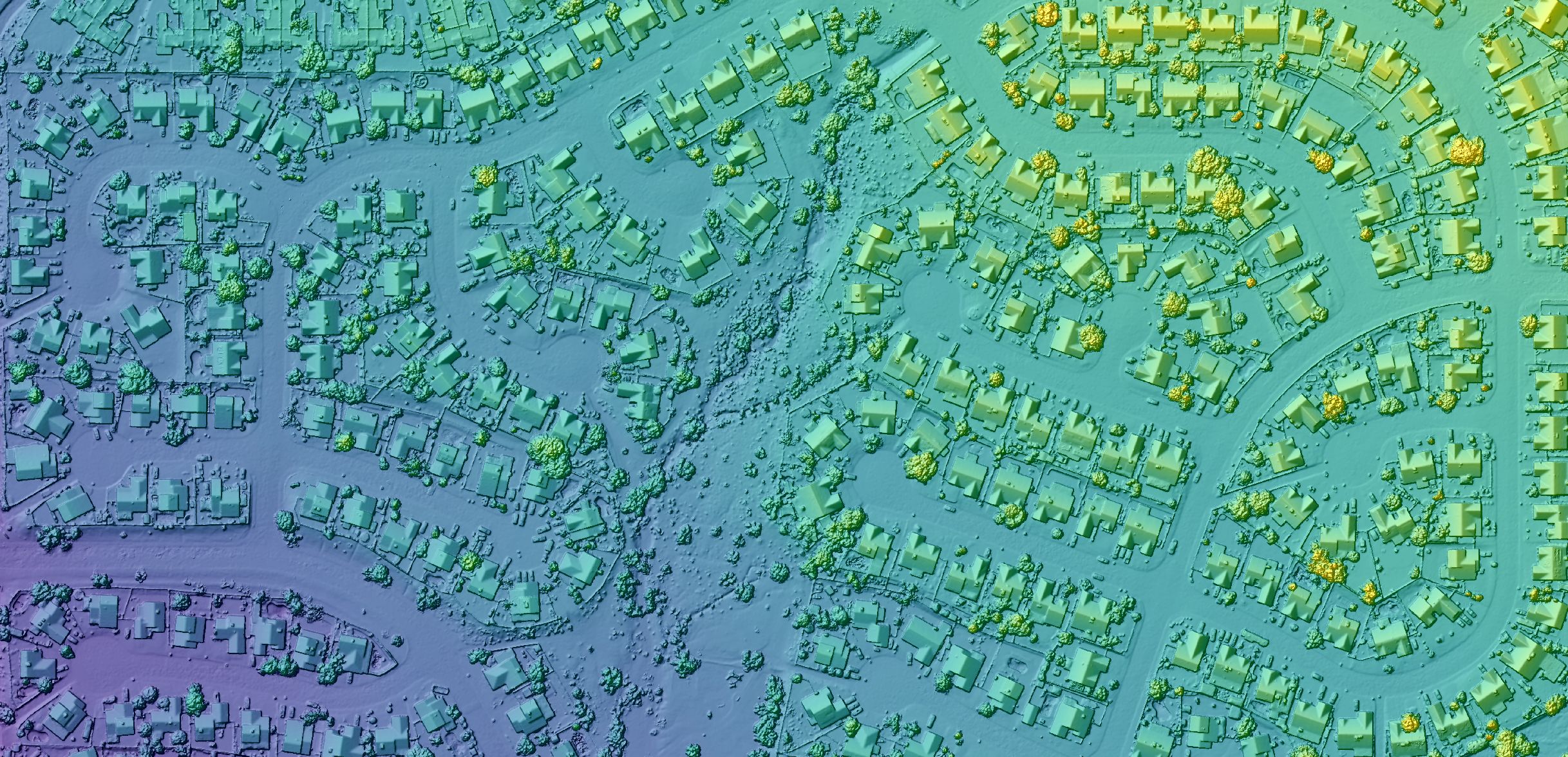 Digital surface model (DSM)
 Orthomosaic
In the sequence below, you can compare the difference between the digital terrain model, and the digital surface model. Can you see how a creek line becomes more evident in the DTM around the centre of the scene, running north south?
Digital surface model (DSM)
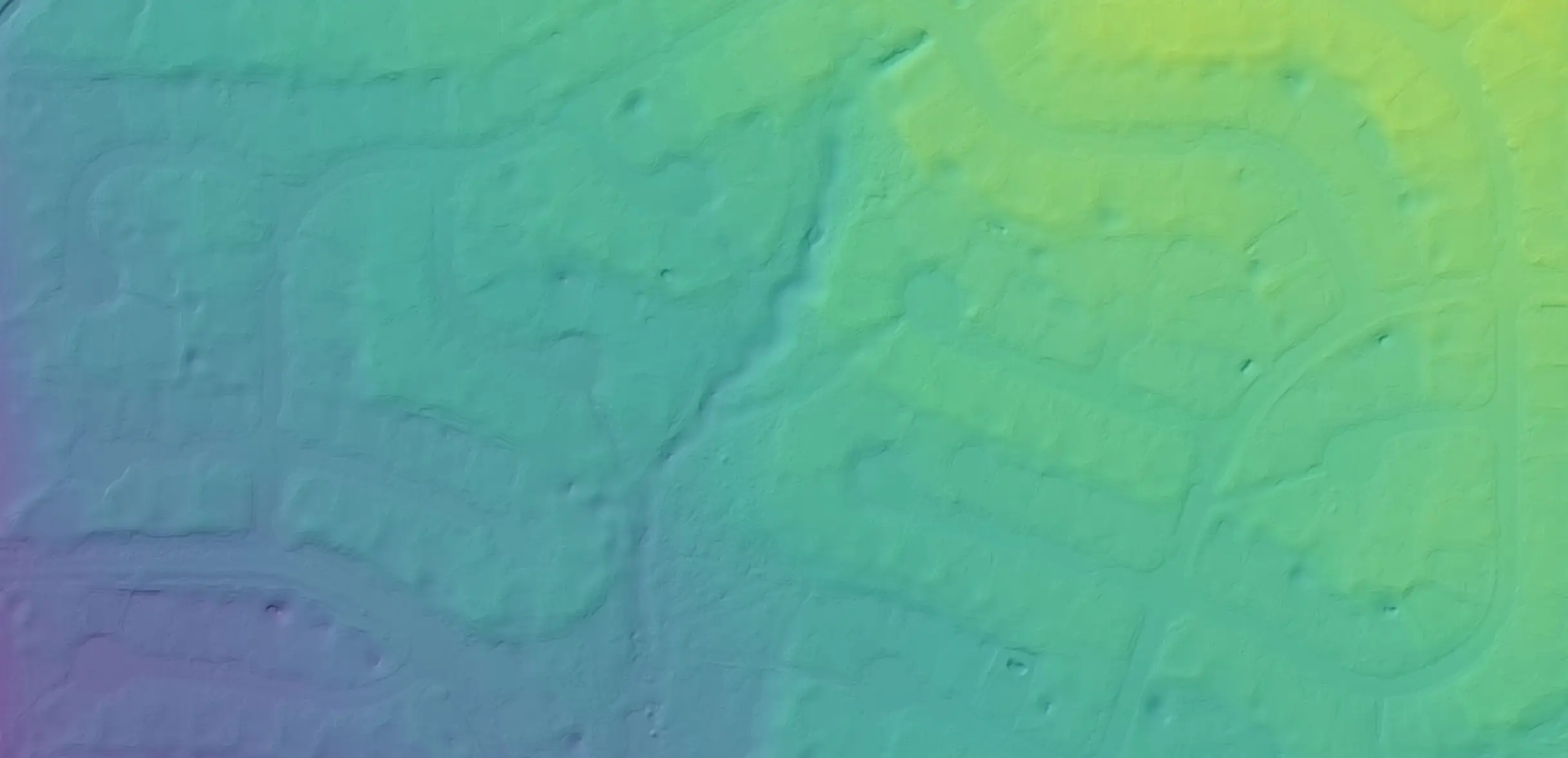 Digital terrain model (DTM)
How are 3D drone models used?
So why would anyone want a 3D model of something? Well, there are many reasons!
Monitoring changes in vegetation: 3D models can be used to create topographic maps of forests and other vegetated areas, which can be compared over time to monitor changes in tree heights and canopy cover.
Assessing landslide risk: We can identify areas at risk of landslides by analyzing slope and elevation data, in turn helping to develop plans to mitigate risks and protect people and property.
Mapping coastal erosion: With 40% of the global population living within 100km of a coast, monitoring these regions is of critical importance. We can monitor erosion due to climate change and a number of other local pressures to guide coastal protection efforts and land-use planning.
Modeling flood risks: DEMs can be used to model the impacts of floods on different areas, including predicting the extent of floodwaters and identifying areas at high risk for damage.
Evaluating mining impacts: 3D models provide valuable information on mine site extraction and restoration including changes in topography and erosion.
- Archaeologists: we can use 3D drone models to study the structure of ancient artifacts and buildings without having to touch them.
And even gamers can use 3D models to create realistic game worlds!
The example image series below shows a new bmx track at the James Cook University Nguma-bada campus in Queensland, Australia. The 3D drone models combined with the orthomosaic show the change in vegetation as well as the volume of earthworks. Check out the imagery on GeoNadir captured by Shawn Depper from Trinity Bay High School.
How to create a 3D drone model
As mentioned above, you’ll need to first make sure that you fly your drone in a ‘drone mapping formation’. It’s like a lawnmower in the sky. There are plenty of free apps available to help you do this. We have a number of recommendations and easy to follow videos in our step-by-step guide to help get you started.

Once you’ve captured your data, you can upload it to GeoNadir and we’ll create the orthomosaic and 3D drone models (DSM and DTM) for you. We use a process called structure from motion photogrammetry. Depending on the size and complexity of your dataset, you’ll usually see the results within a couple of hours. Then it’s over to you to analyse!
Click here to get started with a free GeoNadir account so that you can start processing and using your 3D drone models today! To switch between viewing orthomosaics and 3d drone models on the GeoNadir platform, choose the map layer you want from the tools on the right hand side of any map display as below.

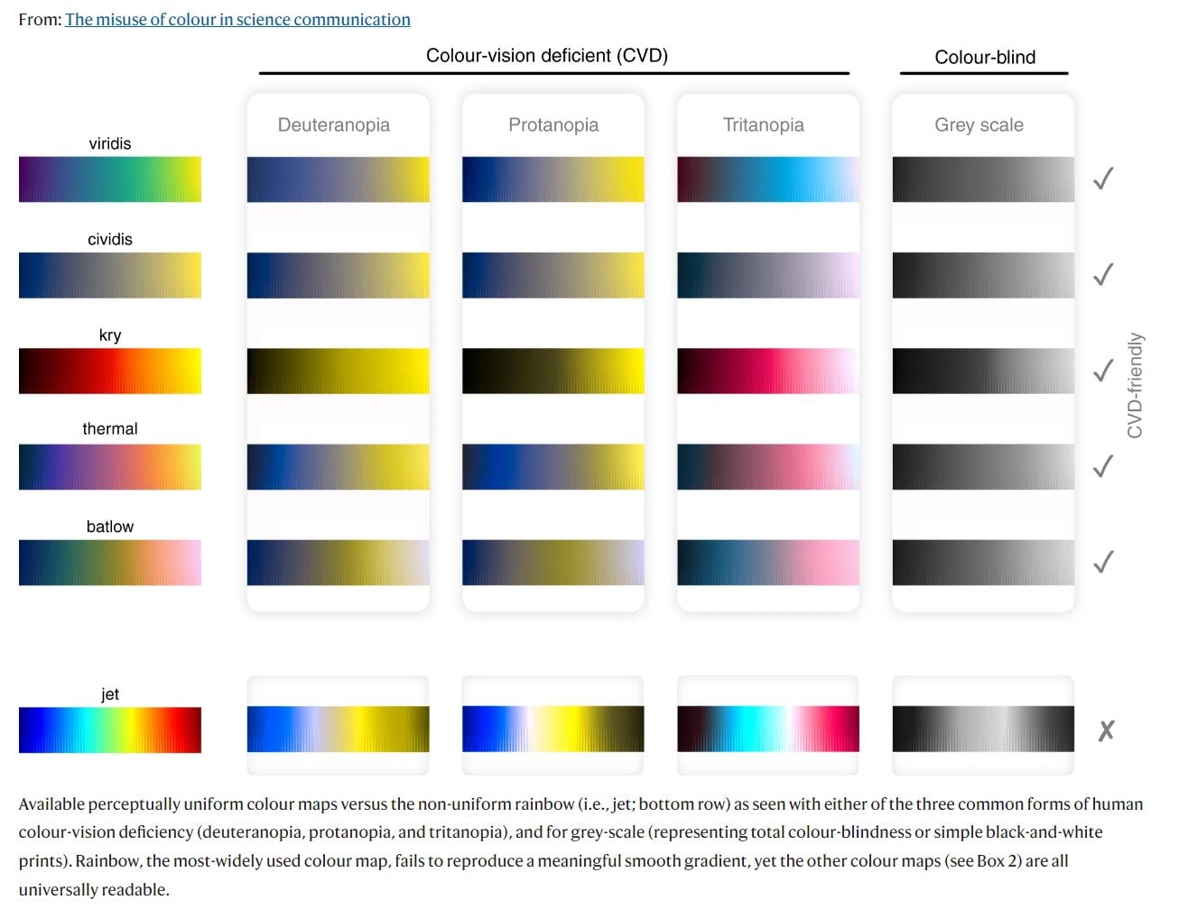
What’s at the end of the rainbow?
A pot of gold of course! But what does that have to do with a 3D drone model? Actually, I’m referring to the colour scheme that we use to represent the DSMs and DTMs. Traditionally we visualise these types datasets with a rainbow colour scheme. But it turns out that although the rainbow is used to signify inclusivity and pride in parts of our society, it’s actually damn hard for those with colour visual impairments to see!
So as we’ve built our DSM and DTM visualisation capability in GeoNadir, we’re standing by the end of the rainbow. In mapping of course – we definitely don’t want to say goodbye to real rainbows or to LGBTQIA+ support!
As per the figure from Crameri et al (2020), we’ve chosen to use the viridis colur palette on GeoNadir. In addition to a better option for those who have colour visual impairment, it is also represents colour values more accurately, and is thus more scientifically appropriate to use.
The science behind capturing, processing, visualising and analysing drone 3D models is complex! But thankfully its made so easily accessible today through a range of online tools. If you want to get started using your drone for building 3D models, all you need to do is fly it and we’ll take care of the processing for you at GeoNadir. Click here to create your free account and get started today!

