There’s no doubt about it – drone mapping analysis and manually digitising a map can be a tedious task! But let’s not make it harder than it needs to be. At GeoNadir we are constantly looking for ways to simplify data processing and analysis workflows, so introducing keyboard shortcuts was a no-brainer for us. They significantly reduce your mouse movement and number of clicks, allowing you to navigate and edit with speed and efficiency.
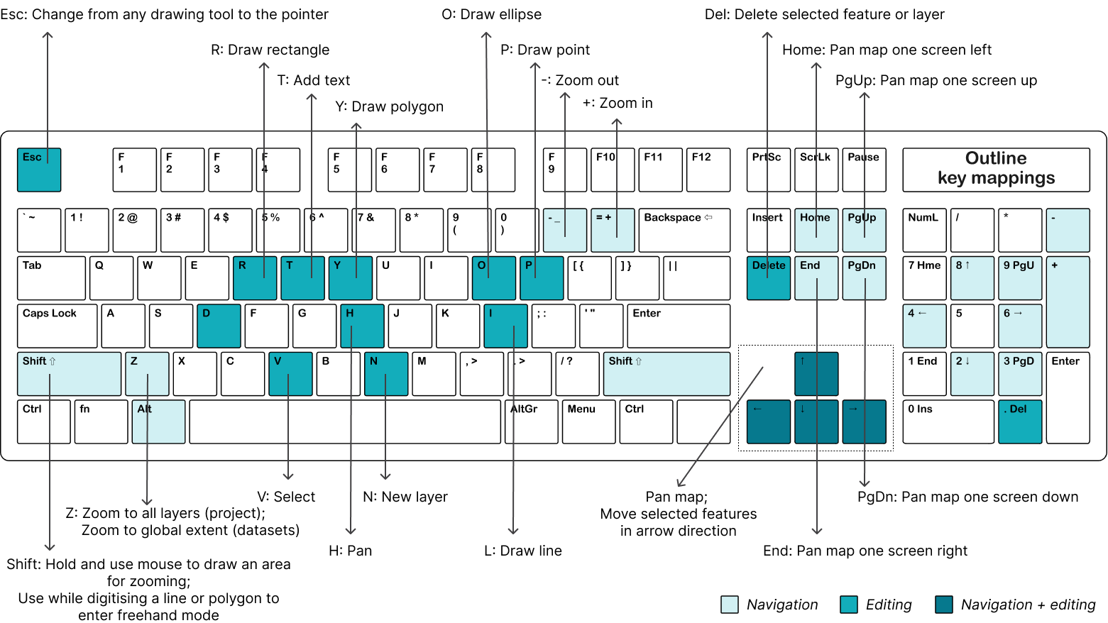
Let’s have a look at the current options available, and we’ll highlight our favourite ones for you to try. Below you can see all of our single key actions. There’s a different colour for those used for navigation, editing, and both.
Contents

Navigation keys
Esc: close an open pop up
+: zoom out
-: zoom in
Z: zoom to global extent (datasets); zoom to all layers (projects)
Shift: hold and use your mouse to draw a box around an area to zoom in to
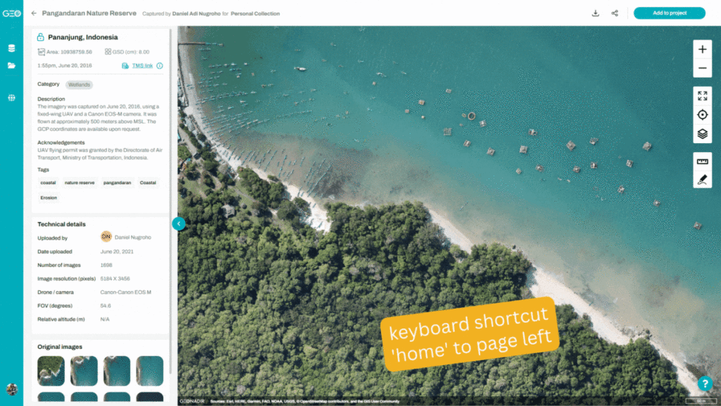
home: move the map interface one entire screen to the left
end: move the map interface one entire screen to the right
PgUp: move the map interface one entire screen up
PgDn: move the map interface one entire screen down
Up arrow: move the map up
Down arrow: move the map down; move the selected feature down by one pixel at a time
Left arrow: move the map left
Right arrow: move the map right
Editing keys
Esc: change from any drawing tool to the pointer
R: draw rectangle
T: add text
Y: draw polygon
O: draw ellipse
P: draw point
H: pan
L: draw line
Delete: delete selected layer or feature
Ctrl + Z: undo last edit (use cmd on mac)
Ctrl + shift + Z: redo last edit (use cmd on mac)
Up arrow: move selected feature up one pixel
Down arrow: move selected feature down one pixel
Left arrow: move selected feature left one pixel
Right arrow: move selected feature right one pixel
Our favourite shortcut keys for drone mapping analysis
First prize has to go to the shift key. Hold it down and draw out a box with your mouse to zoom into that area. Or if you are in editing mode within a project and are digitising a line or polygon feature, holding the shift key will take you into freehand mode. This is particularly great if you have irregular shaped features and are using a stylus in your analysis.
Coming in a close second is the full page panning tools. Click end to pan to the left; home to pan to the right. And to pan up and down, use the ‘pg up’ and ‘pg down’ keys. These actions are particularly great when analysing large drone mapping projects. You can systematically work your way through analysing every section of your imagery without missing anything!

Check out these options today with a free account on GeoNadir to up your mapping game! We’d love to hear from you about the operations you are performing most frequently and how we can make them more efficient for you!
If you’d like to learn more about digitising insights from your drone mapping analysis, you might enjoy ‘How to share insights from drone mapping data‘.


