
Currently, drones are helping with green sea turtle conservation. Drones can map their nesting beaches to help monitor threats and local populations.
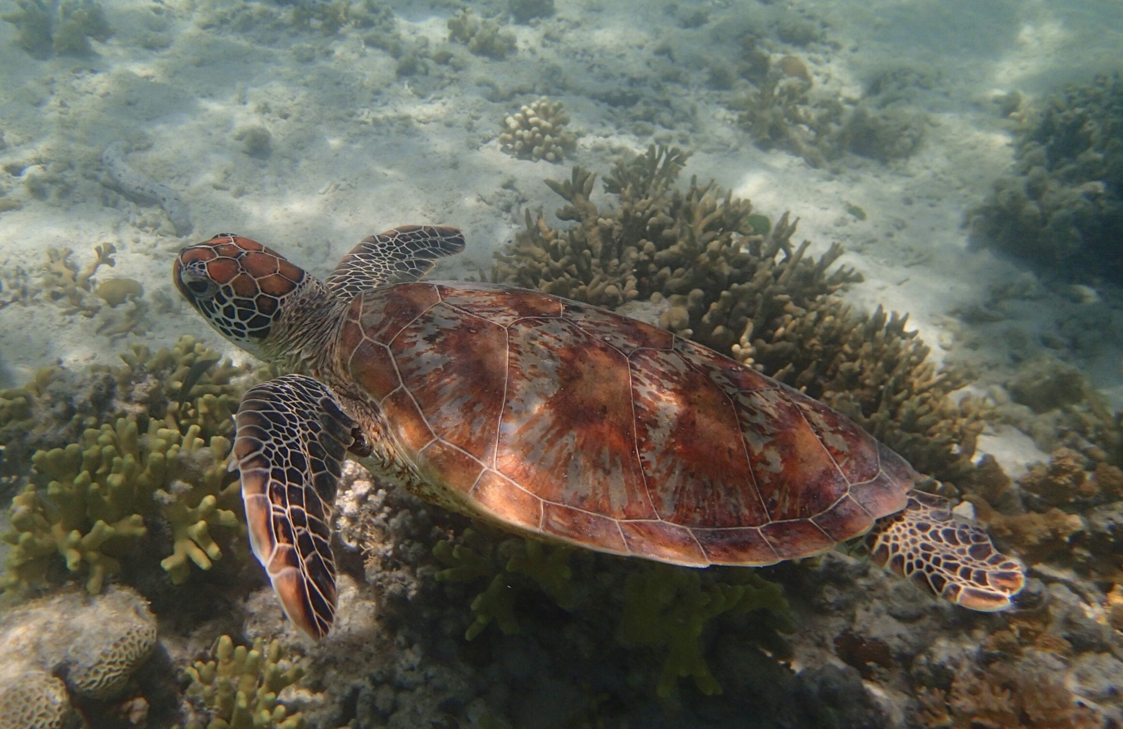
Green sea turtles are an iconic species, found globally in subtropical and tropical oceans. They play an important role in maintaining the health of seagrass ecosystems and all the organisms seagrasses support. Like many larger marine creatures however, green sea turtles are under threat. By-catch from fisheries, plastic pollution and threats to nesting beaches are all contributing to declining turtle populations.
Many conservation efforts focus on protecting nesting beaches, and drones can help these efforts.
Eroding nesting beaches
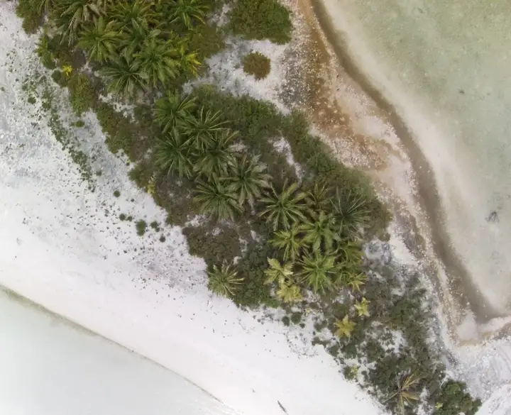
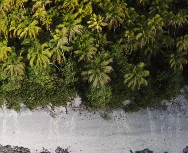
Teti’aroa is a coral atoll in French Polynesia that green sea turtles use for nesting. Like many low-lying tropical islands, it’s vulnerable to sea-level rise and erosion, which can damage nesting beaches.
Eroded beaches pose significant challenges for nesting mothers. Erosion can reduce the total beach area where turtles can nest. It can also lead to the formation of steeper beach slopes or sandy escarpments. It takes more energy for turtles to climb steeper beach slopes, exhausting nesting turtles sooner. It can also mean more turtles will choose to lay their eggs lower down on the beach, where nests are more likely to flood and drown with high tides or storms. If the beach conditions are too challenging, turtles might even abandon nesting attempts all together.
Mapping nesting beaches with a drone
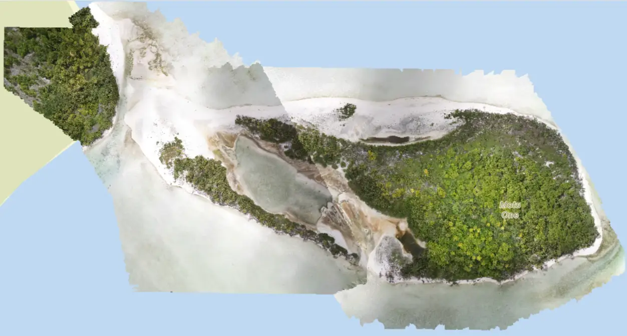
Te mana o te moana is an organisation dedicated to protecting the Polynesian marine environment, including green sea turtles. They were concerned that erosion might be negatively affecting nesting beaches on Teti’aroa. So, in January, 2021, they decided to hire a drone pilot to map the beaches so they could compare the current state of the beaches to a LIDAR survey from 2017.
Martijn van der Helm was the drone pilot tasked with this mapping project. By mapping the beaches with a drone, he could produce detailed, three-dimensional models of their topography. These could then be directly compared to the LiDAR survey to identify how the beaches have changed.
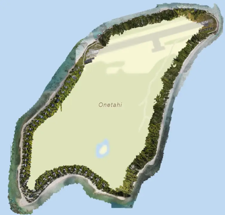
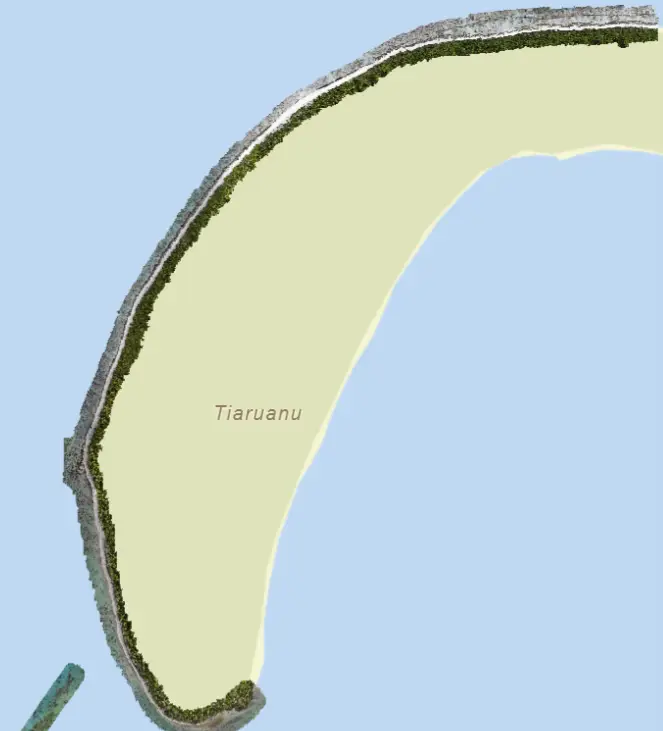
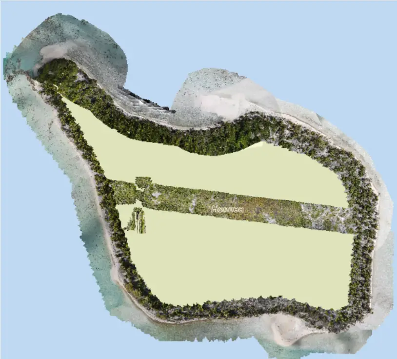
The findings? In comparison to the LIDAR survey, the beaches have actually grown in size since 2017. However, all of the new beaches are low lying, making them poorly suited for successful nesting. There are also more steep slopes, especially on the islands of Honuea and Onetahi, where 28% and 13% of beaches have become unreachable for nesting turtles.
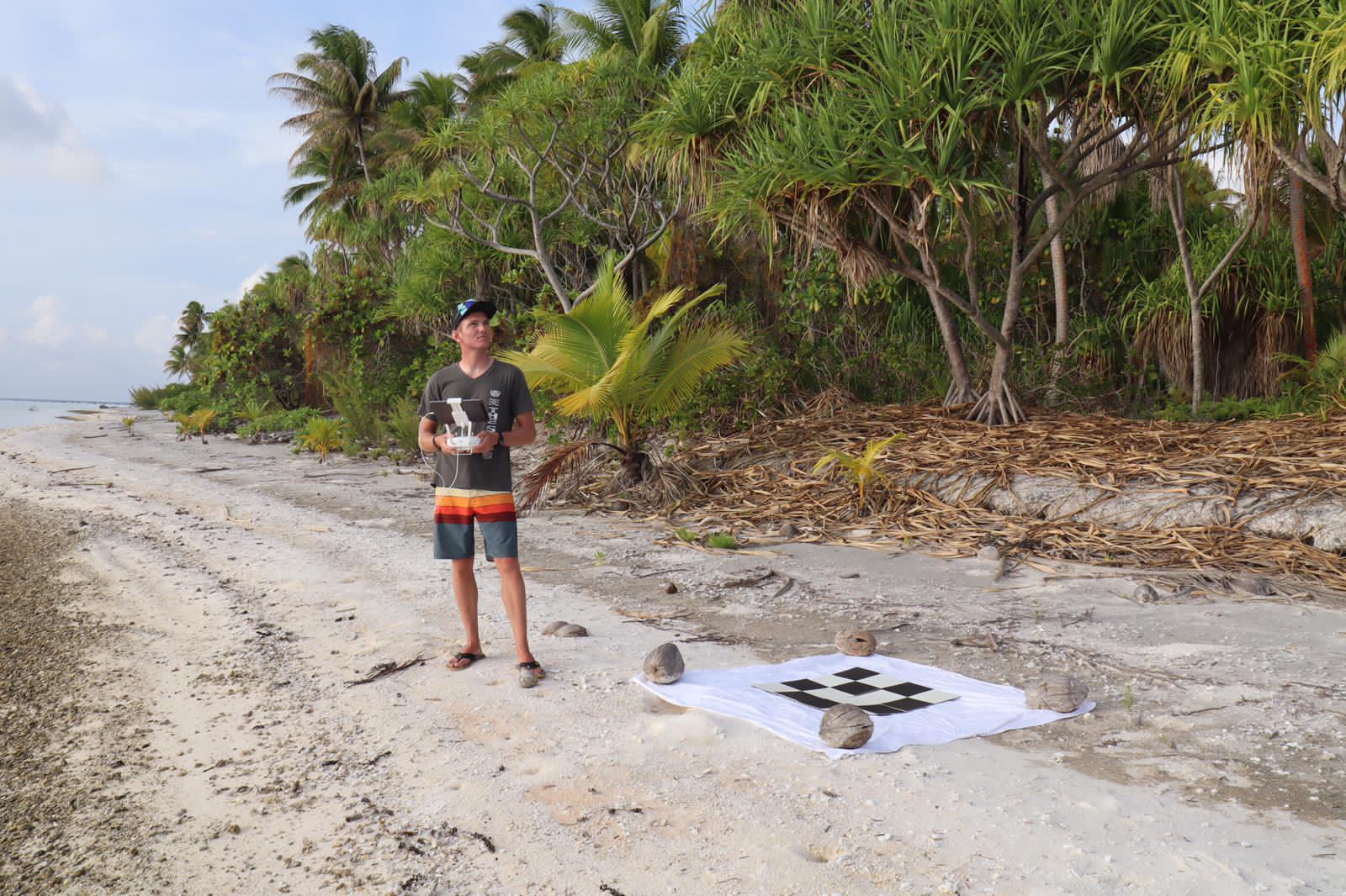
Martijn flying a drone over one of the nesting beaches. Source: Martijn van der Helm.
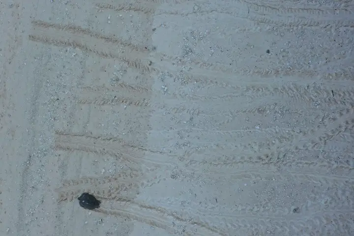
Recording turtle tracks
Drones are also helpful for actively monitoring turtles during the nesting season. Monitoring programs during the nesting season, are a key way researchers can monitor turtle populations. An important part of this process is turtle track surveys.
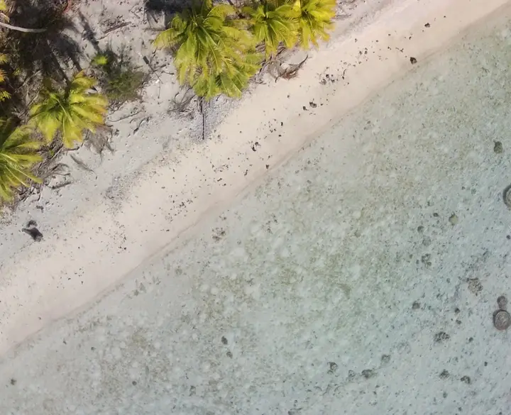
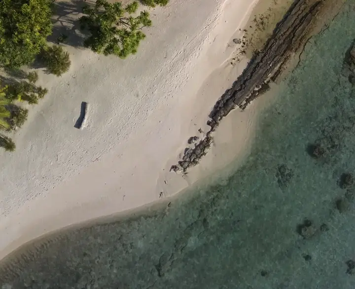
As turtles crawl up the beach to find a nesting spot, they leave distinctive tracks in the sand. Each turtle species leaves its own kind of track, and the track can also tell you which direction the turtle was moving. By doing track counts at the end of each nesting night, researchers can estimate how many turtles came up to nest, and whether more than one species is using the beach as a nesting site.
While these track counts are traditionally done on foot, drone mapping can also quickly record this data, supporting the monitoring process, especially over large stretches of beach.

Manage your drone mapping data on GeoNadir
GeoNadir is a platform designed to help you store, manage and share your drone data more easily, and you can get started for free! Simply upload your drone mapping datasets to take advantage of secure storage and automatically generated orthomosaics. Plus, you’re datasets are automatically displayed on a world map, making finding and viewing them a breeze!
Create an account and get started today!

