
Drones play a big role in helping us understand the natural environment and the impact that we have on it. But the same attributes that make drones so useful in the environmental sciences also make them useful in other fields. We are constantly at risk of losing valuable history from heritage sites around the world as they slowly degrade with time. Drone mapping heritage sites give us the chance to create a highly detailed, comprehensive record of these valuable sites before they’re lost.
The Chillagoe Smelters, North Queensland, Australia
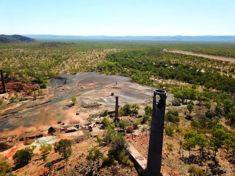
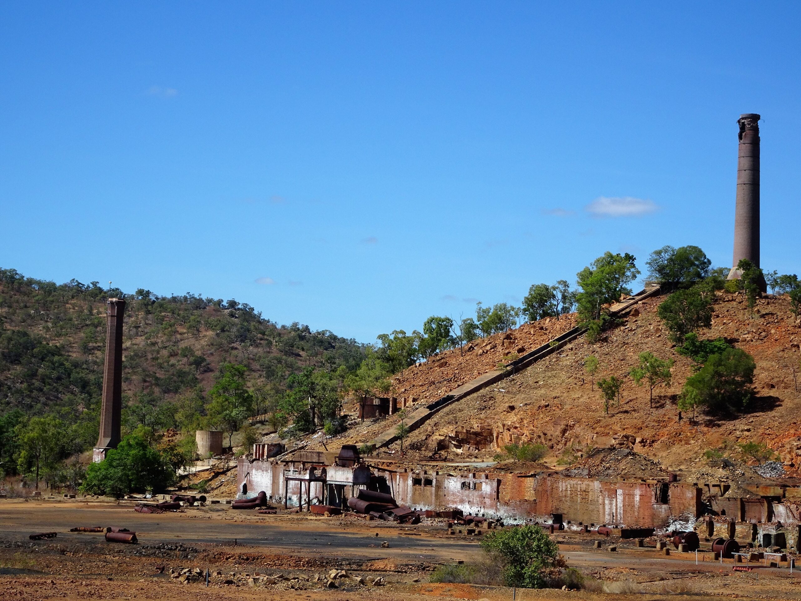
If you drive inland from Cairns to Chillagoe, you might notice some old chimneys poking out of the red countryside. While they might not look like much today, these are the remains of the Chillagoe Smelters, a refinery that once drove economic development in the Cairns hinterland. Between the early 1900s to 1943, the refinery processed vast quantities of ore, copper, lead, silver and gold. At times, the refinery and ancillary industries supported over 1000 jobs in the region.
Despite the refinery operating for over 40 years, it never once turned a profit. In fact, the two owners of the refinery are thought to have lost between 4 and 8 million pounds from operating it!
Eventually, refineries were built closer to the major ore mines like Mt Isa, and the Chillagoe Smelters were shut down. Today, the Chillagoe Smelters are a state heritage site. The Queensland government added them to the register in recognition of the important role they played in the development of North Queensland. They also hold some of the little remaining evidence of the smelting techniques and technologies of the time.
A detailed history of the Chillagoe Smelters and their importance is available on the Queensland Heritage Register.
Are we losing history?
Mining and resource extraction is an enormous part of Australia’s colonial history. Mining remains one of Australia’s biggest industries, and is an important driver of economic development, especially in rural areas. There are nine other heritage-listed refineries in Queensland alone, along with many other historical mine sites, structures and settlements.
Despite the importance of these sites, their continued existence is at risk from steady deterioration with time. Unfortunately, it’s not possible to restore or preserve all heritage sites. In fact, sites like the Chillagoe Smelters often aren’t safe for preservation works due to old pits, chemical contaminants and asbestos. So how do we make sure that we don’t lose the valuable history and heritage of these sites?
Drone mapping heritage sites
The same attributes that make drones such a useful tool for data collection in environmental science also make them useful for creating a lasting, detailed record of historical sites, like the Chillagoe Smelters. Dr Karen Joyce, one of the co-founders of GeoNadir, mapped the smelters when she visited them on a family holiday. In doing so, she created a comprehensive, detailed, quantitative record of the Chillagoe Smelters. Plus, because she used drone mapping rather than just taking pictures, we can also recreate a 3D model of the site. Now, even if the Chillagoe Smelters were to disappear tomorrow, we would still have a precise record of the site.
Using drones to map heritage sites also offers a new way to share the stories of these sites. Thanks to Karen mapping this site, anyone in Australia, or the world, can view detailed aerial imagery of the Chillagoe Smelters and be inspired to learn more about the history of mining and refineries in Australia.
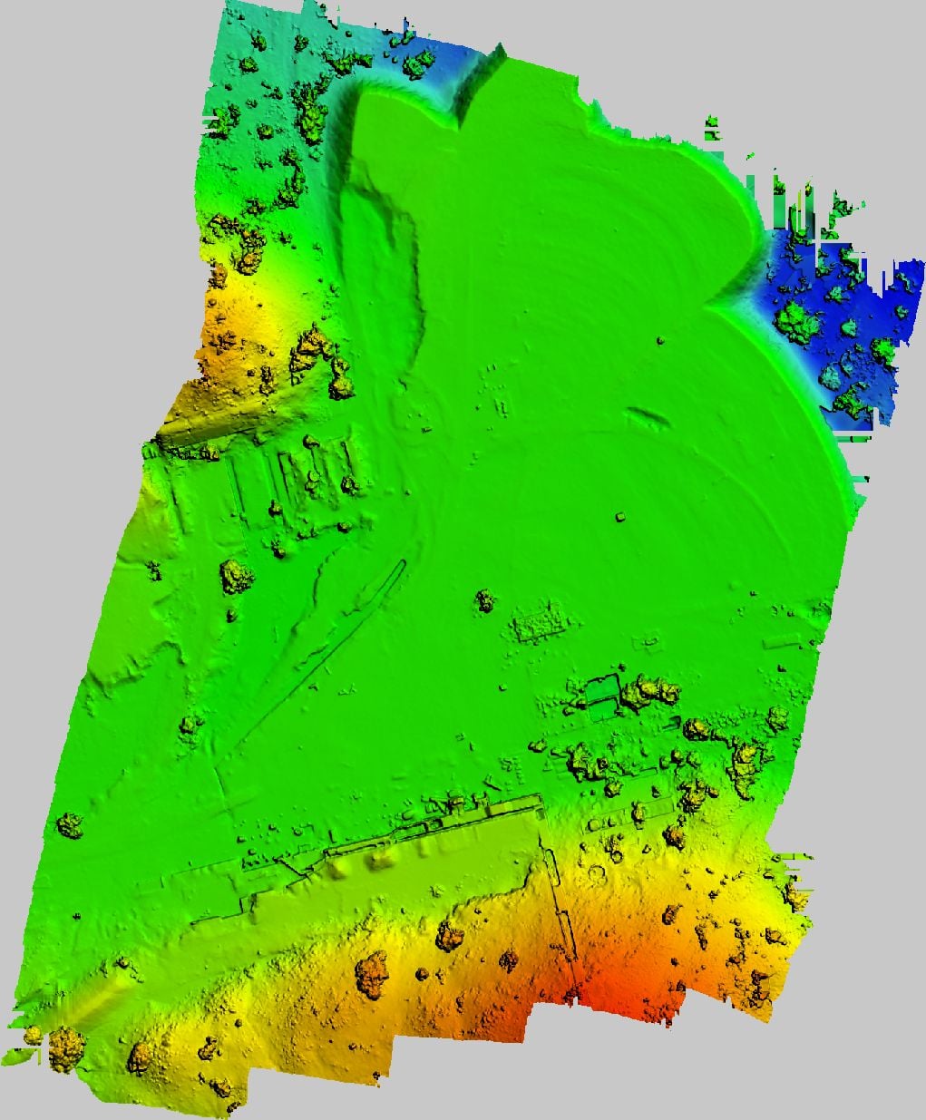
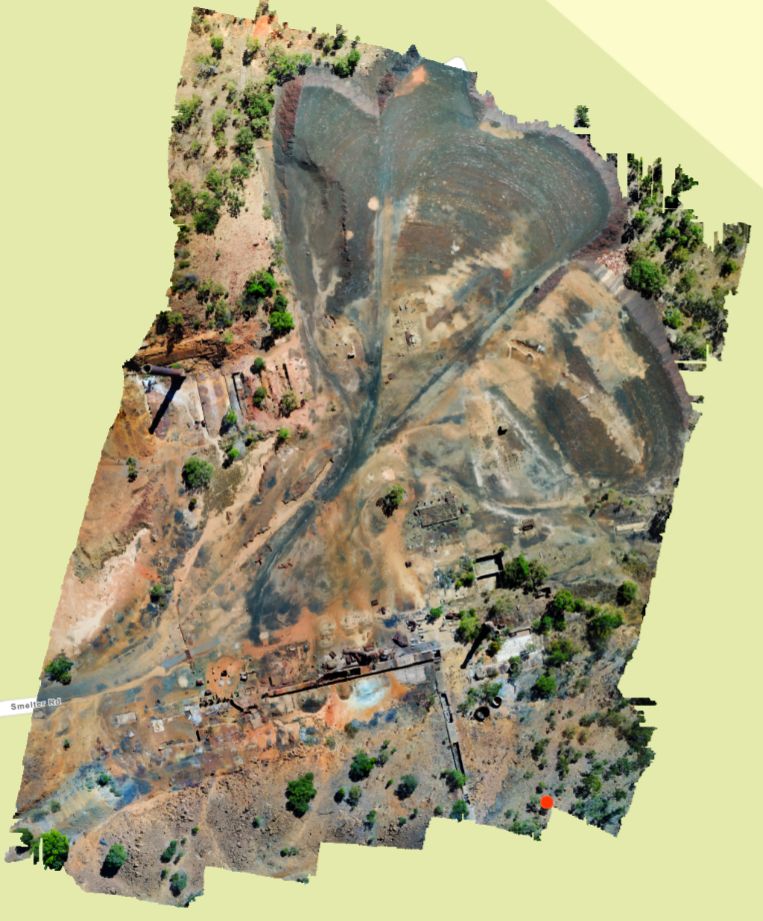
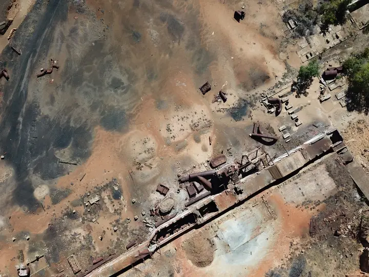
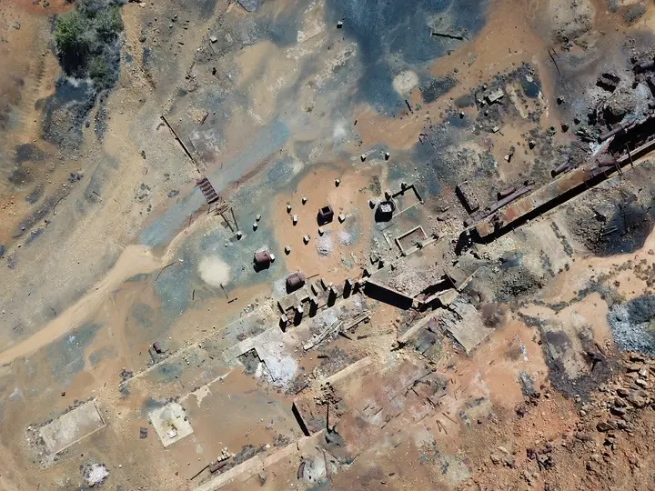
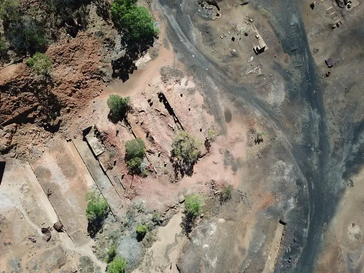
A collection of some of the images captured from the drone and used to make the orthomosaic of the Chillagoe Smelters.

Other ways drone mapping is helping capture history
Drones aren’t just useful for capturing known heritage sites. They’re also useful for capturing new sites as archaeologists uncover them. An important element of any archaeological dig is accurately recording where artefacts have been found within the site and in relation to one another (called geometric documentation). Drones can do this quickly, non-invasively, and with a high level of detail and positional accuracy. Because drones can cover large areas in high detail, they can also help identify larger patterns and features at a site, like old buildings. The addition of different types of environmental sensors can also help reveal features that aren’t clearly visible to the human eye.
You can read more about the applications of aerial drone photogrammetry to archaeology here.
Can I help with drone mapping heritage sites?
If you want to help record heritage sites for future generations, it’s super easy! All you need is your drone and a little bit of spare time. Once you’ve mapped somewhere, upload your images to GeoNadir, and we’ll turn them into a beautiful orthomosaic for you for free! Plus, they’ll be available for anyone to view on the platform, so everyone can enjoy viewing the heritage site you mapped. As always, Just make sure you are following local regulations where you fly.
Never drone mapped before? No worries! We have a handy free training guide to teach you all the basics you need to start.
Happy flying!

