Geospatial Data Labeler
Unique opportunity to join GeoNadir
Are you passionate about maps and Earth observation, including drone and satellite imagery?
Do you dream of making a real impact in the geospatial industry?
GeoNadir, one of Australia’s fastest-growing geospatial companies, is offering an exceptional opportunity to kickstart your career!
We are offering this role to up to three successful candidates initially.
The role
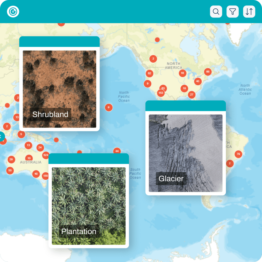
We know that Earth is comprised of a diverse range of ecosystems, and that many of the habitats making up these ecosystems are changing over time. We need to develop better systems to allow us to track these changes reliably and repeatedly through space and time.
While artificial intelligence (AI) can help, it must first be underpinned by human intelligence to identify and record information about these valuable ecosystems.
In this role, you will use GeoNadir’s online desktop mapping software to identify a range of pre-determined features within drone imagery. This work can be undertaken anywhere, anytime, and with flexibility that suits your lifestyle.
We recognize that AI has developed an underground culture of modern slavery, with the human intelligence inputs requiring underpaid long hours in poor conditions. We do not condone and will not support that culture at GeoNadir. Instead, we value and ethically manage the work of our human workforce with a mission to invest in those looking to get started in the industry.
Required skills and equipment
• Passionate about maps and Earth observation, including drone and satellite imagery.
• Desire to work in or contribute to the geospatial industry.
• Curious and keen to learn.
• Independent and responsible work ethic with the ability to self-schedule and manage your time.
• Access to a desktop or laptop computer (i.e., not a mobile device) with reliable internet connectivity.
• Attention to detail, methodical work practices.
• Identify as a woman or non-binary (Why? Because the only way to break down bias in a biased system is to actively counter bias and invest in minoritized groups).
• Legally able to work in Australia, and currently living in Queensland.
Desirable skills
• Current or previous studies / experience in geography, GIS, remote sensing / Earth observation, surveying, or similar.
• Experience interpreting aerial imagery.
Conditions
• Casual role for up to three months.
• Work from home or other flexible location.
• $30 per hour.
We especially welcome applications from those of all ages, who are culturally or linguistically diverse, neurodiverse, Black, Indigenous, of Colour, living with disability, or otherwise within an underrepresented or marginalized group.
How to apply
Take the first step towards an empowering career in the geospatial industry. Send Paul Mead a 90-second video, showcasing your passion, skills, and why you are the right person for this opportunity.
Join GeoNadir and become part of a team that is making a positive impact on our planet’s future.
Should you require any further information, please do not hesitate to Paul Mead. paul@geonadir.com or 0432 469 500.