
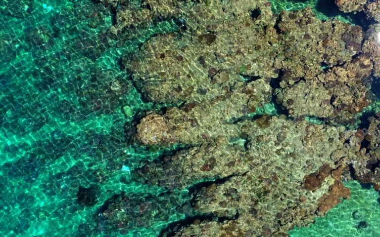
Seeing the Great Barrier Reef is on many people’s bucket lists, but not many people have seen it from quite as many angles as Associate Professor Karen Joyce. Since the 90’s, she’s been using remote sensing to try and map the amount of live coral cover on the reef. In the past, she relied on satellite imagery, but in 2013 she added drones to the mix and she hasn’t turned back since.
Managing her drone data
As Karen collected more and more datasets for her research at James Cook University, she was soon faced with the challenge of what to do with them all.
“I’ve been capturing drone data for many years now, and students and other researchers are always asking me if I have drone data over a certain area and if they can get a hold of it,” Karen said.
“It’s always been really difficult to continue to go backwards and forwards with them and say, ‘Okay, which bit do you need? Which date do you want? Does this work?’ – ‘Oh no, do you have something a little bit to the west of that?’ and there’s this constant backwards and forwards to get it right,” she said.
“I thought it would be so much easier if there was a place, not only that I could figure out for myself where all my data are, but where others would be able to find it and self-serve.”
It was from this idea that GeoNadir was born.

More than just data management
When Karen and her co-founder and husband Paul started GeoNadir, they wanted it to be more than just a convenient place for people to store their drone mapping data. They wanted to help make drone mapping data more accessible for everyone.
“It’s so easy to do localised studies with drones. But how relevant is that on a global scale and how transferrable is it? You don’t really know until you use an algorithm that you’ve created locally and try to apply it elsewhere or to scale globally. And to date, it’s been really difficult to be able to have data from different places to test and try to roll out different things,” Karen said.
“One of the coolest things that the United States government did in 2008 was to open up the Landsat satellite data archives. They realised that they opened a multibillion dollar industry where people could gain all sorts of different insights they hadn’t even thought were possible previously,” she said.
Karen thinks there is similar, untapped potential in drone mapping data.
“There’s a handful of satellites from an even smaller number of data providers, but there are hundreds of thousands of drone operators and millions of drones. So we have the opportunity to do something similar for ourselves, where that’s something that we’re controlling locally but scaling globally.”
Supporting the drone mapping community
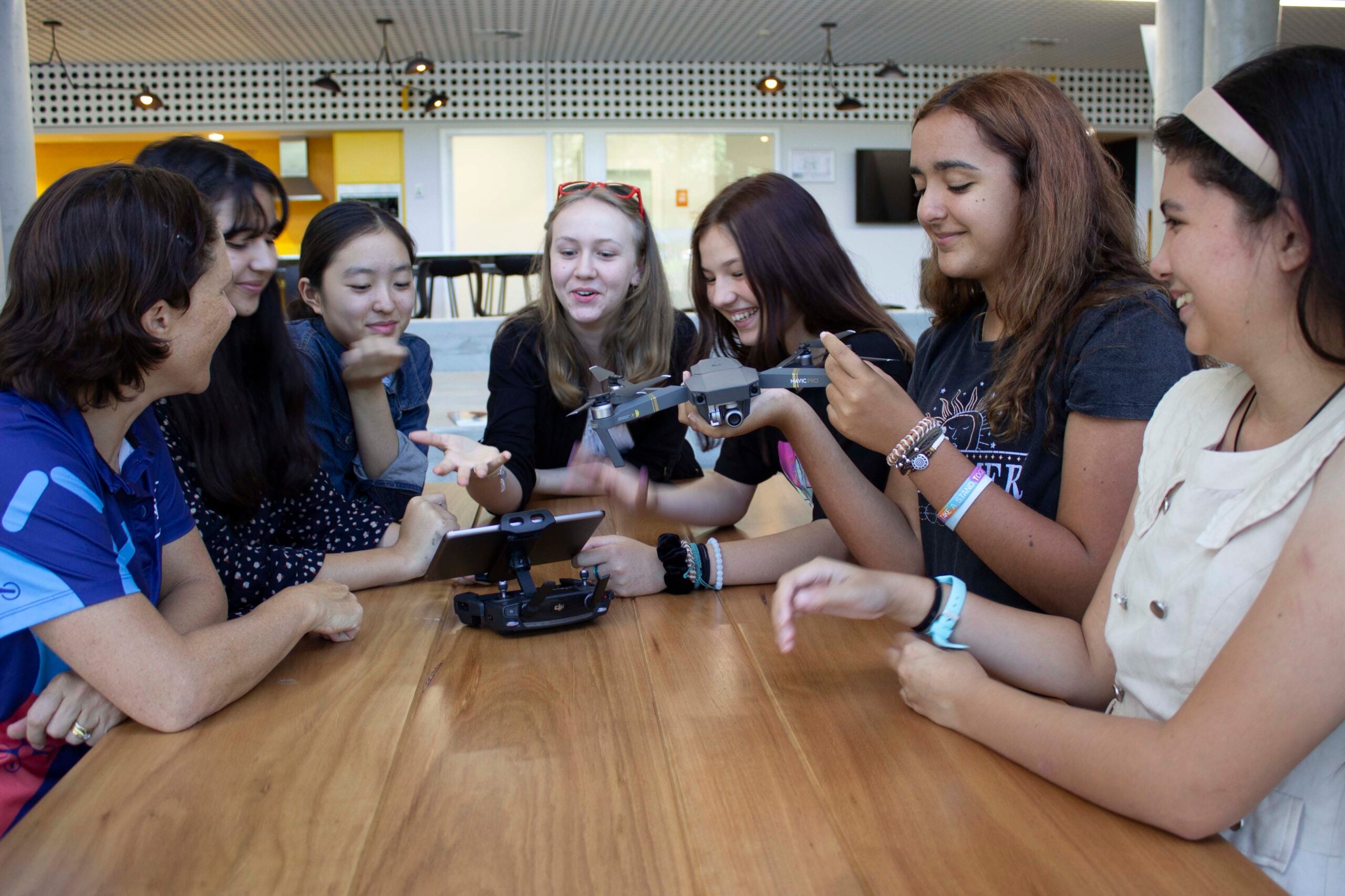
Karen also realised, through working with groups like Indigenous Rangers and school groups, that many people didn’t have somewhere they could easily store, process, or analyse their data.
“I wanted to help with an easy way that they could capture, process, and safely store their data without having a huge burden of learning different software, dealing with all the different software licenses, and staying up to date with hardware requirements,” Karen said.
“And I realised that mostly they don’t actually want to know all the technicalities behind drone mapping. They just want to be able to capture the data and get to the end state. But it’s quite difficult with so many steps along the way,” she added.
“So I wanted to tie those things together, where I could provide a system that would help people get to their results a lot faster, but then also keep data in one place that we can all share and collectively build on each other as opposed to doing things in silos”
Wide experience in earth observations
While Karen loves working on the reef, she’s also worked in many other parts of the drone and geospatial industry throughout her career.
After her PhD in coral mapping, she worked as a Geomatic Engineering Officer in the Australian Army before moving to New Zealand to work with the Conservation Estate and Department of Conservation. While in New Zealand, she also worked with GNS Science to map natural disasters like volcanoes, earthquakes, and floods to improve understanding of the events and inform better management.
Now, in addition to continuing to develop GeoNadir, Karen is a Senior Lecturer at James Cook University. She is also the co-founder and Education Director of She Maps, a company working to make drone and geospatial education easier and more accessible for schools across Australia.
Where did it start?
GeoNadir was an idea that Karen and Paul had been discussing for a while. But it wasn’t until a challenge from their mentor that they decided to see if the idea had any traction.
“The trigger point was a mentor that Paul and I work with who, let’s say he dared us to to take action. He said to us, ‘All right, stop talking about it. Just put up a landing [web]page, and if you can get 20 people to sign up over the weekend, then you know you’ve got something that people are interested in,” she said.
“So we put up a really basic webpage, put up a post on Twitter, and by the end of the weekend, we had 200 people sign up to a mailing list of something that was really just an idea.”
Since then the platform has been developed and people from all over the world have taken the time to upload their drone mapping data to GeoNadir.
“Lots and lots of people have jumped on board to upload their drone mapping data to the platform to share and it’s really cool to see that they are excited about what we are doing as well, which is awesome,” Karen said.
“I love exploring other people’s datasets and seeing where their interests are. And I always learn so much from the descriptions that they put in their datasets about what they’re doing and what their research is on. I love learning so this is always exciting to me,” Karen said.

Where is it going?
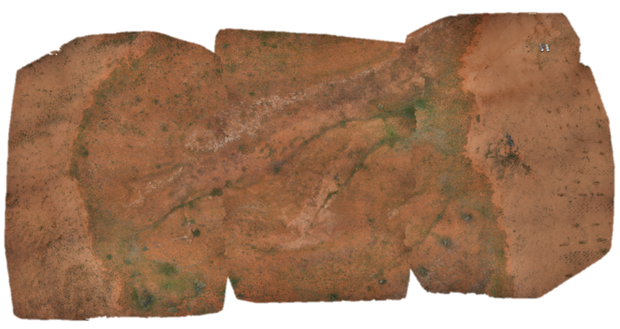
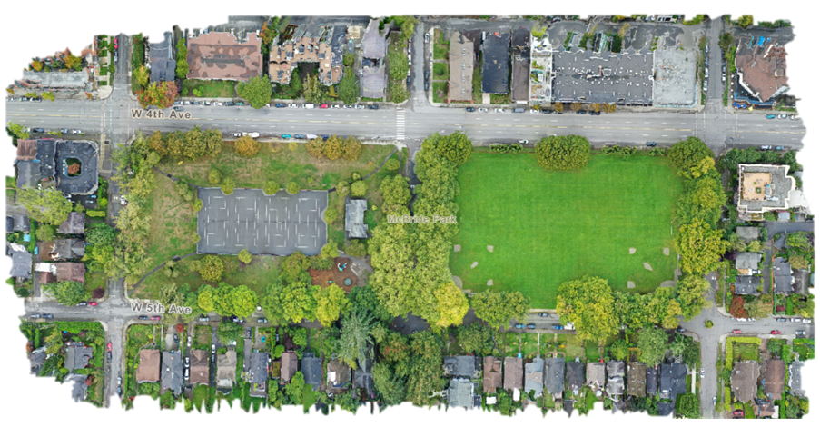
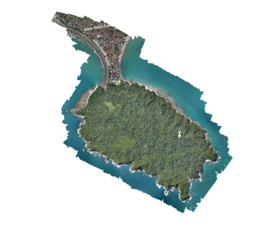
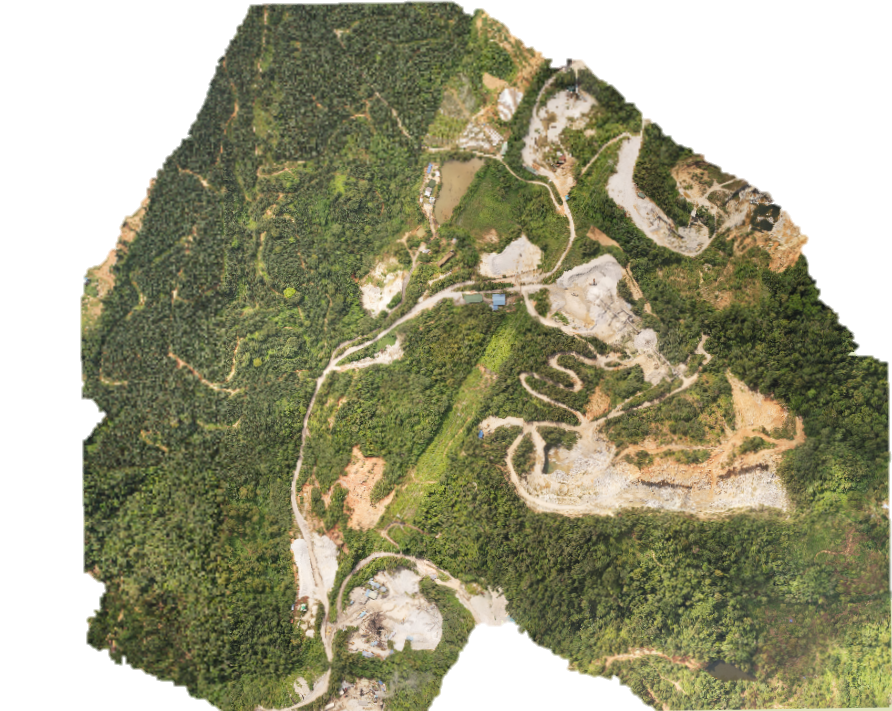
“I’d love to see GeoNadir as a place where people are contributing drone data to create what is effectively the most detailed map of the world, sort of the next generation of what we see on Google Earth,” Karen said.
“Because while we have Google Earth being created using satellite data from satellites that are hundreds of kilometres up, we have the ability to collectively build something that has much higher detail and has been built by the community,” she said.
“So we can all use that to collectively build on insights and continue to help us understand the Earth and ways in which we can look to manage and monitor the Earth sustainably.”
Add your drone data to GeoNadir
Creating such a detailed map of our planet will take help from drone pilots all over the world. If you use drones for mapping, consider uploading your data to GeoNadir!
You can get started for free, storage is secure, and your raw images will automatically be turned into an orthomosaic. By uploading, you can help make sure your mapping data is being used to its full potential!

