Dryland salinity and drones: Managing salinisation in WA

If you’re a farmer in Western Australia, dryland salinity is an old enemy. It takes productive pastures and croplands and turns them into barren, salty fields. In southwest WA, dryland salinity has caused the loss of over 1 million hectares of productive agricultural land. A further 2.8 to 4.5 million hectares of productive land is at risk of salinisation in the future.

It’s a constant battle for farmers to identify and manage salinity. Drones are one tool joining the arsenal to track the impacts of dryland salinity and the effectiveness of management strategies.

What is dryland salinity?

Dryland salinity refers to the build-up of salts in the upper layers of non-irrigated soils. It’s a big problem for agriculture because many valuable food and fodder plants can’t grow in salty soil.


In severe cases, dryland salinity can kill all the plants in an area, leaving it bare and barren. But even at lower levels, dryland salinity reduces the yield from crops and causes a decline in pasture quality.

What causes dryland salinity?

Much of Australia’s native vegetation is deep-rooted to take advantage of underground water supplies when the weather is dry. A lot of this deep-rooted vegetation has been cleared and replaced with shallow-rooted crops or grazing pastures. These plants use less water than the native vegetation, meaning, more rain now makes it into the groundwater. Across agricultural regions in WA, groundwater is commonly rising by 10-20cm per year. 


In most cases, rising groundwater doesn’t cause issues beyond some extra waterlogging and seepage, but a lot of Australia has naturally saline soils. As the water table rises, it absorbs this salt and moves it to the surface of the soil. Once this salty water is at the surface, it evaporates, leaving the salt behind. As this cycle repeats, the soil gets saltier and saltier, until it becomes too salty for plants to survive. Because water carries the salt, areas where water pools tend to concentrate salt. Sometimes it’s easy to predict where this will happen, like at the base of valleys or in gullies. Other times, changes in underlying geology (like dykes or shallow bedrock) can bring groundwater to the surface in more unexpected places.

Where does the salt come from?

Rising groundwater bringing salt in the subsoil up to the surface is what causes dryland salinity. But how did the salt get in the subsoil in the first place? In WA most of the salt is actually sea salt. The prevailing winds carried salt inland as part of rain or on dust particles. Over thousands of years, this salt slowly accumulated in the soil. But in other places around the world that suffer from dryland salinity, the cause can be different. For example, in the USA and Canada, the salt comes from the breakdown and weathering of ancient marine rocks.


Sometimes, this salt will naturally accumulate on the surface. This usually happens in very arid areas, where there is little rainfall to wash the accumulating salt down into the subsoil. In extreme cases, you get the formation of features like salt pans. This is where water has carried salts that accumulated on the surface to a lake which has then evaporated leaving the salt behind.

Namibian Salt Pan dryland salinity
Etosha Salt Pan, Namibia

What’s the impact?

The most significant impact of dryland salinity is on the agriculture industry. Seventy percent of Australia’s dryland salinity occurs in WA, impacting 10% of agricultural land. It’s been estimated that the loss in agricultural productivity due to dryland salinity in WA is $519 million per year.


The area affected by dryland salinity is still expanding. It’s been predicted that salinity could impact up to 4.5million hectares of agricultural land, resulting in $1 billion per year in lost productivity. Lost agricultural productivity isn’t the only impact of dryland salinity. The loss of plant cover from salinity also means that saline areas are vulnerable to erosion, which can cause knock-on water quality issues.

Dryland Salinity in WA dryland salinity
A salt scald in a paddock in WA. The green shrubs are saltbush, which have been planted to try and manage salinity. Source: Monty House

So how do we manage salinity?

There’s not much farmers can do to reduce the salinity of soil once it’s gotten salty. Instead, management of dryland salinity focuses on stopping existing salinity from getting worse and finding productive uses for saline land.


Engineering solutions, like deep surface drains, can help channel groundwater away from areas. This helps reduce waterlogging (waterlogging makes plants more sensitive to salinity) and helps keep the water table lower nearby so it doesn’t bring salt to the surface. This can help keep land that was starting to become salty productive, but it can sometimes cause water quality problems since the salty run-off is just being diverted elsewhere.


An alternative solution is replanting saline areas with salt-tolerant plants. The plants help draw down the water table near the surface, stopping the salinity from getting worse. They can also offer a new way to make the land productive. For example, saltbush is a popular salt-tolerant native often planted in and around salty areas to both stop salinity from worsening, and to provide fodder for sheep.

A saltbush plantation in a paddock impacted by salinity. Source: Monty House. View the dataset on GeoNadir

Where do drones come in?

Tree planting sites
Trees Australia planting sites mapped by drone. Source: Monty House via GeoNadir.

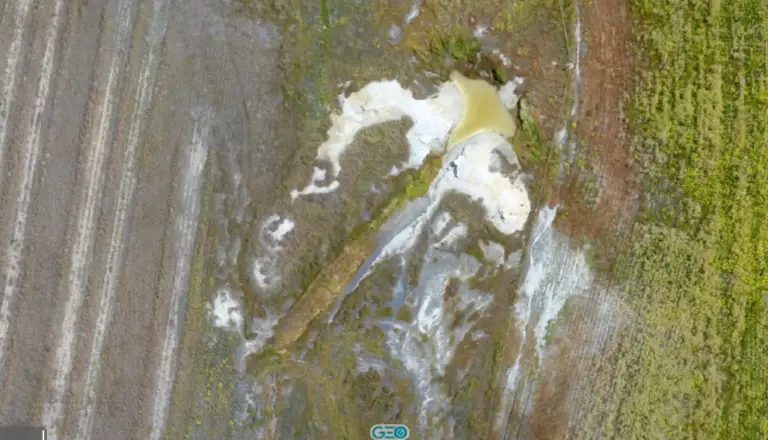
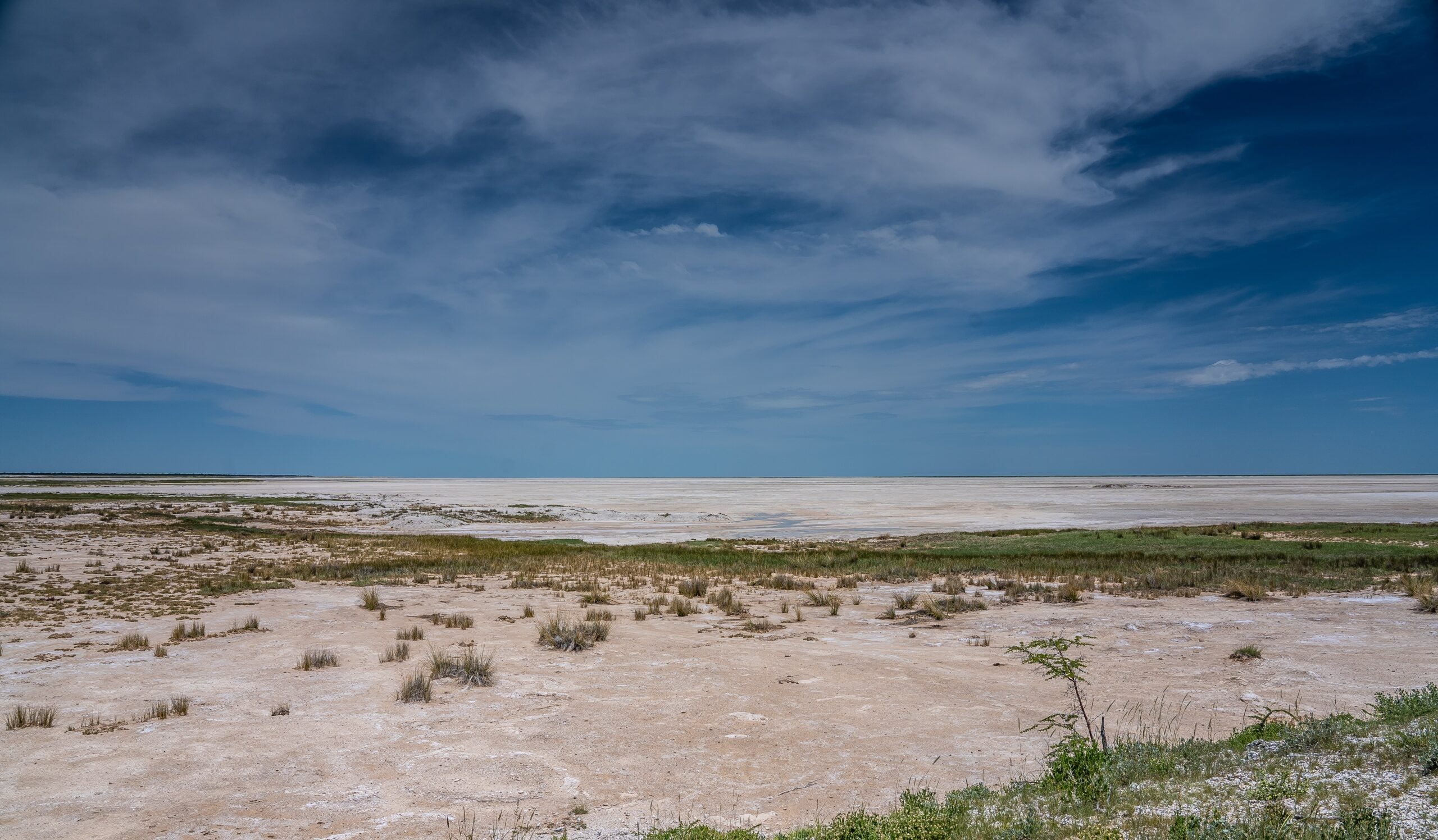
There’s a lot of value in on-the-ground observations and measurements for understanding dryland salinity. But drones offer a new perspective on the problem. High-resolution drone mapping can quantitatively show the extent of saline areas and how this changes over time. Plus, they can offer a new perspective on how water seeps, moves, and pools across the landscape, which is important for identifying areas that might be at risk of salinity. Some researchers have even learned how to estimate soil salt content based on the multispectral images collected by drones.


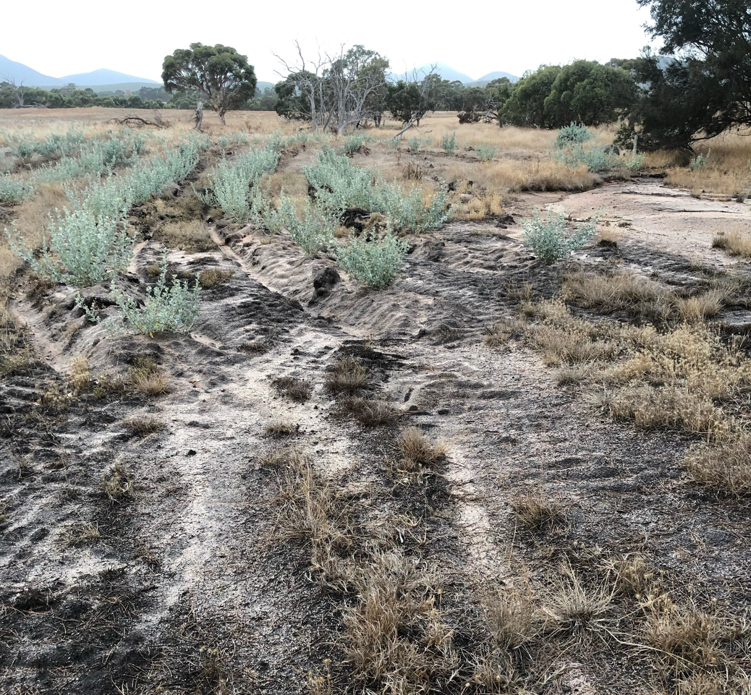
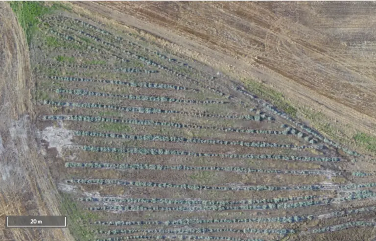
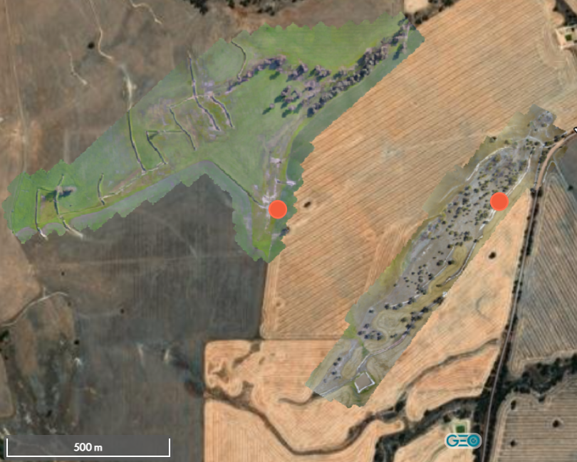
Drone imagery is also a useful way to look at how well salinity management strategies are working, particularly with re-vegetation, when you don’t always know how well the plants will grow under the conditions. Trees Australia works to re-vegetate farmland in WA, often where the land is no longer as productive due to dryland salinity. As part of their work, they have mapped many of their planting sites with drones so they can see how well the tree survive and how salinity changes over time.


Re-vegetating these areas with trees will help draw the local water table down, reducing the amount of salt that accumulates on the surface in the future. And although Trees Australia, doesn’t currently use any of their planting sites for offsets, there is the potential for treed sites like these to become carbon farming sites, offering farmers an alternative source of income.

Check out more datasets like this

You can check out more of the Trees Australia planting sites on Geonadir and explore some of the other awesome datasets that people have uploaded.


Have something cool that you’ve captured when mapping with your drone? Upload it to GeoNadir and send us a message. We’d love to write about your interesting dataset next!

Subscribe for more stories from above, tips, & tricks

Share this article with your peers on social media.

Facebook
Twitter
LinkedIn
Topographic map with dots displaying data points of environmental drone mapping data. Three drone mapping overlays in different environments

Get a free account

  • Unlimited orthomosaics
  • Unlimited uploads
  • Free storage
Manage, process, analyze, and collaborate with your drone mapping data.