Orthomosaic, the Short Answer:
The output from a process where a number of overlapping photos (e.g. from a drone or aerial camera) are stitched together with distortions removed to create a complete and continuous image representation or map of a portion of the earth.
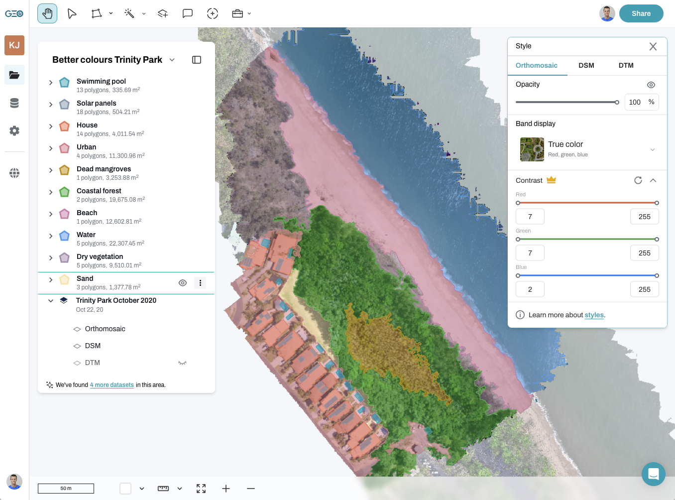
The orthomosaic below is made up of 283 individual drone photographs.

The longer answer:
When we consider the origin of the term ‘orthomosaic’, it comes from ‘ortho’ + ‘mosaic’.
Ortho – from Greek origins meaning ‘straight’ or ‘erect’
Mosaic – from the Cambridge English Dictionary “a pattern or picture made using many small pieces of coloured stone or glass, or the activity or method of making these; a combination of many different parts forming one thing”
Many people are now familiar with using their phones to create panorama pictures, where the camera takes many individual overlapping photos – or small pieces – and stitches them together in a process called mosaicking. Unsurprisingly, mosaicking creates a mosaic 🙂
However, this is not necessarily ‘ortho’.
Photos taken from an aerial perspective (including from a drone), contain a number of distortions that we need to remove to create the ‘ortho’ part of the orthomosaic. Tall objects such as trees, rocks, cliff faces, buildings etc appear ‘pushed over’ the further they are away from the centre of a photo. This effect is called radial displacement and is really helpful if we want to calculate the height of the object, but very challenging when we need to place the feature on a map. This is because the top of the object is now in a different location from its base – see the images below showing how the rock feature is distorted. Creating an orthophoto ensures that features are in their true location so that we are able to make accurate measurements – this is the science of photogrammetry (literally – photo measurements).

What’s the difference between an orthophoto and an orthomosaic?
An orthophoto is a single image with the distortions removed, while the orthomosaic is the final product after stitching together all the individual orthophotos.
How are orthomosaics made?
We have been creating mosaics from satellite and aerial images for decades. This is not new technology. However, using photogrammetry software to automate this process is relatively new and is pretty exciting. There are a number of different software options to choose from, but they all effectively do the same thing.
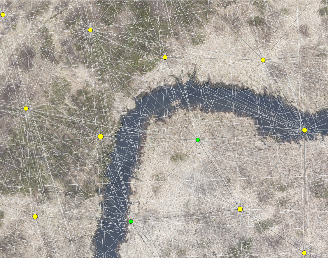
The user uploads photos with a high degree of overlap, and the software then searches for pixels or ‘tie points’ within each image that it can identify as matching with adjacent images. In the image below, the coloured dots represent the centre of a drone photo, and you can see the network of lines connecting one photo to another based on its tie points.
In the ‘olden days’, and still with photos with insufficient overlap or challenging environments, the analyst was required to manually search for these tie points. It’s a hugely time-consuming process, and I don’t recommend doing it unless you have to!
How does an orthomosaic correct for height distortion?
With the human vision system, each eye sees the world from a slightly different, though overlapping perspective. Our brain processes this information to understand our surroundings in 3D.
Photogrammetry software uses this same concept to take overlapping photos to create a 3D model, known as a Digital Surface Model (DSM). It is this model that is used to correct the distortions due to object height, to create the ‘ortho’ in our photos. Together with our tie points, the software can stitch together the imagery to build the orthomosaic with some pretty fancy algorithms.
The other aspect of it is that with such a high degree of overlap, there is a lot of redundancy in our imagery. We can optimise our orthomosaic model based on the central part of the image, where there is the least distortion while the camera is at a nadir angle (facing directly down).
You can check out a whole range of beautiful orthomosaics from around the world by launching GeoNadir. If you’d like to learn more about how to capture data suitable for creating orthomosaics, see our step-by-step guide for drone pilots.
Questions? Have any insights that I missed? Need to brainstorm a topic you’d like to write about? Share below in the comments — I’d love to help and hear them!