

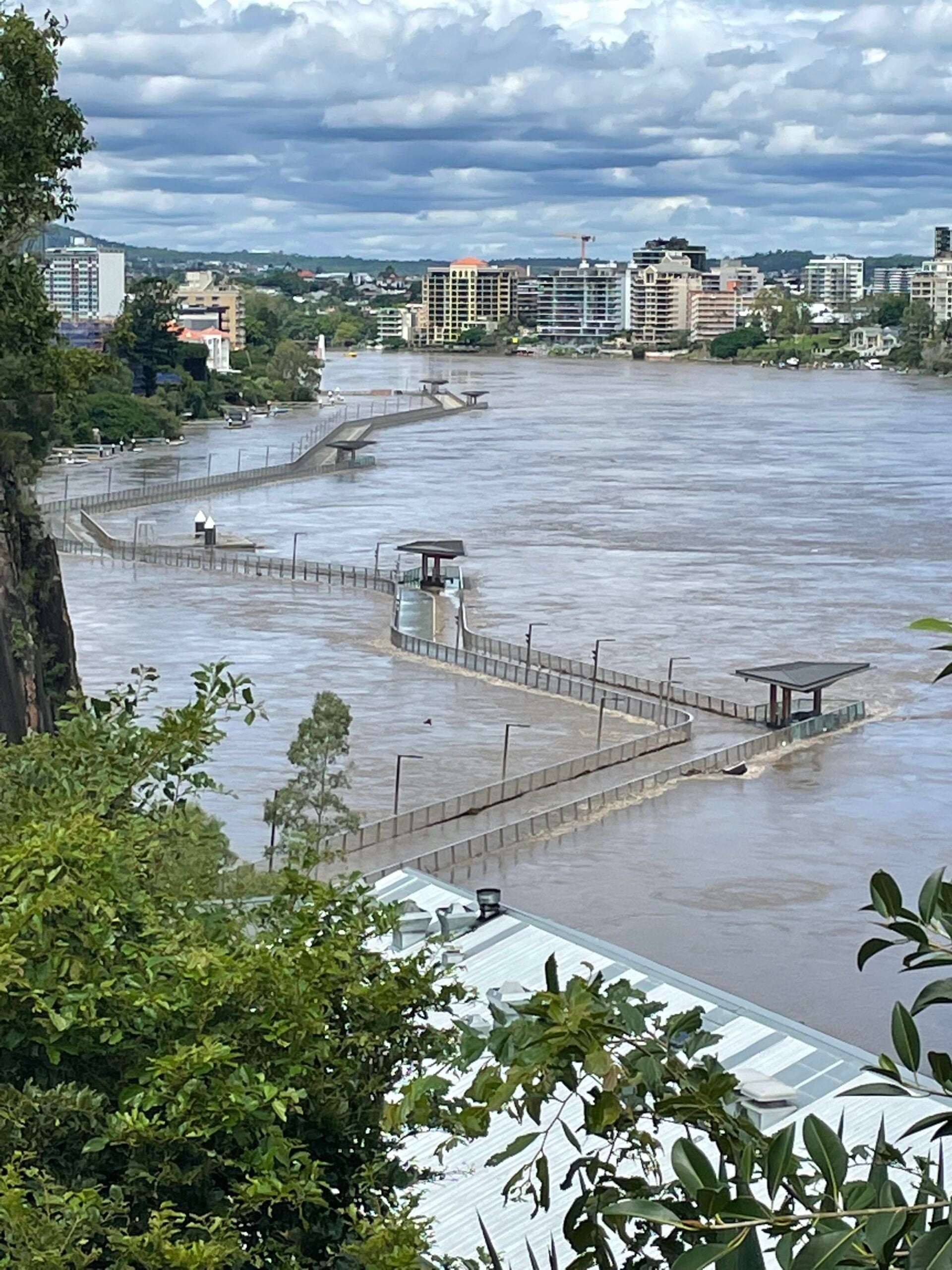
The flooding in south-east Queensland and northern NSW has been some of the worst in decades for many regions. As the weather system responsible moves south, clean-up and damage assessment begins in QLD. New South Wales is bracing for more heavy rainfall.
Australia is no stranger to flooding. Most of our towns and cities are built along waterways and on flood plains. As we’ve seen recently, this can result in serious damage during flooding. The government is continually putting money and effort into flood mitigation, warning, evacuation, and recovery strategies. These strategies continue to evolve as we learn more about flood behaviour and new technologies emerge.
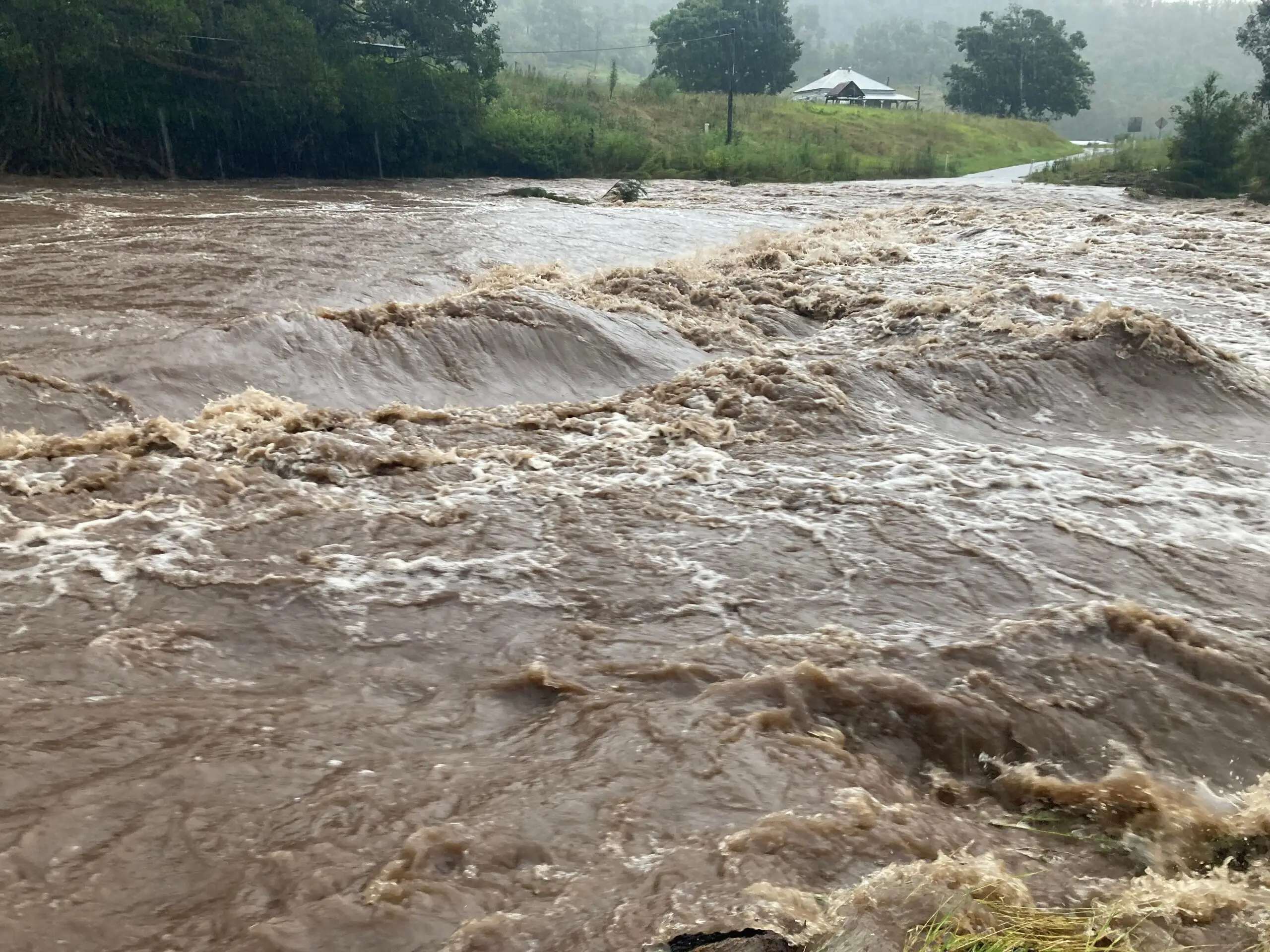
During significant flooding events in Townsville, such as recent incidents, numerous accidents and injuries occurred as a result of hazardous conditions, underscoring the need for effective monitoring solutions.
Drones are one technology that is becoming a more important element of flood management before, during and after flood events.
How can drones help during flooding?
There are lots of sources of information that are used to help us track flood events.
Flood gauges, reports from people on the ground, calls for assistance and footage from traditional aircraft and helicopters all help emergency responders to gauge the extent and severity of a flood and get people to safety. Drones help complement this suite of tools by capturing footage of flooding as it is occurring.
Why is high quality footage of flooding so important?
There are three main reasons why it’s helpful to get as much high-quality footage during flood events as possible:
- It helps emergency responders identify areas of high risk. This helps focus evacuation efforts and can help rescuers find and evacuate people who have become stranded in flood water.
- It helps disaster response teams prepare and get plans in place for when flood waters recede. Identifying worst hit areas as soon as possible means that resources can be prepared for urgent repairs and restoration of access routes. This helps communities get back on their feet faster.
- Aerial flood footage also helps give quantitative records of flood extents and depths. This is important for two reasons:
- It helps researchers understand flood risk and flood behaviour to help prepare for future flood events
- It provides direct evidence that can be used in insurance claims and applications for disaster relief funding
Why are drones a good way to capture footage?
While you’re unlikely to see anything in drone images that you wouldn’t be able to see from traditional aircraft and helicopters, drones are often much cheaper and easier to operate. Unlike traditional aircraft, drone flights can be conducted by trained volunteers rather than requiring licensed pilots.
Drones can also be deployed flexibly and on short notice, like during a short break in dangerous weather that would otherwise ground aircraft. Using drones to take footage of flood events also means that manned aircraft can focus on finding and evacuating people that have been stranded by flooding without having to worry about collecting footage at the same time.
Satellite can also be used to assess the scale and extent of natural disasters. But during flood events, cloud cover often presents satellites from capturing any useful images.
Flooding in Townsville in January 2019, captured by Queensland State Emergency Services, and flooding in Luxembourg, January 2022 by Margherita Bruscolini.
How can drones help after flooding?
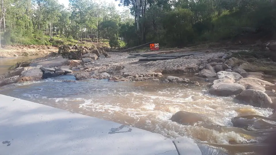
After flood waters recede, the challenge becomes assessing the scope of damage. Identifying priority areas for cleaning and repairs helps communities start to recover. Drones are often a cheaper, easier way than traditional plane or helicopter-based surveys to see the damage revealed by receding water. They can also support large scale assessments of damage from satellite imagery since drones can map damage to a finer resolution than satellites.
Timely, accurate, extensive flood damage assessments help decision makers determine where and how much support is needed. Quickly knowing how severe the flood damage is can help decision makers determine whether extra support needs to be requested and the level of funding that might need to be applied for. It can also prevent over allocation of resources to areas with less severe damage, saving time and money.
How can drones help with flooding when there’s no flooding?
It might seem like a strange question, but there’s actually a lot that drones can do to help prepare for the next flood event.
Flood modelling
As far as prevention goes, there’s not a whole lot that can be done to stop floods from occurring. Rain is going to fall whether we want it to or not, and floods are important for many ecosystems. What we can do is reduce the impact of floods when they occur. The best way to do that is to build our cities and towns to be safer during floods. To do that, we need accurate flood modelling.
Flood modelling is a pretty big and complicated field, but one important piece of data that is needed for accurate modelling is high quality elevation data. Drone mapping and photogrammetry can provide finer resolution elevation data than can be achieved through mapping with manned aircraft. This data can be fed into models to figure out where water is likely to flow. This informs what sort of flood mitigation measures, like levies, can be built to reduce flood impact.
‘Before’ pictures
Knowing what was there before a natural disaster is one big challenge that scientists and decision makers often face when looking at a disaster’s aftermath. In some cases, the impact is obvious: once there was a bridge there, now there isn’t. But smaller, more subtle things, like changes to the path a creek or river takes or the extent of erosion caused by a flood, can be difficult to gauge without some sort of quantitative measure from before the flood occurred. This absence of a ‘baseline’, so to speak, can make judging the scale of impact difficult. Drones and drone mapping are a relatively easy, cost-effective way of collecting these baseline data over large areas.
You can view the whole dataset associated with the picture on the right on GeoNadir.

How can you help?
So, you have a drone. Can you use it to help gather information about flood events?
Well, yes and no.
During floods: No
During flood events, you shouldn’t be flying your drone. Although it can be tempting to put your drone in the air to get some spectacular views, random drones in the air can also interfere with emergency services. In fact, it’s illegal to fly your drone in areas where emergency services are operating. It can make what is already a dangerous situation even more complicated. In fact, you can be fined $11,000+ or receive jail time for flying a drone where emergency services are operating.
If you want to help with your drone, consider volunteering with your local SES. Many teams are starting to include drones as part of their emergency response strategy and they could do with trained pilots. Otherwise, while the flooding is happening, keep your drone on the ground. There are plenty of other ways you can help support your community.
Video footage of the Townsville floods in 2019 captured by the SES using drones,
Before and after floods: Absolutely!
When emergency services are no longer active in your area, feel free to fly your drone and get some footage. Images before and after flood events can provide a valuable source of information to predict flood behaviour and understand the impact of floods.
Just keep in mind the rules around flying you drone safely. If you need a refresher, check out the Civil Aviation Safety Authority’s video, or if you’re based in USA, you can read the FAA’s updated guidelines here.

While there’s value in taking individual pictures or videoing a flight over an area, the most useful way to collect flood data with your drone is to fly mapping missions. This involves flying in a specific pattern, with your drone’s camera at nadir angle (pointing downward) taking pictures at regular intervals. These images can then be fed into a program that will stitch them all together into one continuous map, called an orthomosaic, which can easily be analysed to extract important information.
Let’s go!
So what are you waiting for? Get out and map! If you’ve never flown your drone on mapping missions before, don’t worry. We have a handy guide for how to get started on drone mapping free to download from our website here.
After you’ve finished mapping, don’t forget to upload your pictures to GeoNadir! We’ll automatically turn them into an orthomosaic and make them available on our platform for anyone to learn from and use.

