Online
Drone Mapping Course:
Capture and Analyse Data
We train you in drone mapping skills to efficiently capture and analyse data.
Approx 16 hours
Beginner
$695 incl GST


What you will learn in this course:
This course will give you all the tools you need to become proficient at drone mapping for data capture and analysis.
Mission Planning
We guide you through decisions such as where you can fly (legally and ethically), the sort of drone to purchase for your application, the apps you’ll need for mission planning, and how to create an effective flight plan to acquire data suitable for environmental mapping.
Data Pre-Processing
After you’ve captured your image data, you’ll need to perform pre-processing to create an orthomosaic. You may also want a 3D model. We help you navigate the software required to make your mosaics and models while forming the basis for further analysis.
Field Survey
It’s often necessary to calibrate and validate our drone data using in-situ field observations. We help you create and execute your survey plans to supplement your image data.
Information Extraction
The most important part is urning your data into information. We’ll cover some GIS basics including an introduction to your choice of ArcGIS Pro or QGIS (open source), displaying data, incorporating your field survey and other layers, creating new data through digitising, and finally communicating your output with some effective cartography skills.
Expert Support
You get direct and LIVE access to our team to help you learn drone mapping. Personal email and phone support is always available.
Note: It is outside the scope of this course to investigate automated and semiautomated remote sensing image processing techniques such as OBIA, spectral analysis, and pixel-based classifications.
What experts and students are saying:

Lorraine Chaffer
Vice President Geography Teachers Association
Thanks for sharing Karen! The course looks great and I will share with my geography networks
Christine Munisteri
Engineer at GEO Jobe GIS Consulting
Every part of this program is so well planned and executed; it’s an exciting option in the ever-evolving world of drones and geospatial tech!


Jon Caris
Director, Smith College Spatial Analysis Lab
Thank you for the very accessible write-up on
orthomosaics and one that I will share with my
students.
Jaelen Myers
PhD candidate, James Cook University
I’m so glad I found GeoNadir. The processing software is excellent at rendering my images and I can use the interactive features to make measurements and create layers. I love that I’m able to do all this without the need for other mapping software, which makes my efforts more efficient. It really has everything I need.


Nick Matuche
Nova Scotia Community College
I absolutely love GeoNadir. The idea of a catalogue of our coastlines and vulnerable areas is very important to me. As an avid drone pilot, I feel like it’s my duty to contribute. I mapped these locations because I believe it’s extremely important to keep records of our beautiful coastline here in Nova Scotia, Canada. We have many salt marshes that need protecting.
Zac Adie
Bushland Regenerator, Chief Remote Pilot
Having spent the past few years deep diving into learning everything I can about #photogrammetry and drones, becoming a Chief Remote Pilot, I thought I knew quite a bit; however upon completing the course and reflecting on its contents I am happily reminded that there are always new things to learn, new tips and tricks to take on-board to improve your skills or your workflow.


Dr Karen Joyce
INSTRUCTOR
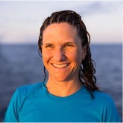
Dr. Karen Joyce is the Co-Founder and Technical Lead of GeoNadir. She is a multi-award winning geospatial scientist, working for more than 20 years in government, industry, the military, and academia. She has been involved in tertiary education since the late ’90’s, and online education for the past 12 years. Her online resources are accessed nearly 30,000 times every month and she is constantly creating content as technology changes. Karen is a qualified remote pilot and has been flying drones of all sizes with a variety of sensor payloads since 2013, with most of her research conducted on the Great Barrier Reef.

30 DAY MONEY BACK GUARANTEE
We stand by our products and they have been tested by thousands of participants, so we know they work. However, if you're not 100% satisfied, we will refund your money within 30 days of purchase.
FAQ
Yes, this course teaches concepts you need a drone to put into practice and make the most of the learning process. With a drone, you’ll be able to plan and execute missions and then analyse the data.
Maybe. Regulations and guidelines vary by location and drone size, so always check with your local authorities before drafting your mission plan.
GeoNadir’s drone mapping course offers a variety of materials designed to teach you everything you need to know about this topic in much more in-depth and in a more traditional class environment, unlike what you get from our free ebook.
You should already be familiar with the safe operation of your drone in order to apply the teachings of this course.
You can work through the course materials at your own pace. However, it is recommended that you set yourself a schedule and some goals for completion over a period of four to eight weeks for a better learning experience.
This course includes step-by-step videos using ArcGIS Pro and QGIS.
If you’re not 100% satisfied, we will refund your money within 30 days of purchase.
Sign up for a free account