
Thermal drone mapping: A case study with SmartShot Photo
We recently spoke with Michael Bevis, the owner of SmartShot Real Estate Photography in Texas, USA about how he has processed his thermal drone mapping data on GeoNadir for free to create insights for his customers.
Michael has been in the real estate business for years and has a unique understanding of the challenges building owners face and their need to protect their assets. He has managed high-rise condos, dealing with leaking roofs on commercial assets before drones were a thing!
Now he is using various technologies to assist owners and agents to better understand and sell their assets, after spending years selling properties. Using 3D tours and drone imagery has allowed Michael and SmartShot Photo to offer unique perspectives to his customers.
Thermal drone mapping is also proving to be a game-changer for conveyancers conducting property inspections. By leveraging this technology, they can detect structural issues, insulation gaps, and moisture problems that might otherwise go unnoticed.
As Michael found with GeoNadir’s latest ability to upload, process, and visualise thermal data, it adds a new dimension to real estate inspections, and when combined with the RGB data can enhance insights for building owners.
We already know that drones can cover large areas of real estate quickly and efficiently, much faster than ground-based inspections. This is particularly useful for large properties or developments.
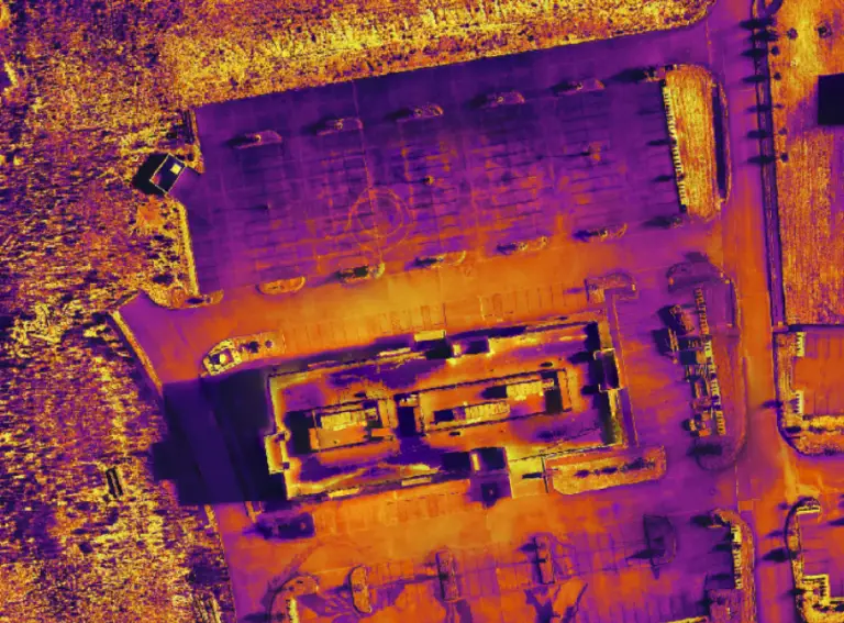
But using thermal sensors on drones can quickly provide insights in these two areas, as Michael has been experimenting with using the Mavic 2 Enterprise:
Identification of Water Damage and Leaks: Thermal imaging can reveal water damage or leaks in a property by showing cooler areas where moisture may be present. This can be particularly useful for identifying hidden issues that are not visible to the naked eye.
Detection of Heat Loss and Insulation Issues: Thermal cameras on drones can detect areas of heat loss in buildings, highlighting potential insulation problems. This is crucial for energy efficiency assessments and identifying areas that may require additional insulation.

We have a demo project of thermal data that you can explore.
Try out a couple of things in this project:
- Change the transparency of the thermal orthomosaic to see the RGB orthomosaic underneath (hover over the word ‘orthomosaic’ and move the slider).
- Read this article here to find out more about using thermal data in the field.
Processing of thermal drone data
Professional subscribers to GeoNadir can upload their thermal mapping data to GeoNadir, and we will process, store, and manage it all. Unlimited data storage and processing of RGB and Thermal data on GeoNadir.
You can get started now to create insights for your customers, just like Michael.

