Category: Featured Collection

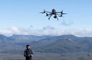
drone flying over landscape to collect data
Case Studies

National research drone data available to the public

TERN data on GeoNadir GeoNadir and the Terrestrial Ecosystem Research Network (TERN) have completed a project to make all TERN’s current and future drone mapping data available on the GeoNadir global map. TERN is Australia’s national ecosystem observatory and has over 1000 sites around Australia where drones are used to capture changes in vegetation and

Read More »
Featured Collection

Join GeoNadir as a Data Labeler

Geospatial Data Labeler Unique opportunity to join GeoNadir Are you passionate about maps and Earth observation, including drone and satellite imagery? Do you dream of making a real impact in the geospatial industry? GeoNadir, one of Australia’s fastest-growing geospatial companies, is offering an exceptional opportunity to kickstart your career! We are offering this role to

Read More »
Environmental monitoring Gudai-Darri bat caves
Case Studies

Drone environmental monitoring: The benefits of perspective

Creating a sustainable future is a tricky balancing act of causing the smallest environmental impact for the largest positive outcome. Knowing the environmental impact of an activity, and mitigating the impact, depends heavily on good environmental monitoring. Drones are quickly becoming an indispensable tool in this space. Drone environmental monitoring offers a fast, cost effective,

Read More »
what is orthomosaic
Drone Data Capture

What is an Orthomosaic?

Orthomosaic, the Short Answer: The output from a process where a number of overlapping photos (e.g. from a drone or aerial camera) are stitched together with distortions removed to create a complete and continuous image representation or map of a portion of the earth. The orthomosaic below is made up of 283 individual drone photographs.

Read More »
how to map with a drone
Drone Data Capture

How to Map With a Drone (Top 10 Tips)

How to map with a drone: I know that lots of people love flying drones, but I’m not one of them! Yet what I do love is the #earthobservation data that I can capture with my drone. I’ve been working with remote sensing data since the late 1990’s and know full well that not all data

Read More »