
Transforming Neilly Group's drone data
Neilly Group are environmental engineers who use Earth observation data to map, monitor change, and quantify sites as part of their tendering, construction, and post construction monitoring phases. But due to the vast amount of data they collect it was causing issues in storage, visualisation, and team accessibility. One team member was responsible for this process and he was becoming overwhelmed by the workload of their current tech stack.
Neilly Group are specialists in surface water and engineering for the environment, HQ in Townsville with 19 staff in multiple offices around Australia. Their staff have considerable experience in gully erosion remediation; rehabilitation of degraded waterways; and the design and monitoring of large-scale waterway diversions and levees for the mining industry.
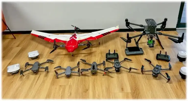
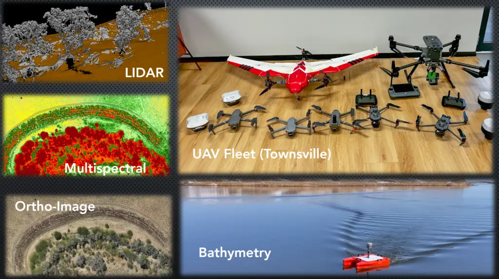
With this breadth of work in the environment, they deal with a range of Earth observation data, including from drones. After a number of years of flying drones they had amassed over 1,500 flights with several TB of data.
Solving their frustrations
With new projects coming online, the volume of drone data to be collected was going to increase significantly, and their current workflow was not fit for purpose.
They were using DroneDeploy to process and visualise their data, but with only one person with an account, they were becoming a bottleneck to manage the whole workflow from data capture, processing, downloading, and sharing data with the team. The cost of DroneDeploy was also increasing to a point where they weren’t getting value for money for their application, and adding in additional team members was too costly.
Neilly Group wanted a solution that could:
- Have drone mapping data uploaded by multiple people and processed automatically.
- Have the data organised and discoverable in one central repository.
- A workspace where their hybrid and multi-location team could easily find and access the data, without using clunky servers or posting hard drives to each other.
- Give the person currently in charge of the workflow back time to focus on creating insights, not managing data folders.
- Increase staff efficiency by having instant access to data, wherever they are.
- Being able to see what data they had already collected, reducing recapture costs due to data being lost.
They needed to make a decision on either building their own custom solution with on-premise servers, integrating a drone mapping data processing software, and cloud based storage solutions, OR, finding something that was an ‘off the shelf’ end to end solution.
This is when they found GeoNadir, and realised that it was far more cost effective than building and maintaining a custom built in house solution, and provided additional features that they wouldn’t have been able to build themselves.
Our solution for them
GeoNadir provided Neilly Group with a Pro + plan allowing multiple people to upload data to a single team workspace. This workspace can be accessed by all the staff at Neilly Group with various user permission levels, and all the organisations drone data is displayed on the map, increasing data visibility and discoverability. Neilly Group also uses some of the Pro + features such as GCPs to increase the accuracy and precision of their data for their clients.

Neilly Group has reduced their ‘key person risk’ with data stored and visualised on GeoNadir, making it easily accessible by anyone on the team. They also have been able to reduce recapture costs by seeing what data they have on file with a couple of clicks to search their data catalogue.
Looking forward
Since working with GeoNadir, Neilly Group saw the potential of increasing the discoverability of all their Earth observation data – nearly 50 TB of data. Their Earth observation data is not just drone mapping data, but also LiDAR, satellite imagery, and other vector data. This data contains rich information that is currently stored on hard drives or local servers and not discoverable or available to exploit valuable information from. This contains significant value for Neilly Group and their clients.
GeoNadir has been set up to support additional Earth observation data types beyond drone mapping data, and we are currently working with Neilly Group to make the remainder of their data discoverable in their GeoNadir workspace.
By the end of this project, Neilly Group will have a workflow for their Earth observation data that will increase their ability to create insights and intelligence from their data; reduce data recapture costs; and make their projects more profitable. This will be achieved by:
- Reducing staff time searching hard drives for data.
- Increase staff efficiency in combining different data layers in one tool to derive deeper insights.
- Provide more information and better recommendations to their clients, resulting in a more cost effective projects with better decisions.
This will give Neilly Group a competitive edge, whilst also allowing them to create better outcomes for the environments they work on.
Ready for a more organised drone mapping data analysis workflow?
Upload a few datasets today. It’s free to get started.

