Online
Training
Drone Mapping Course:
Drone Mapping Step-by-Step Guide
Learn the basics of executing a drone mapping mission with our step-by-step guide.
1 hour
Intermediate
Time for your first autonomous mapping mission!
01
Safety first
Make sure to follow all local regulations and safety guidelines. Check with the appropriate authorities, as regulations vary by region.
02
Pick your app
To choose from the many available mission planning apps, consider your budget, drone compatibility, price, features, and ease of use.
03
Watch the explainer video for your chosen app
These videos cover how you can use your app for drone mapping missions.
Pix4D Capture
DJI GS Pro - iOS only. Compatible with DJI drones only.
DJI GS Pro
Pix4D Capture - iOS and Android. Compatible with DJI, Parrot, Yuneec drones.
Autel Explorer
Autel Explorer - iOS, and Android. Compatible with Autel drones.
04

Create your mission plan
Consider the weather, terrain, obstacles, and double check your parameters
Consider the weather, terrain, obstacles, and double check your parameters
Remember the rule of 80s: 80m altitude, 80% overlap, 80% sidelap (some projects may have variations, but when in doubt, stick to this).
Fly high enough to stay clear of trees and other obstructions.
Plan enough time to return home safely.
Create a single grid, not a cross grid or perimeter capture.
Stay in a rectangular area of coverage when possible.
Orient the camera nadir (directly down).
Make sure you can take off and land close to the survey site.
Remember that midday flights over land are best to minimise shadows.
Mid-morning and mid-afternoon flights are best over water bodies (rivers, lakes, creeks, oceans) to avoid strong sun reflections.
Keep your flight area small so you don't run out of battery juice!
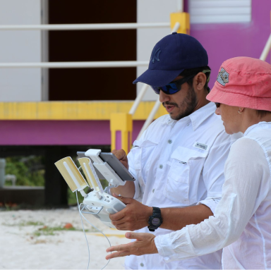
05

Time to execute your mission and fly away!
You've done all the prep work and your mission is planned, now it's time to finally fly! Remember to abide by local regulations and stay safe while flying and catching your drone.
You've done all the prep work and your mission is planned, now it's time to finally fly! Remember to abide by local regulations and stay safe while flying and catching your drone.
06
Process your data
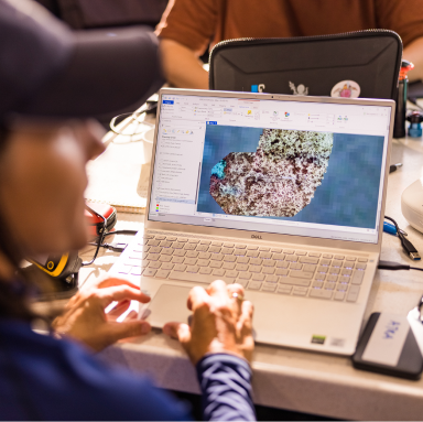
For the best place to store, process, and manage your drone mapping data, upload it to your free GeoNadir account. We’ll create an orthomosaic, digital surface model, and digital terrain model from your mapping data.
Related videos
Create free account
Create free account
Create free account
Further training
FAQ
This guide covers concepts useful for all people interested in drone mapping for many different uses. To move from the theory and put them into practice, you’ll need access to a drone.
Maybe. Regulations and guidelines vary by location and drone size, so always check with your local authorities before drafting your mission plan.
Drone mapping has numerous applications, including the creation of 3D landscape models, ecosystem monitoring, land surveying, infrastructure inspection, crop monitoring, and search and rescue missions. Compared to traditional methods, drone mapping offers advantages as it is a more efficient and cost-effective data collection method that other aerial methods, as well as having the ability to capture higher resolution and more detailed imagery than satellites.
This guide and the ebook complement each other. They cover similar topics in different ways, so we recommend you check both of them out to see which one fits your learning style better.
In addition to that, the ebook goes more in-depth on topics such as optimal flying height, the best time of day for drone mapping, ground control, plus other tips and tricks you’d have to spend years learning on your own.
The course is our most complete resource. It covers all the concepts you need to become a drone mapping expert in much more depth than this guide, plus it delivers them in a more traditional class environment for easier learning.
You learn about data pre-processing, field-surveying, mission planning, and information extraction, plus you even get personalised LIVE expert support.