
Learn how to capture, process, and analyse drone mapping data to produce accurate maps and meaningful environmental insights.
Thanks to support from the NRMA Insurance Help Fund this course is free to everyone.
Build core geospatial literacy and learn how spatial data flows from collection to insight.
Select drones, sensors, and accessories that deliver reliable data for environmental mapping.
Plan flights, manage data, and follow best practices for consistent, repeatable results.
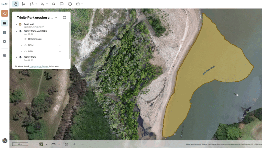
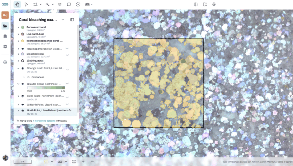
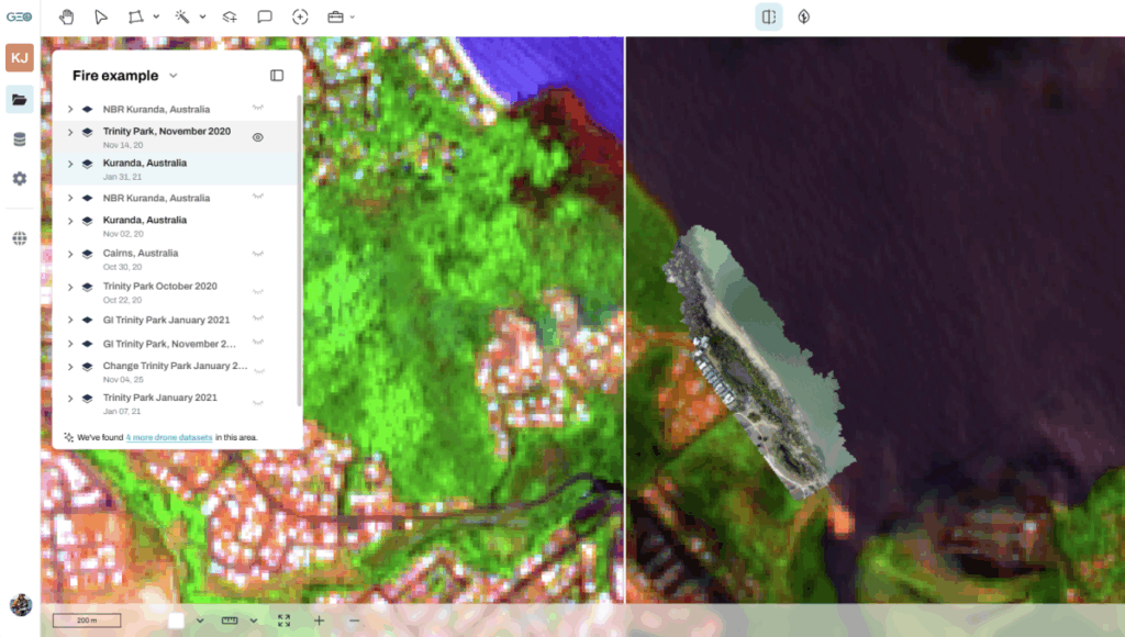
Turn raw imagery into environmental insights using visualisation and analysis tools.
Explore real-world tutorials that combine drone and satellite data for climate and ecosystem analysis.
This course will save you from making painful and expensive mistakes. Dr Karen Joyce has been flying drones since 2013 and has developed the most effective way to get from data capture to data insights. This experience is shared with you.
Dr Karen Joyce has 25 years experience in geospatial technology across military, government, industry, and academia. She lives and breathes Earth observation.
Karen has been teaching remote sensing and GIS at universities since the late 90’s. Karen got a taste of drones at NASA in 2013, and since then has built her own drone capabilities for research and commercial purposes.
She has taught hundreds of people to fly drones for the first time, and her online content is viewed thousands of times each week by people around the world.
Karen is a co-founder of GeoNadir, and is regularly asked to speak at international conferences on research and practical applications of drone and satellite data in an environmental context.
Previously we have sold this course for $750. Thanks to some generous support through the NRMA Insurance Help Fund they have funded access to this course for anyone.
NRMA Insurance Help Fund is funding several projects we are conducting with community partners to empower them to see, measure, and understand environmental change – so they can act with confidence.
This course covers concepts useful for all people interested in drone mapping and data analytics for many different uses. If you want to collect your own data, then you’ll need access to a drone. All the tutorials include publicaly accessible data.
No, you don’t need a subscription to take this course. However some of the practical tutorials at the end of the course use more advanced analytical tools that are only available in a paid subscription. You can sign up for a free account first, and then purchase a GeoNadir subscription on a month to month basis once you start to explore the tutorials.
Maybe. Regulations and guidelines vary by location and drone size, so always check with your local authorities before flying your drone. We cover the key considerations in this course.
This course does not provide 1:1 teaching support. We can provide technical onboarding support as part of our GeoNadir Pro+ subscription.
If you have feedback or general questions about the course and what comes next, please contact us at hello@geonadir.com.