
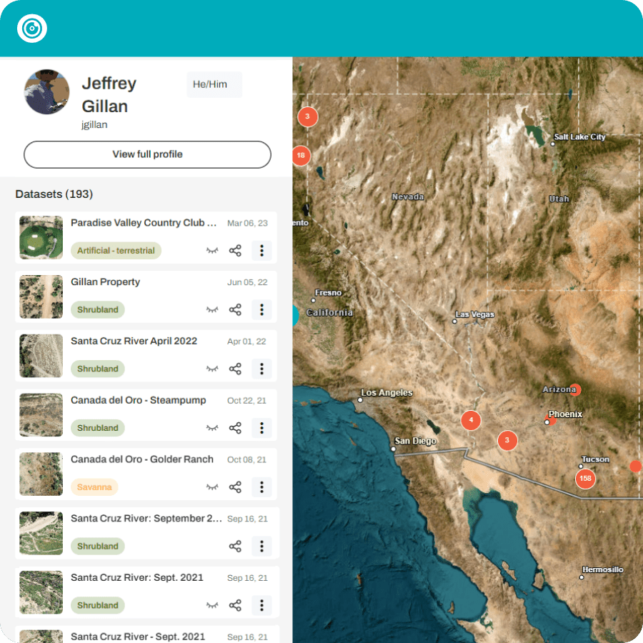


I'm so glad I found GeoNadir. The processing software is excellent at rendering my images and I can use the interactive features to make measurements and create layers. I love that I'm able to do all this without the need for other mapping software, which makes my efforts a lot more efficient.


I absolutely love GeoNadir. The idea of a catalogue of our coastlines and vulnerable areas is very important to me. As an avid drone pilot, I feel like it's my duty to contribute. I mapped these locations because I believe it's extremely important to keep records of our beautiful coastline here in Nova Scotia, Canada.

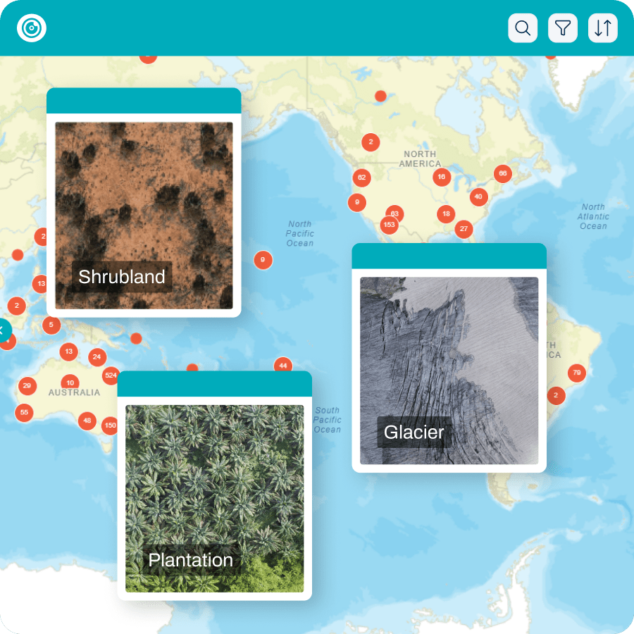
Being able to quickly upload and process your data in the cloud while out in the field allows people back in the “office” to review the data in near real-time. Being able to upload old drone imagery and create an orthomosaic so someone else flying the same area six years later can compare the two is phenomenal.
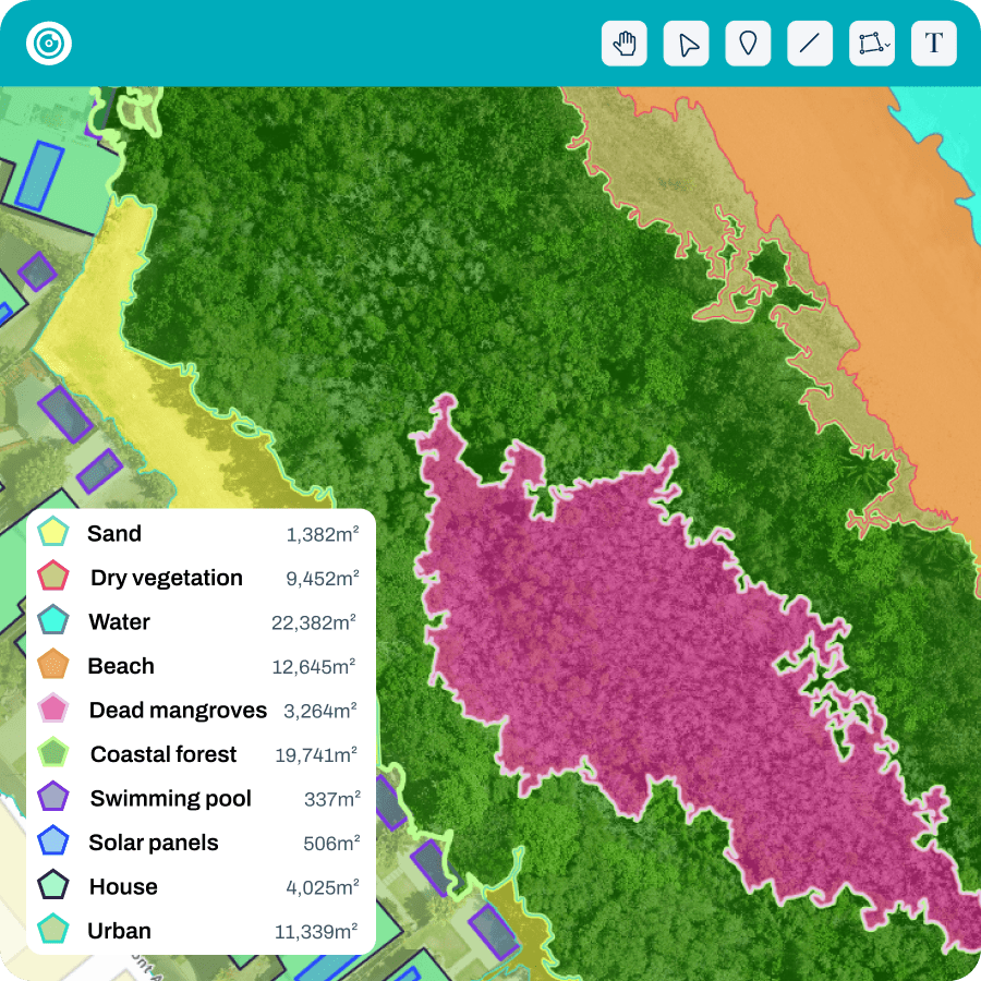
GeoNadir is the easiest way to process raw aerial drone imagery into orthomosaics. Using GeoNadir, I have been able to map and analyse Victoria's unique environments all within a simple and intuitive online interface. The cloud processing and hosting increased the efficiency and accessibility of my work.
